SOMERSET RECORDED.
On this page there are photo albums of mainly Somerset towns and villages (more than 370), including photos of churches, canals, rivers, railways, bridges, pubs, post offices, follies, and many other interesting features. Rapid development in many areas has meant that many of the features that we thought would always be there have disappeared. Existing cottages and houses are being demolished and replaced with modern housing. Many old farms, farm buildings and green fields are rapidly being converted into luxury dwellings or large housing estates. Look at the North East Bridgwater Development or Wilstock village estate just south of Bridgwater as examples of building on green field sites.
Originally started as a Genealogical project this is now an unrivalled
source of pictures and information on the Internet. Most of the 375+ places featured have some level of
descriptive text to accompany the images. Check back from time to time as this
is a work in progress. ( More ) Last updated on 260418
Books by
David C Bown https://dbown100.tripod.com/Books.htm
Use these links to locate the name of the place you want to find below >> A B C D E F G H I K L M N O P Q R S T U W Y
After you have opened an album, click on ‘Download’ and then ‘Open’ in the pop up box to view a larger image.
Contact me by going to the following web page for my email address: https://dbown100.tripod.com/db.jpg
■ Diary of what’s been done & when ■ To Do List Some of the places still to do ■ Panoramic Some wide angle Panoramic pictures
■ Postcards Some Old Postcard views of some towns & villages ■ Changing Somerset: That was then; This is now : Changing Somerset
■ Online Maps Google OSt genuki.org (old OS maps)
■ Canals Canals in Somerset■ Rivers Rivers in Somerset ■ Railways Railways in Somerset
Abbot’s Leigh
Aisholt http://cid-f2f65a21417102d0.skydrive.live.com/self.aspx/Somerset%20villages/aisholtAlbum101.jpg
Just a few pictures of the church from the road.
Alford http://cid-f2f65a21417102d0.skydrive.live.com/self.aspx/Somerset%20villages/alfordAlbum101.jpg
4189 the river Brue to the north of the church, 90 west view of the church, 91/93/96 Alford House, 92/95 south view of the church, 94 the cross, 97 the font, 99 screen at the west end of the nave, 00 organ, 02 looking east through the nave, 03 the carved oak pulpit dated 1625, 09 the rood screen from the chancel, 16 picture on the wall shows the old rectory now the car park to the west side of the church,
Aller. http://cid-f2f65a21417102d0.skydrive.live.com/self.aspx/Somerset%20villages/allerAlbum101.jpg
The Norman1166 church: 4752 Looking towards the chancel with the 1610
carved pulpit on the left and the organ to the right, 4754 the Norman font,
4755 the pulpit, 4762 the effigy of Sir John of Clevedon d 1372, 4763
looking back into the Nave, 4764/5/6 the Altar, 4770 looking across to the
south wall through the arches, 2685 Looking towards the village from the north
on the road to Othery, 2686 the top of Ridley Hill with the old chapel on the
left, 2688 looking down Ridley Hill, 2690 the Old Pound Inn comes into view on
the right, next to the junction with High st and Church road, 2691 the Old Pond
Inn from the High Street, 2693 looking up Ridley Hill with the old Manor House
on the right, 2964 looking east along hight st, 2696 looking down church rd,
2697 looking across to the manor house, 2698 Chantry farm and outbuildings,
2699 looking west into the village from the Langport end, 2700 Aller Pottery,
2701 village hall on the left, 2703/4/5/6 looking up Ridley hill, P4120047
Aller. Distant view of Aller Court and Aller Church. Aller Court is a Grade 2
listed building dating from the 17th Century. Aller Church is probably Saxon in
origin with a Saxon font. Guthrum, king of the Danes, was baptised at Aller in
878.
2210001/8 Aller Court, 10011-16 panoramic series, 10017 Allert court, 10018 churchyard to the west side of the church, 10019 the entance to Aller Court, 10020 the lane leading back to the village, Allerchurchpan a panoramic view on the east side of the church.
Link to old postcard views http://cid-f2f65a21417102d0.skydrive.live.com/self.aspx/Old%20Postcards/allercardsAlbum101.jpg
Allerford http://cid-f2f65a21417102d0.skydrive.live.com/self.aspx/Somerset%20villages/allerfordAlbum101.jpg
5987/9/94 the packhorse bridge, 5995 the reading room, 6000 the Post Office,
Andersea see Westonzoyland
Angersleigh http://cid-f2f65a21417102d0.skydrive.live.com/self.aspx/Somerset%20villages/angersleighAlbum101.jpg
8680 the church, 681 the Norman font, 682 looking through the nave towards the altar, 683 the organ, 690 the altar, 693 looking out from the chancel into the nave, 694 Leigh Court,
Ansford
PA170001 The Old Post Office, 002 Whitcombe Lane. 003/4 The Bell Inn, 005 village Hall, 006/7 the Old Vicarage, 009/12 the Old School building, 0011/13/14 the church, 0015-21 inside the church, 0023 plaque on the tower, 0024 Millenium garden,
Ashbrittle
Ashcott http://cid-f2f65a21417102d0.skydrive.live.com/self.aspx/Somerset%20villages/ashcottAlbum101.jpg
3436 the village hall, 3439 The Ring o Bells pub, 3440 Middle street, 3450 the old school building, 3451 School hill, and old school close, 3452 west street and the A39, 3454 the post office and village shop, 3455 looking along the A39 towards Bridgwater, 3456 looking towards Street, 3461 the Pipers Inn.
Ashill http://cid-f2f65a21417102d0.skydrive.live.com/self.aspx/Somerset%20villages/ashillAlbum101.jpg
3007 the green, 3008 the old main road looking towards Taunton, 3009 Ashill house and the pink Ashill Farm, 3010 rear of the Ashill Inn with the red telephone box and letterbox, 3011 Ashill Farm has the old sign post from the crossroads in their garden, 3013 the Ashill Inn, 3014/16 the Old Rectory, 3015 Primary School, 3017-19 the church, 3020 the south porch now bricked up, 3021 the font, 3022 the nave, 3023 the pulpit, 3024/5 North wall effigies, 3026 the organ, 3027 the altar, 3029 memorial stone in the nave to William Speke of Jordans, who died 1680, 3031 the brightly coloured cushions, 3032 the roof timbers, 3033 the medieval wall plate carvings, carved out of the solid roof timbers, 3034 the north entrance to the church past the school, 3036 looking to the Windmill hill turning on the right in the distance, 3037 the back garden of the old rectory.
Ashington http://cid-f2f65a21417102d0.skydrive.live.com/self.aspx/Somerset%20villages/ashingtonAlbum101.jpg
4118 south aspect of the church from the road, 4119/20 the duckpond nearly opposite the church, 4121 the south porch, 4123 the font, 4124 the screen behind the font, 4126 looking towards the altar through the nave with the Jacobean carved pews, 4127 the pulpit dated 1637, 4129 the chancel and altar, 4130 niche in the west wall, 4131 close up of the figure, 4134 the nave and west wall, 4135 the carved pulpit, 4136 one of the two chairs either side of the altar, 4137/8 ancient glass set into the tops of the windows, 4139 cottage near the church, 4140 Manor farm next to the church,
Athelney http://cid-f2f65a21417102d0.skydrive.live.com/self.aspx/Somerset%20villages/athelneyAlbum101.jpg
The river Tone & Athelney from Burrowbridge, the old bakery, the pumping station, Alfred’s monument,
Axebridge. http://cid-f2f65a21417102d0.skydrive.live.com/self.aspx/Somerset%20villages/axebridgeAlbum101.jpg
4494/5 the village from the reservoir, 4503/9 King John’s Hunting Lodge, 4505 the Almshouse Bistro, 4506 the Lamb Inn, 4507 the square with the farmers market, 4510/6 the church, 511 looking towards the chancel, 512 the organ, 4518 the Post Office, 4519 the Crown Inn, 0627/33 the old railway tunnel near Winscombe.
B…………………………………………………………………………………………………………………………
Babcary http://cid-f2f65a21417102d0.skydrive.live.com/self.aspx/Somerset%20villages/babcaryAlbum101.jpg
9543 the old Rectory, 544 entering the village on Babcary lane from the A37, 545 the church undergoing refurbishment inside, 547 churh farm, 548 looking towards Baker street, 550 the red lion inn, 551 the old chapel on main street, 552 the old corner stores, 553/4/5 the old school,
Babington
Backwell
Badgworth http://cid-f2f65a21417102d0.skydrive.live.com/self.aspx/Somerset%20villages/badgworthAlbum101.jpg
434 the church, 449 the cross in the churchyard, 452/3 the rectory, next to the church, 454 looking into the village from the Allerton road, 457 looking out of the village on the Allerton road, 458/9 Badgworth Court,
Bagborough
Baltonsborough http://cid-f2f65a21417102d0.skydrive.live.com/self.aspx/Somerset%20villages/baltonsboroughAlbum101.jpg
5338/9 Farrants Mill, 5340 ‘The Gatehouse’, 5341 Mill Cottage, 5342/3 the church from the mill stream at Farrants Mill, 5344 the mill Stream feeding into a holding pool just to the side of Farrants Mill, 5347 the Vicarage, 5360/1 cottages next the churchyard, 5362 Clerks Cottage, 5364 the Greyhound Inn, 5363/5 the war memorial and shell case, 5366 the Old School, 5367 the Morovian Chapel, minister’s house and school on Ham Street, 5369/70/1/5 Baltonborough Flights, the river Brue flows over the weir after passing along Dunstans Dyke from West Lydford, and the Mill stream branches off at the same point to flow through Baltonsborough.
Banwell http://cid-f2f65a21417102d0.skydrive.live.com/self.aspx/Somerset%20villages/banwellAlbum101.jpg
9404/5 Steeplejacks attend to the clock face on the church tower, 406 the 1872 chapel on Church street, 407 looking down Church Street, 408 West Street, 409 the Square, 410 High Street with the Old Bakehouse on the left, 411 the Bell Inn on the Square, 412 Hill Path with Rock House on the left, 413 ‘The Narrows’ on High Street, 414 the Jubilee well of 1887, is 76 feet deep, 417 the Old School on High Street, 418 the old White Hart Inn on High Street, 419 looking up Castle Hill, 420/1 the Square, 422 the Old Chapel on East Street, 425 the Old Fire Station on East Street, 449 Lower Church Street, 450 looking across the bowling green to Mill House, 451 Lower Church Street leading to Riverside, 453/4 the other mill building, 457 Mill House, 458 the Old Village Bakery on West Street, 459 the butchers and Post Office, 460 the Old Malt House on West Street, 461-5 the castle.
Barrington http://cid-f2f65a21417102d0.skydrive.live.com/self.aspx/Somerset%20villages/barringtonAlbum101.jpg
1161 inside the great hall, 3992 the Barrington Oak Inn, 4005 quaint cottage to the right hand side of the church, 4006/7/13 the Wesleyan Methodist chapel built 1859, 4010 Manor House? 4011 thatched cottage at the west end of the village, 4012 cottages by Bakers Lane, 4020 Glebe House, 4021 ?uggs Farm, 4023 a lovely thatched cottage, 205/6/7 St Mary & St Peters CE first school, 4028 large barn opposite ?uggs Farm, 4030 Rose Cottage.
Barrington Court: http://cid-f2f65a21417102d0.skydrive.live.com/self.aspx/Somerset%20villages/barringtoncourtAlbum101.jpg
1152/3 Barrington Court gardens, 1154/62 Barrington Court ,
Barrow Gurney
Barton St David http://cid-f2f65a21417102d0.skydrive.live.com/self.aspx/Somerset%20villages/bartonstdavidAlbum101.jpg
40185 the church, 186 the cross in the churchyard, 187 looking north on church lane, 188 looking east on Broadclose way, 189 the 15c font, 190 the painting of King David, 191 looking towards the chancel from the nave, 192 the old manual organ, 193 the Holy table dating from 1613, 194 the early 17c pulpit, 195/7/9 the tablet referring to Henry Adams b 1583, possibly the Henry Adams who sailed to America, and whose descendants produced two Presidents of the United States, John Adams 1797-1801, and his son John Quincy Adams 1825-1829, 198 the squint that allowed bell ringers to see the altar, 200 looking out from the chancel to the nave, 201 the door in the north porch with pumpkins ready for harvest festival, 202 the war memorial, 203 looking north on High street towards the cross roads, 204 looking west towards the church, 205 looking east towards the junction with Blind Lane, 206 Blind Lane, 207 High lane, 208 Peacocks Hill, 209 Peacocks Hill house, 210 Copse cottage on High street, 211 village hall, 212 junction of church lane and high street, 213 Tootle bridge and Tootle bridge farm, 214 Mill house near Tootle bridge, 215 the bridge over the river Brue, 217 Dunstans Dyke(the river Brue), 219 Mill house and Tootle bridge, 220 the mill stream with Mill house in the distance, 221/2 Mill house from the field,
Barwick
Batcombe
Bason Bridge http://cid-f2f65a21417102d0.skydrive.live.com/self.aspx/Somerset%20villages/basonbridgeAlbum101.jpg
397 the old milk factory tower from church road in East Huntspill, 403 the river Brue looking west, 404/5 east on the Brue with the milk factory tower, 406 looking along the old Glastonbury to Highbridge railway trackbed in the Highbridge direction, 407 looking towards the Bason Bridge Inn, 408 the bridge over the Brue, 409 the old station platform to the west of the bridge, 410 the Bason Bridge Inn, 411 Bason Bridge Garage, 412 Factory lane, 413 the Post Office, 415 the old station masters house just beyond the station platform,
Bath
Bathampton
Bathealton
Batheaston
Bathford
120036 the swing bridge with the church spire in the background, 37 looking north from the swing bridge, 38 looking east along the canal to the A38 road bridge, 39 & 44 looking east under the road bridge, 41 & 43 All Saints church beside the canal, 45 looking west to the swing bridge from the road bridge, 46 east side of the road bridge, 47 & 48 Tapster water cottage just south of the canal, 190020 looking south with swing bridge cottage on the left, 21 the Bathpool Inn and Hyde Lane, 22 looking west along A38 towards the railway bridge, 23 looking towards the canal bridge, 24 swing bridge road, 25 looking west towards the old post office and the Chapel. The old River Tone crossed under the road here, you can see the walls of the bridge, 26 the old post office, 27-29 Bathpool chapel dated 1865, 31 bridge over the railway, 32 railway looking east, 33 railway looking west towards Taunton station, 35 &36 river Tone looking west towards Taunton, 37 looking east, 38-40 looking towards the original Bathpool bridge and the road junction, 41 old buildings where the Tone flour mill stood, 45 & 46 river Tone to the west of the road bridge,
Dsc05978 – 05985 May 2013 view of new development progressing towards the canal bridge.
Bawdrip. http://cid-f2f65a21417102d0.skydrive.live.com/self.aspx/Somerset%20villages/bawdripAlbum101.jpg
2901-3 the A39 at the Bawdrip turning into New Road, 2905-7 coming into the village under the old railway bridge, 2586 The Church, 1033/3418 Uplands House, 1034 the old chapel and post office buildings on the A39, 2736 the council houses at East Side Lane, 3503 the former site of Church Farm, 0719-23 the village from Bawdrip levels near the river, 0344 the church. A rare view of the north face, taken between demolition of church farm and the building of the new housing estate. 2737 the wall running along the old S & D railway line, 0956 the village hall next to the location of the old halt on the railway,
P1180039-47 Sion chapel of 1830, and some headstones.
Look at old postcards? http://cid-f2f65a21417102d0.skydrive.live.com/self.aspx/Old%20Postcards/bawdripcardsAlbum101.jpg
Beckington
Beer http://cid-f2f65a21417102d0.skydrive.live.com/self.aspx/Somerset%20villages/beerAlbum101.jpg
A small hamlet about a mile east of Aller: 2679 view from Beer Door, of the north end of Beer woods, the lookout point known as Turn Hill at a height of 329ft, 2680 Beer farm, 2678 Beer wall, the Sowy river looking south, the Sowy river and Langacre rhyne cross under the A372 road here, the Sowy is a short river that links from the Kings Sedgemoor Drain river north of Othery to the river Parrett west of Langport, 2682-4 panoramic series of Beer from Beer Door,
Beer Crocombe http://cid-f2f65a21417102d0.skydrive.live.com/self.aspx/Somerset%20villages/beercrocombeAlbum101.jpg
8124/5 the old rectory, 126/7 the church, 128 the font, 129looking through the nave to the altar, 131 the organ, 133 the altar, 134 the nave from the chancel, 135 the pulpit, 143 the old school house of 1868, 144 Little portion cottage, 145 Allens cottages on the village green, 146 Allens farm, 147 Allens cottages and the signpost at the crossroads, 148 looking towards Little portion cottages,
Berkley
Berrow Pictures of the church.
Bickenhall
Bicknoller. http://cid-f2f65a21417102d0.skydrive.live.com/self.aspx/Somerset%20villages/bicknollerAlbum101.jpg
4536/48 views of the exterior of the church, 4538 the west window, 4537 the 16c screen that came from Huish Champflower church in 1726, 4541 the organ case and 16c bench ends, 4545/6 the original stone altar, 4549 the 1000yr old yew tree and the parish stocks underneath it, 4551 the Bicknoller Inn, 4552/3 cottages in church road, 4554 the post office and village hall.
Biddisham https://onedrive.live.com/?cid=F2F65A21417102D0&id=F2F65A21417102D0%211196&v=3
PC100010 view across the main road towards the village from the layby on the A38, 00012 the village hall in the distance on the main road, dsc08367 looking south along the road, 369 looking towards Manor farm from the church entrance, 371 the old Rectory from the road, 373 the old school just beyond the church entrance, 375 the cross in the churchyard, 377 south porch, 393 church from se, 399/401 crooked tower, 403 rear of the old school, 407 church from the north, 411 old school from the road, 413 further down Biddisham lane with the old river axe winding past Riverside farm, 415 looking north towards the mendips,
Bishops Hull http://cid-f2f65a21417102d0.skydrive.live.com/self.aspx/Somerset%20villages/bishopshullAlbum101.jpg
6019/23 the Old Mill, 6020 the mill stream, 6021 the river Tone downstream, 6022 upstream the weir, 6024/7 the church, 6025 church cottages, 6028/30 the Old Inn, 6029 the Post Office, 6031 Shutewater Hill, 6032 the Coach house, 6033 the United Reform Church, 6034 the Meryan House Hotel, 6035 the Wheel House, 6036 Netherclay House
Bishops Lydeard http://cid-f2f65a21417102d0.skydrive.live.com/self.aspx/Somerset%20villages/bishopslydeardAlbum101.jpg
9120 the Lydeard Bell Inn on West St, 9121 the Almshouses on High St, 9122 the old Police house at the junction of West st with High St, 9123 looking up High St towards Cothlestone, 9124 looking down towards Church st, 9125 The 1837 Chapel at top of High St, 9126 looking down High St with the almshouses on the left, 9127 the old Vicarage down vicarage lane, 9128 the church tower from vicarage lane, 9129/30 the church, 9131 the church cross with the village cross behind it, 9134 the 14c font, 9155 the church from west st, 9156 Lydeard house stable block, 9157 Lydeard house, 9158 west street near the Bell Inn, 9159/60 the bottom end of church st, 9161 the village school, 9162 Mount st garage, 9163 cottage at junction of Mill lane, 9164/5 the Mill on mill lane, 9167/8 the mill wheel of the overspill type, 9169/70/1 figures in the mill museum, 9174 looking along mill lane towards mount st, 9175 Warre house, 9176 the Lethbridge Arms, 9177 Gore sq stores and garage, 9178 Farringdon cottage on Gore sq, 9180 the Post Office on Taunton rd just off Gore sq, 9183/5 the Bird in the Hand pub, 719/20 the ‘Fives’ wall in the car park of the Lethbridge Arms pub,
Bishopswood http://cid-f2f65a21417102d0.skydrive.live.com/self.aspx/Somerset%20villages/bishopswoodAlbum101.jpg
9816 looking towards the ford, 817 the ford, 819 outskirts of the village where the river Yarty passes under the road, 821 looking up the hill to the village, 822 looking out of the village,
Bishopsworth
Blackford http://cid-f2f65a21417102d0.skydrive.live.com/self.aspx/Somerset%20villages/blackfordAlbum101.jpg
623 entrance gate to the church, 624 the Sexeys Arms Inn, 625 the Holy Trinity church built 1823, 626 the High street with the white cottage Bakers Batch on the left, 627/9 the old Methodist chapel?, 628 Brook farm, 630/1 the Brook, 632 the old bakery, 633 Yew tree house, 634 old barns behind yew tree house, 635 the old vicarage, 636 cottage called Butterfield, 637 the Manor House,
Blagdon http://cid-f2f65a21417102d0.skydrive.live.com/self.aspx/Somerset%20villages/blagdonAlbum101.jpg
6178 the High Street, 6180 the Rent House, 6181 the Village club, 6182 the ….. pub ?, 6183 the Baptist chapel, 6185 pink cottages on the green, 6192/3/5 the church, 6196 Blagdon Lake, 6224 Bell Square, 6225 Garston Lane & Pound Corner, 6226 Blagdon station,
Bleadney http://cid-f2f65a21417102d0.skydrive.live.com/self.aspx/Somerset%20villages/bleadneyAlbum101.jpg
467 the river Axe to the south of the B3139 road on the edge of Bleadney, 468 the river on the north side of the road, 469 just a few houses off the main road make up part of this hamlet, 470 entering the village on the Wedmore/Wells road,
Bleadon http://cid-f2f65a21417102d0.skydrive.live.com/self.aspx/Somerset%20villages/bleadonAlbum101.jpg
4950/1 the church, 4952 the water pump, 4953 the Queens Arms, 4958 looking towards the chancel, 4960 looking over the Nave, 4961 the 1460 carved stone pulpit, 4962 the font, 4963 the mysterious arches in the north wall,
Blue Anchor http://cid-f2f65a21417102d0.skydrive.live.com/self.aspx/Somerset%20villages/blueanchorAlbum101.jpg
8406 Blue Anchor Railway museum, 407/8/9 the wonderful flower display on the station platform, 418 No88 pulls into the station at 14-20, 417 the sea front road looking east, 418 the Smugglers Hotel on the right and the Blue Anchor Inn in the distance, 419/27 looking west towards Minehead, 421 the Blue Anchor Inn, 423/5/6 looking along the beach towards Dunster, 424 the Blue Anchor Inn from the beach, 0168 the Smugglers Hotel,
Bossington http://cid-f2f65a21417102d0.skydrive.live.com/self.aspx/Somerset%20villages/bossingtonAlbum101.jpg
6002 house with very tall chimneys, 6009 bridge over the river at the NT car park, 6011/5/6/7 looking out across towards Exmoor and the coast from the coast guard path, 6015 sheep on the steep Cliffside with the Welsh mountains covered in snow across the Bristol Channel, 6018 looking inland towards Exmoor and the village of Porlock,
Bradford on Tone http://cid-f2f65a21417102d0.skydrive.live.com/self.aspx/Somerset%20villages/bradfordontoneAlbum101.jpg
5835 a train heading for Exeter on the nearby mainline, 5836/7/8 the river Tone, 5839 looking up the hill into the village from the riverbridge, 5840 the 13th c church and war memorial, 5841 the crossroads, 5842 the village hall, 5844 the White Horse Inn and the post office/ shop, 5846 the stocks in the churchyard, 5849 the Victorian font carved from Caen stone, 5850 looking towards the chancel, 5852 the organ, 5853 the altar, 5854 looking towards the nave, 5856 the 18th c pulpit which came from St Mary’s church Taunton, 5857 The effigy of Sir John de Merriet, Lord of the Manor and Patron of the church(1350-91). Note that his elbow is missing, probably hacked off to make way for a pew, 5858 the Courthouse, 5859 the Old School House and Gardeners Hall Cottage, 5860 the Old Vicarage,
Bradney http://cid-f2f65a21417102d0.skydrive.live.com/self.aspx/Somerset%20villages/bradneyAlbum101.jpg
0442 entering Bradney Lane from the A39, 0447 Chapel House.
Brean
Brean Down http://cid-f2f65a21417102d0.skydrive.live.com/self.aspx/Somerset%20villages/breandownAlbum101.jpg
608 looking north along Brean beach towards Brean Down, 1600 up on the Down, the few bushes or trees are heavily windswept, 1602 looking down towards the fort on the end of Brean Down, 547 brick gun emplacements?, 549/563 Weston Super Mare from the Down, 550 Steep Holm from near the end of the Down, 553-6 pictures of the fort, 562 Brean showing the ramp onto the beach, and looking inland towards Uphill,
Brent Knoll http://cid-f2f65a21417102d0.skydrive.live.com/self.aspx/Somerset%20villages/brentknollAlbum101.jpg
0398 the top of Brent Knoll from near the start of the Western access, 0399 looking out across the Bristol channel with Steep Holm and Brean down visible, 0400 looking down on the village from the Knoll, 0403/4 the village down below as it stretches out towards the A38, 0406 Glastonbury Tor in the distance, 0407/8 Cheddar Gorge & the Mendip Hills, 0410 the M5 motorway heading south towards Bridgwater, 0411 the steep descent from the Knoll, 4875 the Manor House?, 4876 the Rectory in front the church, 4880 the John Somerset memorial, 4882 the font, 4884 the 14c carved bench ends, 4885 the Stuart period pulpit, 4886 the organ, 4892 the Charles 2 period coat of arms over the vestry door, 4893 the plaque commemorating George Norcote who ‘brought the great boon of water to Brent Knoll’, 4898 the Methodist church, 4899 the Post Office,
Bridgetown http://cid-f2f65a21417102d0.skydrive.live.com/self.aspx/Somerset%20villages/bridgetownAlbum101.jpg
677 the village on the Western side of the River Exe, taken from the A396 road, 678 approaching the village from the south with the Badgers Holt Inn on the right, 679 the turning left to the bridge over the river Exe, 679/80/86 Chapel Cottage and the Old Chapel of 1848(pink building), 681 Week Lane leads over the bridge, 682/3 the bridge from the river bed, 684/5 looking back into the village from Week Lane, 688 the Old Post Office,
Bridgwater http://cid-f2f65a21417102d0.skydrive.live.com/self.aspx/Somerset%20villages/bridgwaterAlbum101.jpg
882/3 the Cornhill illuminated for Christmas, 2754/5 demolition of the old TA centre, 3039/40 construction of the new bus station, 3574/6 construction of the new Asda, 5784/87/7508/9 new housing construction at Crowpill near the NDR bridge, 7492 the junior school at Hamp next to the river, 7496/7 old chimney from brick & tile works near the present Laundry site on Taunton road, 7498/500/1/2 new development at the old Hamp industrial Estate on old Taunton road, 7503/1339 the Taunton road bridge over the canal, 7504 Old Taunton road bridge over the canal, 7505/6 looking back toward the town from St Matthews Field( Alternatively known as Northfield or the Fairfield) 7507 looking down Durleigh road towards the town, 7511 looking towards the junction at Wylds road from the NDR bridge over the Parrett, 1302/4 the old telescopic railway bridge, 1305 the swing bridge at the east end of the docks, 1307 canal boats moored in the docks, 1308/9/10/12 the old warehouse now a pub and flats, 1313 Bowerings animal feeds building, 1314 the walkway along the riverside in Blake gardens near the library, 1340 the canal looking towards Northfield,
Bw2001 http://cid-f2f65a21417102d0.photos.live.com/self.aspx/Somerset%20villages/bw2001Album101.jpg
Bw2002 http://cid-f2f65a21417102d0.photos.live.com/self.aspx/Somerset%20villages/bw2002Album101.jpg
Bw2003 http://cid-f2f65a21417102d0.photos.live.com/self.aspx/Somerset%20villages/bw2003Album101.jpg
Bw2004 http://cid-f2f65a21417102d0.photos.live.com/self.aspx/Somerset%20villages/bw2004Album101.jpg
Bw2005 http://cid-f2f65a21417102d0.photos.live.com/self.aspx/Somerset%20villages/bw2005Album101.jpg
Bw2006 http://cid-f2f65a21417102d0.photos.live.com/self.aspx/Somerset%20villages/bw2006Album101.jpg
Bw2007 http://cid-f2f65a21417102d0.photos.live.com/self.aspx/Somerset%20villages/bw2007Album101.jpg
Bw2008 http://cid-f2f65a21417102d0.photos.live.com/self.aspx/Somerset%20villages/bw2008Album101.jpg
Bw2009 http://cid-f2f65a21417102d0.skydrive.live.com/self.aspx/Somerset%20villages/bw2009Album101.jpg Pictures include the old Splash buildings.
Bw2011
Bw2012
The BCL site http://cid-f2f65a21417102d0.skydrive.live.com/self.aspx/Somerset%20villages/bridgwaterbclAlbum101.jpg
http://www.worldisround.com/articles/302235/photo73.html
Brick and Tile Museum. https://skydrive.live.com/?sc=photos&cid=f2f65a21417102d0#!/?cid=f2f65a21417102d0&sc=photos&uc=3&id=F2F65A21417102D0%21224!cid=F2F65A21417102D0&id=F2F65A21417102D0%211086&sc=photos
The original No6 kiln of Barham Brothers (Est 1857) forms the key point of the museum buildings which were situated on the east side of the river Parrett just north of the old telescopic bridge.
A small album of old b&w prints taken in April 1981 around the area of the town, the river, and the Docks.
No1 looking towards the town bridge from the north. 2. The old telescopic bridge from the east side of the river. Docks No 1. The docks from the east showing the warehouse, the crane, Bowering’s buildings and the mound. 2. The docks from the canal lock gates at the west end, shows the mound at left and the warehouse at right. 3. The warehouse from the north side of the docks with Sully’s coal yard buildings to the left. 4. The east end of the dock from the north side shows Sully’s buildings in the distance.
North East Bridgwater Development
This covers the most of the old BCL site, Little Sydenham farm, and all the green belt area between the railway and the motorway out as far north as Dunball.
Taunton Road Development
This includes Wilstock, Stockland, Dawes farm, Heathfield farm, between Taunton road and as far west as Rhode Lane.
Old Taunton Road site(Hamp Industrial
Estate)
Bower Lane New Hospital site
Brislington
Broadway http://cid-f2f65a21417102d0.skydrive.live.com/self.aspx/Somerset%20villages/broadwayAlbum101.jpg
6112 the church, 6115 the 15c font, 6119 the organ, 6122 the pulpit, 6123 the altar, 3038 looking west from the east end of the village near Stepps farm, 3039 Stepps farm, 3040/42 Every’s Almshouses date from around 1600, 3041 the old school house, 3043 the Bell Inn, 3044 the vicarage almost opposite the Bell Inn, 3045 cottages next to the old school house, 3046 Knights opposite Tanyard house dates from 1725, 3047 Tanyard house, 3048 looking east towards the almshouses, 3049 Yatford cottage and farmhouse, 3050 Congregationalist chapel of 1739, opposite Goose Lane junction, 3051 war memorial, 3052 Threeways which was the old Smithy, 3053 Tudor Cottage, 3054 Manor House, 3055 looking towards Porch House in the distance, 3056 Porch House, at the junction of Olivers Lane, reputed to be the oldest house in the village, 3057 Oliver House, 3058 looking east towards the old Bakehouse, 3059 the old bakehouse on the far side, 3060 looking east towards the Manor on Broadway road, 3061 The Manor in Goose Lane(probably Manor farm),
Brockley
Brompton Ralph http://cid-f2f65a21417102d0.skydrive.live.com/self.aspx/Somerset%20villages/bromptonralphAlbum101.jpg
907/8/9 the church, 910 the cross, 912 the church path leading out to the war memorial, 913 the yew tree near the south porch, 915 the war memorial and the church from the south, 917 the village hall,
Brompton Regis http://cid-f2f65a21417102d0.skydrive.live.com/self.aspx/Somerset%20villages/bromptonralphAlbum101.jpg
646 the village from near the Wimbleball Lake car park, 647 the old school with the headmasters house just beyond it, 648 the George Inn and the church, 649 looking towards the junction with Sanctuary Lane, 651 looking down through the churchyard, 652/4 the old Vicarage, 653 the church(which was locked due to the fact that a piece of plaster had recently fallen from the ceiling during a service) 656 the Post Office, 657 the ‘Lockup’ at the bottom of the churchyard, 658 the Old Forge, 659 view of the village from the old forge, 660 Sanctuary Lane and Sanctuary cottage on the left, 661 the Old Post Office, 662 the old drinking water supply, 663 the village hall, 664 the old bakery, 689/90/2/3 Pulhams Mill, claimed to date back to Doomesday 1086, driven by water from the Pulham River,
Broomfield http://cid-f2f65a21417102d0.skydrive.live.com/self.aspx/Somerset%20villages/broomfieldAlbum101.jpg
P4080001/2 view of the church from the North Petherton road, 003 the junction to go to Fyne Court, 004 looking along ‘The Avenue’, 005 Fyne Court Nature Reserve information Board, 006 Folly in the form of a castle near the lake, 007/8 the Serpentine Lake now badly overgrown, 009 remains of the boathouse, 010 the stream beyond the boathouse, 0011 the rear wall of the boathouse, 012 the lake in front of the boathouse, 013 the walled garden, 014 the strea feeding the ponds, 015 the pond and the boathouse in the trees on the hill, 021-24 main buildings at Fyne Court where Andrew Crosse pioneered his work, 028 entrance to Fyne Court, 029-31 looking towards the church, 032 cottages to the west of the church, 037 the old School room now the village hall, 038 Fyne Court farm near the church, 040/41 south side of the church, 042 north and east sides, 043-59 inside the church, 066 old tree lying near the entrance,
Brushford
Bruton http://cid-f2f65a21417102d0.skydrive.live.com/self.aspx/Somerset%20villages/brutonAlbum101.jpg
645 High st looking east, 646 High st looking west from near Hugh Sexey’s Hospital, 647 the Castle Inn, 649/50 the post office, 651 the Sun Inn, 652 Priory House on High St, 653 the old chapel, 654 the library at the east end of High st, built on the site of the old Wellington Inn655 looking down Packwell st towards the church, 656 looking back west on High st, 657 Blue Boar Hotel on Combe st, 658 the 15c packhorse bridge over the river Brue, 659/60/62 stepping stones over the old ford, 664 the rectory on the right and Plox house on the left on Silver st, 666 the community hall and buildings, 667/8 the church, 669 view of the Dovecote on the hill behind the church, 672/3 church bridge, 674 unusual shot of the church shows the two towers, 682/4 the Jacobean screen of 1620, 686 looking up through the nave, 688 the 1847 font, 690 the south aisle west window dedicated to the Ames brothers who emigrated to the USA, 694 the lecturn and Jacobean pulpit, 695 the plaster Reredos over the altar, 697 the Royal Arms of Charles II, the parish registers from 1554 refer to both CharlesI & II both staying in Bruton and worshipping in the church, 698 the rood screen with above it Christ on Calvary with St Mary & St John, 702 the rererdos behind the north Aisle altar, 703/5 looking out into the nave towards the west window, 704 the tomb of Sir Maurice Berkeley d 1581, 706/7 the roof above the chancel, 709 the organ of 1760, 711 the Somerset king post roof of the nave, 713 close up of Christ above the rood screen, 714 the packhorse bridge from church bridge, 716 church bridge from the path, 718/9 the packhorse bridge, 722-5 the rear of Hugh Sexey’s hospital building, 726 Mill Lane, 727 Town Mill house at the west end of High st, 728 west end of High st, 729 the Methodist chapel, 730 the Mill pond, 731/2 Combe Brook feeding the mill pond, 733 West end with the dovecote on the hill, 735 1897 Red cross hall on High st, 737 Sexey’s Hospital 1638, 738-40 inside the hospital grounds, 741/2 inside the hospital chapel, 748 Bruton Station, 749/51 the Dovecote, 752/3 views out over the town from dovecote hill.
http://somersetvillages.tripod.com/brutonpan1.jpg view from the churchyard looking towards church bridge
http://somersetvillages.tripod.com/brutonpan2.jpg view out over the town from dovecote hill
Brympton D’evercy
Buckland Denham
Buckland St Mary http://cid-f2f65a21417102d0.skydrive.live.com/self.aspx/Somerset%20villages/bucklandstmaryAlbum101.jpg
9777 the Post Office, 778 the church, 780 the school, 809/11 the rectory, 813 Pound lane,
Burnett
Burnham on Sea http://cid-f2f65a21417102d0.skydrive.live.com/self.aspx/Somerset%20villages/burnhamAlbum101.jpg
Burrington http://cid-f2f65a21417102d0.skydrive.live.com/self.aspx/Somerset%20villages/burringtonAlbum101.jpg
6130 Rock of ages plaque commemorating where the Rev A M Toplady wrote the hymn, 6132 Burrington House, 6133 the Parish Room, 6134 looking up the road leading to the combe, 6135 the School, 6136/7 the church, 6141 the font,
Burrowbridge. http://cid-f2f65a21417102d0.skydrive.live.com/self.aspx/Somerset%20villages/burrowbridgeAlbum101.jpg
2527/ 0418 the mump from Turn Hill, 2565/7 the mump from the Westonzoyland road, 2569 the A361 towards Lyng, 1206/7 the King Alfred Inn, 1213/4 where the toll house used to be next to the bridge, 0157/8 4056-60 the Ebeneezer chapel and some gravestones, 0194-96 The church, 4061 Lockyers farm, 2749 the river Parrett..
Dec 2009 P1010045 view of the bridge and King Alfed Inn from the south bank. Note the height of the river on the bridge, 0046-63 views from inside the church,
Look at old postcards? http://cid-f2f65a21417102d0.skydrive.live.com/self.aspx/Old%20Postcards/bbcardsAlbum101.jpg
Burtle. http://cid-f2f65a21417102d0.skydrive.live.com/self.aspx/Somerset%20villages/burtleAlbum101.jpg
Just pictures of the church.
Bury http://cid-f2f65a21417102d0.skydrive.live.com/self.aspx/Somerset%20villages/buryAlbum101.jpg
665/6/7/8 the Packhorse bridge over the river Haddeo which flows directly out of Wimbleball Lake a few miles NE, 669 the Forge, 670 the narrow bridge, 671 the River Haddeo and the Forge on the left, 673 the Ford across the river, 674 Church House, 675 the Old School House, 676 a Land Rover ‘fording the river’,
Butcombe
Butleigh http://cid-f2f65a21417102d0.skydrive.live.com/self.aspx/Somerset%20villages/butleighAlbum101.jpg
5312 The village cross, south of the village near Lower Hill Farm, 5313 entrance to the church, 5314/5/6 the church, 5317 Butleigh Court, 5327 looking along High Street, 5328 the Post Office, 5329 an old house of 1699 next to the school, 5331 the Old School, 5332 Corner House, 5334 Old House in High Street near the junction with Chapel Lane, 5334 the old Chapel, 5336 Sycamore Cottage in Water Lane,
C…………………………………………………………………………………………………………………………
Cameley
Camerton
Cannington http://cid-f2f65a21417102d0.skydrive.live.com/self.aspx/Somerset%20villages/canningtonAlbum101.jpg
4818/24 the church(only open 10-12), 4819/20/2 Cannington Brook, 4823 the Old Vicarage, 4825 looking towards the chancel through the 15th C rood screen, 4826 the 15th C font, 4833 the Reredos of 1885 shows the whole company of heaven with Christ occupying the centre panel, 4834 the organ, 4835 the carving of ‘The child of Cannington’, 4836 the Nave, 4838 the village Hall, 4839/49 Cannington College buildings, 4842 the Priory, 4845/6 the Henry Rogers 1672 Almhouses, 4847 the Globe Inn, 4848 Priory Cottage,
Carhampton http://cid-f2f65a21417102d0.skydrive.live.com/self.aspx/Somerset%20villages/carhamptonAlbum101.jpg
2851 East gate entrance to churchyard, 2853 the remains of the village cross, 2854/7 the butchers Arms, 2855 the lychgate to the south west onto Sea Lane, 2856 Charlier Cottage, formerly the Smithy, next to the church, 2858 the Post Office and stores on Main road, 2859 corner house, 2860 the community orchard at the junction of High st, 2861/4 Myrtle Cottage at the west end of the village, 2862 the Old School and school house, 2863 Bridge cottage to the left of the bridge, 2865 Nook cottage next to Stoney Bridge, 2866 south on high st, 2867/8 Chapel cottage, 2869 the village hall, 2870 Elm cottages a the top of High st, 2871 looking down High St to the main rd, 2872 Laurel cottage on Park Lane, 2873 the Old Forge next to Laurel cottage, 2874 Court cottage on Court drive, 2875 cottages on High st, 2876 post office, 2877 old oak chest in the church known as the Peter Pence Box , 2878 font, 2879 pulpit, 2880-3 15c rood screen, 2884 east window, 2885 the altar, 2886 organ, 2888 rood screen from the chancel, 2889 nave roof, 2892 the vicarage in church lane, 2893 church lane near the junction with main road,
Cary Fitzpaine
Castle Cary http://cid-f2f65a21417102d0.skydrive.live.com/self.aspx/Somerset%20villages/castlecareyAlbum101.jpg
A short walk around Castle Cary and Ansford, visiting all the places on the town guide.
Panoramic photo of the town from the castle mound
http://cid-f2f65a21417102d0.skydrive.live.com/self.aspx/Somerset%20Panoramas/castlecareypan.jpg
Pictures from around the village, including the church, and the old schoolhouse.
Chaffcombe http://cid-f2f65a21417102d0.skydrive.live.com/self.aspx/Somerset%20villages/chaffcombeAlbum101.jpg
277 the church from the road, 278/306 Pound cottage, 280/1/2/3 the church, 285 looking out over the village from the churchyard, 286 looking down the approach path to the church, 287 the sign at the Pound field, 290 the font, 291 looking towards the chancel, 292/3 the altar, 294 the organ, 297 looking out into the nave, 300 the village hall, probably the old school, 301/2 the old school house, 303/4/5 the war memorial,
Chapel Allerton http://cid-f2f65a21417102d0.skydrive.live.com/self.aspx/Somerset%20villages/chapelallertonAlbum101.jpg
7602 the old school house, 621 manor farm, 622 the junction for Stone Allerton,
Chard http://cid-f2f65a21417102d0.skydrive.live.com/self.aspx/Somerset%20villages/chardAlbum101.jpg
9860 Chard Museum at the top end of the High Street, 861/3 Site of the old School built in 1854, 862 looking down High st into the town, 864 Myrtle cottage at the junction of Crowshute Link, 865 Richard Harvey’s home left by him in his will of 1663, rebuilt in 1842 for use as a hospital, 866 looking down High st, 867 Old Brewery court, 868 Crowshute House on Crowshute Link, 869 Community Primary School on Duck Lane, 870/1 looking north on Holyrood Street with Mill lane on the right, 872 Holyrood House and the Borough boundary on Duck Lane, 873 the Kings Head Inn on the corner of Church st, 874 St Mary’s church on church st, 875 Glebe Land on Forton road.This was the home of Dr R A Fawcus, 876 looking down Mill Lane towards the Boden Club & Institute, erected in 1892 by Henry & Walter Boden for the mill workers, 877 the Law Chambers on Holyrood Street, 878 the Lace Mill Workshop on Holyrood Street, 879/80 Holyrood Lace Mill buildings, manufactured plain net from 1829-1964, 881 Baptist’s church on Holyrood st, 882 junction of Fore st & Holyrood st was the site of the Corn Hill and the Bakers dozen. Here in 1343 stood the medieval borough chapel of St Francis, 883 the Chard Town Hall on Fore st, 884 Hope Terrace on Combe st built by Revd John Gunn to relieve acute hardship caused by unemployment in the 1820’s, 885 Prospect House the home & workshop of James Gillingham a pioneer in making artificial limbs, 886 the Lodge next to Chart cemetery, 887 the chapel of rest & the cemetery, 888 the Bel & Crown in on Helliers road, 889 looking up Fore st, 890 looking down Fore st, 891/2 the Methodist church at the lower end of Fore st, 893 Chard school, btm end of Fore st, was a Manor House owned by John Symes in 1583.The school was founded in 1671.894 Monmouth House next to the school, 895 looking South on Silver st, the old road to Seaton, 896 Church of the good shepard, junction of East st and Furnham rd, 897 looking down East st, 898 looking north on Furnham rd, 899 English Martyrs church at the btm of Fore street, 900 the Boden club on Mill st, 901 Old Town looking towards the Kings head, 902 St Mary’s church and the cross, 903 Chard ‘Joint Station’ buildings on Great Western way, this was on the Taunton to Chard Junction Branch Line railway. For pics of this railway goto http://www.worldisround.com/articles/344376/index.html
Chard Junction http://cid-f2f65a21417102d0.skydrive.live.com/self.aspx/Somerset%20villages/chardjunctionAlbum101.jpg
1904/5 looking south along Station road from Perry Street, 1906 approaching Chard Junction with the old Station House on the right, take the footpath to the right by the broken fence to get to the next picture, 1907 the old Taunton Chard railway trackbed looking towards Perry Street, 1908 the branch line joined the main line which runs left to right this side of the green tanks, 1909 looking back to the old Station House, 1910 the Three Counties, an old Inn?, 1911 looking east on the mainline, 1912/4 looking west, 1913 the crossing.
Charlcombe
Charlinch
See Charlynch
Charlton Adam http://cid-f2f65a21417102d0.skydrive.live.com/self.aspx/Somerset%20villages/chardjunctionAlbum101.jpg
517 the Abbey, 518 looking down church hill, 519 the church and abbey cottage, 536/7 the abbey from the churchyard, 538 abbey barns along top road, 539 the post office, 540 the old school near Broad street and the post office, 541 Corner cottage broadway road, 542 top road looking back towards broad street,
Charlton Horethorne
Charlton Mackrell http://cid-f2f65a21417102d0.skydrive.live.com/self.aspx/Somerset%20villages/charltonmackrellAlbum101.jpg
9485 the church on bonfire lane, 498 An interesting carving of the devilkin, a creature employed by the devil to visit churches to ensure worshippers were singing to the glory of god!, 504 the Court (behind the church, viewed from the graveyard), 505 the school, 506 the Manor house on Mill lane, 507 the lowest part of Mill Lane looking south, 510 Station road looking towards the Greyhound Inn, 511 Charlton House, 512/3 the Greyhound Inn, 514 Pound cottage, 515 the village through the railway bridge, 516 the war memorial by Collins Lane,
Lytes Cary Manor : http://cid-f2f65a21417102d0.skydrive.live.com/self.aspx/Somerset%20villages/lytescaryAlbum101.jpg
Charlton Musgrove
Charlynch http://cid-f2f65a21417102d0.skydrive.live.com/self.aspx/Somerset%20villages/charlynchAlbum101.jpg
0049/50 the village on the hill, taken from Spaxton. The house to the left of the church is Charlynch House, 003 Charlynch House, the west front from the road, 004 looking around towards the church entrance, 005 entrance drive to Charlynch House, 006 looking south down the hill towards Four Forks, 007 the Lych gate, 008 the south side of the church, now a private dwelling called Tower House, 009 looking south out from the churchyard, 010 church and snowdrops, 0011 south porch, 0012 the tower, 0013 west door in the tower, 0014 west face of the tower with the clock now missing, 0015 the white cottage just below the church,
Charterhouse http://cid-f2f65a21417102d0.skydrive.live.com/self.aspx/Somerset%20villages/charterhouseAlbum101.jpg
1513-18 Velvet Bottom Nature Reserve. A Site of Special Scientific Interest, this is a walk down through a valley where lead has been mined since before Roman times.Most of the top end of the reserve is scheduled as an Ancient Monument to protect the Victorian Lead workings.1517 the gateway leading to Black rock valley, 1518 approaching Black Rock, 2195 Blackmore Nature reserve Locn ST504 556, The Romans established a lead mining site in AD48, the earliest and most important site in Britain. 2196 lead workings to the south of the car park, 2197 looking along the approach road towards the car park, 2198 to the north of the car park, 2200-2 views of the Roman Fort now merely a low mound in a field, there was also accommodation for the troops nearby, 2203 view of the reserve from the fort, 2204 back view of the outdoor activity centre with the telescope dome, then Charterhouse church beyond the trees, 2206 A little way up the road from Charterhouse, a Roman Amphitheatre at Locn ST 498 565 32m x 24.4m elliptical in shape, 2207/8 view looking down towards the Blackmore Nature reserve from the road beside the Roman Amphitheatre. 2830-35 black rock area, 2948 the 18” Newtonian reflector telescope housed in the dome, 2953 Dec 2003 work was underway contructing new accommodation for the children at the Activity centre, with the dome centre, and the church to the left, 41208-21 Jan 2008 views down through Velvet Bottom to Black Rock.
Cheddar http://cid-f2f65a21417102d0.skydrive.live.com/self.aspx/Somerset%20villages/cheddarAlbum101.jpg
0854/0634 entering the bottom end of the Gorge, can you spot the rock formation known as ‘Lion Rock’?, 0855/6/7 the cliffs in the Gorge, 1520/6 looking down onto Cheddar from up on the edge of the Gorge, 1523 A spectacular view down into the Gorge with Cheddar, the Axebridge reservoir, Brent Knoll, and the sea in the distance, 1841/2 the waterfall next to Cox’s Mill building, 4496/7 the Gorge cutting through the Mendip hills, taken from Axebridge reservoir, 4533/4 the Church, 4535 the Rectory, 0940-0955 A walk up the side of the Gorge
Cheddon Fitzpaine http://cid-f2f65a21417102d0.skydrive.live.com/self.aspx/Somerset%20villages/cheddonfitzpaineAlbum101.jpg
3104 the north east entrance to the church, 3105 looking north from the church, 3106 south view of the church, 3107 the cross, 3108 southern aspect of the tower, 3109 south entrance porch, 3111 16c oak door in the south porch, 3112 the font dates from Henry VII and is made from Ham stone, 3113/4 two views looking through the nave towards the chancel, 3115 the south window east of the door, 3116 the east window at the far end of the cental aisle, 3118 the pulpit of Ham stone, 3119 the organ, 3120window at east end of the cental aisle, 3121 the north window, 3122 the nave from the chancel, 3127-9 bench ends daring from 1530, 3130/1 soth end of the village,
Chedzoy. http://somersetvillages.tripod.com/chedzoyAlbum101.jpg
0010 Kings Sedgemoor Drain river at Parchey Bridge looking towards Middlezoy, 0027 KSD river looking towards Bawdrip, 0099 Fishers cottages, 0103/2847 Front Street and the old Post office looking into the village from Daltons farm, 0144/01794 Three Oaks farm at Fowlers plot, 0183 the crossroads, 0184/5 the church, 2008 Parchey bridge from the river bank, 3305 looking up Front street towards the village hall and the old school building,
Look at old postcards? http://cid-f2f65a21417102d0.skydrive.live.com/self.aspx/Old%20Postcards/chedzoycardsAlbum101.jpg
Chelvey
Chelwood
Chesterblade
Chew Magna
Chew Stoke
Chewton Mendip https://skydrive.live.com/?cid=f2f65a21417102d0#cid=F2F65A21417102D0&id=F2F65A21417102D0%211154&v=3
005 Ancient cross in churchyard between two yew trees, 009/10 west end of tower, 0029/30 Frid stool/ stone sanctuary seat one of only three in the UK, 0032 tomb of Sir Henry Fitzroger and his wife, 0033 portrait of the Madonna by Raphael , 0034 early 1611 Bible now in a case by the door, 0037/8 east window from outside, 0040 walled path to the main road, 0041/2 Primary school, 0044/45 Waldegrave Arms, 0049 the old rectory, 0051 the old Post Office on the right and the Old Police Station on the left.
Chilcompton
Chillington
Chilthorne Domer http://cid-f2f65a21417102d0.skydrive.live.com/self.aspx/Somerset%20villages/chilthornedomerAlbum101.jpg
976 the church entrance from the road, 979 the font, 980 the chantry from the nave, 981 the altar, 986 the organ, 987 the nave, 988 the pulpit with a roof over it, 989 the entrance door, 991 Home farm, 993 Castle cottages, 994/97 the old Rectory, 995 the old Post Office, 996 Abbey cottage, 998 the Carpenters Arms on the main road to Yeovil,
Chilton Cantelo http://cid-f2f65a21417102d0.skydrive.live.com/self.aspx/Somerset%20villages/chiltoncanteloAlbum101.jpg
4090 east end of the church from the road, 4091 the footpath to Ashington, 4092/3 south aspect of the church, 4094 south porch with an unusual stone carving of Christ which also says ‘I am the door’, 4095 the Norman font?, 4096 the nave with the hagioscope through the left pillar, 4101 the carved oak pulpit, 4106 the altar, 4107 the chantry floor, 4108 the rererdos behind the altar, 4114 the nave and west window, 4115 the carved rood screen, 4117 the west door,
Chilton Polden. https://skydrive.live.com/?cid=f2f65a21417102d0&sc=photos&id=F2F65A21417102D0%21224#cid=F2F65A21417102D0&id=F2F65A21417102D0%21287&sc=photos
Pictures from around the village, including the church.
https://dbown100.tripod.com/chiltonpoldencardsAlbum101.jpg Old Postcards
Chilton Trinity http://cid-f2f65a21417102d0.skydrive.live.com/self.aspx/Somerset%20villages/chiltontrinityAlbum101.jpg
4794/5 the church, 4798 Church cottages, 4803 the only coloured glass in the church,
Chinnock
Chipstable http://cid-f2f65a21417102d0.skydrive.live.com/self.aspx/Somerset%20villages/chipstableAlbum101.jpg
9223 the church, 239 the old school house, 241 the Grange, 242 the old rectory, 243 the old post office, 244 the old police station
Chiselborough http://cid-f2f65a21417102d0.skydrive.live.com/self.aspx/Somerset%20villages/chiselboroughAlbum101.jpg
4460 Court House with the church spire behind, 4461 the church, 4472 the Cat Head Inn, 4473 the Old School, 4474 Michaelmas Cottage, 4476 the River Parrett at Byme Bridge on the A356 Crewkerne Road,
Christon http://cid-f2f65a21417102d0.skydrive.live.com/self.aspx/Somerset%20villages/christonAlbum101.jpg
542/4 the Old Rectory, 543 looking towards the village from the rectory, 545 looking the other way on the road back to Loxton, 546 an old water pump on the roadside, 547 near the old granary, 548 the entrance to Christon court with the church entrance a little further along the road, 549 the Old Granary, 550 the Old Coach house, 551 the church, 552 a hollowed out tree in the shape of a seat, 553 the Norman church porch, 554 the Norman font, 555 looking towards the chancel, which is gated off due to previous thefts, 556 the pulpit, 562 the altar, 563 the nave, 564 Christon Court from the churchyard, 566 church cottages, 567 Crook Peak on the Mendip hills from the churchyard,
Churchill http://cid-f2f65a21417102d0.skydrive.live.com/self.aspx/Somerset%20villages/churchillAlbum101.jpg
9556-60 The church, which was securely locked. 564 the Nelsons Arms, 565 the clock, built 1897, 566/8 the Methodist church, 569 looking west on Front st, 570 looking East on Front st with the old vicarage on the right, 571 the clock, clock house(behind the clock) and the reading room, 573 Dinghurst road near the clock, 575 skinners lane leading to ‘the batch’ the road that heads up over the hill,
Churchingford http://cid-f2f65a21417102d0.skydrive.live.com/self.aspx/Somerset%20villages/churchingfordAlbum101.jpg
01 looking down the hill to
the Post Office, 02 the village hall, 03 the centre of the village where 6
roads meet, 04 the York Inn, 05 Church road, leading toChurchstanton, 06
looking south down Moor Lane, 07 village stores and Post Office, 08 the sign
post at the junction, 09 south on Moor Lane, 010 looking north from Moor Lane
towards the junction, 011 houses on east side of Moor Lane, 012 Ford House, 013
Moor Lane towards the junction, 014 looking west on Honiton road, 015 the old
chapel,
Churchstanton http://cid-f2f65a21417102d0.skydrive.live.com/self.aspx/Somerset%20villages/churchingstantonAlbum101.jpg
016/7 the church from the road, 018/9 the Norman font, standing on Purbeck marble pillars, 020 looking down on the nave and chancel from the gallery, 021 old glass in the south window from the gallery, 022 coat of arms, 023 south aisle east window, 024 chancel east window, 025 embossed lead panel dated 1719 from the tower roof, now on show in the porch, 026/7 more old glass, 028/9 old 15c bench ends used to face the gallery, 030 the organ located up in the gallery, 031 carved oak pulpit, 032 the altar, 033 the carved oak lectern, 034 chancel east window, 036 south aisle east window, 037 one of the beautiful decorated Beer stone columns, 038 the south aisle looking west towards the gallery, 045 nave looking west towards gallery, 046 squint in one of the columns near chancel, 047 the nave, pulpit, and gallery, 048 in the porch lies the old 17c carved oak bier, dated 1625, and the stocks that used to be in the graveyard, 049 the rectory to the east of the church, 050/51 remains of the Sunday school building, 052 north aspect of the church, 053 south porch now dis used, 054 tower and turret tower, 055 looking down the road towards what was the old Kings Arms Public House, 056/58 the old pub
Clapton in Gordano
Clatworthy http://cid-f2f65a21417102d0.skydrive.live.com/self.aspx/Somerset%20villages/clatworthyAlbum101.jpg
694/5 the Reservoir from Waysdown Lane to the south, 696/7/8/9 the Dam, 700 the River Tone continues its southerly course towards Taunton, 701 the church tower and a few buildings that make up the village of Clatworthy can just be seen above the hills in the distance, 702 the church,
Claverton
Cleeve
See Old Cleeve
Clevedon http://cid-f2f65a21417102d0.skydrive.live.com/self.aspx/Somerset%20villages/clevedonAlbum101.jpg
Cloford
Closworth
Clutton
Coat http://cid-f2f65a21417102d0.skydrive.live.com/self.aspx/Somerset%20villages/coatAlbum101.jpg
3606 looking west into the village from near the location of the old road bridge over the Durston Yeovil Brach Railway, 3607 looking west along the main road, 3608 looking towards the Martock road in the distance on the left, 3609 Crofton cottage, 3610 Cripple street on the right, road to Martock on the left, 3611 Little Coat House, 3612 looking further west, 3613 Looking back at Little Coat House, 3614 Coat House, 3615 further west past Coat House, 3616 the Old Coat Inn, 3617 Greystone House and barns, 3618 Forbidden territory! The Lady of this farmhouse at the far west end of the village made a point of coming out to prevent us taking any pictures of her lovely house’Who are you? I’d rather you didn’t take a picture of my house, I can’t understand why anybody would want to do that’ she said. So with as few words as possible we left it at that. Another rather hostile reception. Does she treat all visitors like that, we wondered? 3619 looking back in a more friendly easterly direction!
Combe
Small hamlet between Aller & Langport
Combe Down
Combe Florey http://cid-f2f65a21417102d0.skydrive.live.com/self.aspx/Somerset%20villages/combefloreyAlbum101.jpg
2042-6 panoramic series from left to right showing Combe Florey House, the gatehouse and the church, 2033 the area known as the Monks garden opposite the gatehouse, believed to be the site of a chantry founded by Walter de Meriet, 2034 the church, 2035 the yew tree believed to be 1500yrs old, 2036 looking west from the churchyard, 2037 the gatehouse from the churchyard, 2038/9 Combe Florey House, 2040 the church from the north, 2041 the gravestone of the novelist Evelyn Waugh 1903-66, 2047 the font, 2048 the north aisle, 2049 the north aisle wagon roof, 2050 the nave, 2053 memorial window to Sydney Smith one time rector of Combe Florey church for 15 years, and also prior to that he was Canon of St Pauls Cathedral, 2056 the organ, 2058 the altar, 2059 carved stone figures believed to be of Sir John de Merriet of Hestercombe, and his two wives on the floor of the north aisle, 2060 the 15c carved oak pulpit, 2061 the rood screen from the chancel, 2062 Orchard cottage on the left with the old school straight ahead, 2063 the old school, 2064 Combe farm house, 2065 looking south towards Gwynne cottage, 2066 looking back towards Gwynne cottage, 2067 Shuttern and Shuttern cottage(nearest), 2068 entrance to the rectory, 2071 view of the south side of the church, 2072 the village water pump, 2073 the cemetery, 2074 the headstone of Auberon Waugh 1939-2001, 2075 the cemetery looking back to the road, 2076 the village hall, 2077 approaching the east end of the village, 2078 the old Smithy, 2080 the bridge over what was the mill stream, 2081 the telephone box and post box, 2082 the old Manor House, 2084 the bridge over the stream where once was a ford, 2086 the old Forge on the main Taunton to Williton road, 2088/9 Combe Florey Mill, 2090 the West Somerset Railway(WSR) bridge near the old forge, 2091 the turning left to Combe Florey, opposite the old forge, 2092/3/4 entering the village from the main road, 2095 the old route of the mill stream heading south from the bridge, 2096 the well head near the gatehouse, 2097/8 Combe Wood tower, 2099/100 the Farmers Arm’s public house, 2101 pretty bridge over the stream near the farmers arms, 2102 the turning off the A358 to the farmers arms, and the WSR bridge,
Combe Hay
Combe St Nicholas http://cid-f2f65a21417102d0.skydrive.live.com/self.aspx/Somerset%20villages/combestnicholasAlbum101.jpg
3877 the village green looking across to the Methodist chapel, 3878 looking up Vicarage hill, 3879 Poll Rue, Combe Head road, 3880 Lisieux way with the old Inn on the left, 3881 water fountain memorial to Queen Victoria in 1897, 3882 across the green to vicarage hill, 3883 Methodist church on Lisieux hill, 3884 looking down the hill to the green, 3885 the post office, 3886 Rectory court on vicarage hill, 3887 looking down the hill to the green, 3888 vicarage cottage, 3889 north side of the church from the road, 3890 village from the churchyard, 3891 north side of the church, 3892 south side, 3893 south view, 3894 some of the many iron memorials in the churchyard, 3895 view from the south gate, 3897 the new font, 3898 the old sandstone font dating from the 9c has been defaced by people sharpening knive blades on it, 3899 view looking east through the nave, 3900 nave ceiling, 3901 West archway into the tower dates from the Early English Building of 1239, 3902/3 Part of a Norman pillar incorporated into the north arch nearest the north entrance, the snail track carving on the capital is said to represent the devil, 3904/5/6 the 1470 rood screen, 3907 the pulpit, 3908-11 glass segments in the tops of the north and south aisle windows, 3912/3 the east window above the altar, 3917 view west from the altar, 3918 west view into the nave from the screen, 3919 one of the 2 carved oak chairs, 3920 memorial window in the south aisle to Dr Neville Campbell (1919-1991) a churchwarden and benefactor, 3921 photo album of all those men from the village that lost their lives in the 1914-18 war, 3922 north entrance, 3923 looking down Underway Road with the old Smithy the two white cottages on the right, 3924 east on Lisieux way, 3925 the Grren Dragon Inn, 3926 the village hall on Underway road, 3927 the junction with Frog lane to the left, 3928 looking back west towards the church tower, 3929 Frog Lane, 3930 the Smithy on Underway, 3932 the old Inn by the green, 3933-37 panoramic series of the village green,
Combe Sydenham http://cid-f2f65a21417102d0.skydrive.live.com/self.aspx/Somerset%20villages/combesydenhamAlbum101.jpg
Combwich http://cid-f2f65a21417102d0.skydrive.live.com/self.aspx/Somerset%20villages/combwichAlbum101.jpg
4850/1 the church(locked), 4853 the estuary, 4855 the Anchor Inn, 4856 the Post Office,
Compton Bishop http://cid-f2f65a21417102d0.skydrive.live.com/self.aspx/Somerset%20villages/comptonbishopAlbum101.jpg
573 entering the village at Butts Batch, 577/8 the church, 582 the organ, 583 the Norman font, 585 looking through the nave towards the chancel, 586 the 14c carved stone pulpit, 589 looking out into the nave, 590 the altar, 591 the East window containing the remains of 14c glass, probably made at wells, 593 the porch, 596 the village from near Lower Weare shows Crook Peak towering over it,
Compton Dando
Compton Dundon
3907 view from Collard Hill, 3913 down the main street, dsc07070 – 07090 Hood Monument on Windmill Hill.
Compton Martin
Compton Pauncefoot
Congresbury http://cid-f2f65a21417102d0.skydrive.live.com/self.aspx/Somerset%20villages/congresburyAlbum101.jpg
5908 Bridge over the Yeo at Iwood, 5909 the mill stream at Iwood, 5910 the derelict mill wheel, 5911/2 the church, 5913 the font, 5914 the screen and chancel from the nave, 5915 nativity scene, 5917 the pulpit, 5923 the organ, 5924 looking out to the nave, 5925 the entrance door, 5926/28 the vicarage and refectory, 5927 the courthouse, 5929 the old Inn, 5931 the Ship & Castle Inn, 5932 Broad Street, 5933 the Methodist church, 5935/6 the river Yeo,
Corfe http://cid-f2f65a21417102d0.skydrive.live.com/self.aspx/Somerset%20villages/corfeAlbum101.jpg
8619-22 the church, 624 Saxon/Norman font, 628 the organ, 629 the three arches with inscriptions, 630/3 the altar & rererdos, 631 looking through the nave towards the chancel, 632 the south aisle, 634 looking out from the chancel towards the west window, 638 the pulpit, 639 the old mill house, 640 looking south into the village, 641 the White Hart Inn, 643 the old Baptist Chapel of 1897, 644 the old Bakehouse in the middle, the old Post office on the left, 645 looking north past the old post office, 646 Dun elm house, 647 Corfe House lodge, 648 pretty thatched cottages near the church,
Corston
Pictures from around the village, including the church, the manor house, the school, the shop, and the old S & D station building.
Old Postcards http://cid-f2f65a21417102d0.skydrive.live.com/self.aspx/Old%20Postcards/cossingtoncardsAlbum101.jpg
Cothelstone http://cid-f2f65a21417102d0.skydrive.live.com/self.aspx/Somerset%20villages/cothelstoneAlbum101.jpg
001 Cothelstone Manor from the south, 002/3 the cottages, 004 view of the church from the path, Thomas a Beckets of Canterbury, 007/8 south view of the church, 0010 house to the north of the manor, 0011 west side of the manor, 0012/3 the font, 0015 15c glass St Richard of Chichester & St Thomas of Canterbury (patron of the church), 0018 the carved oak pulpit, 0019/20/29/43 memorial to Sir Matthew de Stawell & his wife Eleanor circa 1380, 0022 memorial to Sir John Stawell (the second of that name) and his wife Frances, 0024 15c glass St Cuthbert of Durham & St Dunstan of Glastonbury, 0025/6 the superb east window in the Stawell chapel, 0028 15c glass St Thomas of Hereford & St Aldhelm of Sherborne, 0034 memorial on the wall on the left side of the chancel to Sir John Stawell (the third) who died 1603, 0036 memorial on the wall on the left side of the chancel to Sir John Stawell (the forth) who died 1661, 0039 lamp holder above the priests seat in the chancel, 0045 Saxon or Norman Pillar between the nave and the Stawell chapel, 0052-55 carved oak bench ends, 0056 bible in glass case dating from 1632, 0063 driveway from the arch near the road, 0064/5 the Gatehouse, 0066 the lodge in the distance to the south west, 067/70/73 the archway ny the road, 068 looking north towards the Vicarage and the Quantocks, 069/72 old barn, 074 house to the east of the Manor formely a school according to OS1900 maps, 077 eastern face of the Manor from the gatehouse arch,
Creech St Michael http://cid-f2f65a21417102d0.skydrive.live.com/self.aspx/Somerset%20villages/creechstmichaelAlbum101.jpg
5494 the church built around 1250, 5497 the Parish stocks, 5498 the 1860 organ by George Holditch, 5507 the Medieval altar, 5508 the 14c font with Victorian cover, 5511 the Riverside Tavern, 5512 cottages in Bull Lane next the Riverside Tavern, 5514/5 the river Tone, 5516 the old mill buildings, 5517/20 the canal bridge, 5518 looking along the railway towards Taunton and the old Mill, 5519 the Taunton & Bridgwater canal, 5521 the old school, 5522 the Zion Baptist Church, 5523 the Bell Inn and the shops, P9190097- P9260135 pictures of the Taunton/Chard canal and railway bridges over the river Tone at Creech.
Also check out this panoramic picture of the Chard Taunton canal and railway. http://somersetvillages.tripod.com/ctcanalatcreech2.jpg
Crewkerne http://cid-f2f65a21417102d0.skydrive.live.com/self.aspx/Somerset%20villages/crewkerneAlbum101.jpg
8814 Looking west on West street, 815 looking east on West street, 817 the old school? in West street, 818 Hurle house on west st, 819 the junction of Market street and Hermitage street, 820 the Unitarian schoolroom and old chapel, 821 the Unitarian chapel on Hermitage st, 822 Tudor cottage on the right and the Hermitage on the left, 823 Hermitage Terrace built 1879, 824 the Royal Oak Inn, 825 the Masonic Hall in South Street, 826 looking east on south st, 829 the Methodist chapel on South st, 830 looking west on south st, 831 Henhayes Lane, 832 looking North on Market Street, 833/4 the church, 835/75/6 the Abbey, 842 the West front of the church, 845 the Norman font, 849 looking through the nave to the altar, 850 the door in the wall, 854 the organ, 857 the altar and the rererdos depicting the last supper, 862 the chancel, 863 the nave, 864 one of the galleries, 867 the oldest memorial, a brass effigy of Thomas Golde dated 1525, 868 A festival trumpet organ stop?, 872/4 the 1636 church hall, formerly the old Grammar school, captain Thomas Hardy, Nelsons flag captain was a pupil here, 878 the Swan Inn on Church Street, (Note there is a ban on wearing any headwear in this pub, How strange!!, 880 looking south on Market street, 881 the George Hotel, 882 the Town Hall, 884 looking east on East Street, 885 Oscars Bar and the Kings Arms, 886 looking up North Street, 887 the White Hart Inn, 889 the Post Office, 892 JH Swaffield & sons garage, 893 Candle Cottage on East St, 894 the old Gospel Hall, 895 1589 Merrifield House, 896 Orchard House in Orchard Lane, 897 the King William Inn on Barn Street, 898 the Crewkerne community hall, 899 Lyewater Lane, the old Chard road,
Cricket Malherbie
Cricket St Thomas
Crickham https://skydrive.live.com/?cid=f2f65a21417102d0#cid=F2F65A21417102D0&id=F2F65A21417102D0%211144&v=3
P8140012- 16 Baptist chapel of 1841 on Rugg hill, 0017/18 The Trotter Inn
Crook Peak http://cid-f2f65a21417102d0.skydrive.live.com/self.aspx/Somerset%20villages/crookpeakAlbum101.jpg
On the West Mendip Way, Crook Peak stands 191m above sea level. To the east lies the village of Compton Bishop, and to the west, on the other side of the M5 motorway, lies the village of Loxton.
0001 The start of the walk on the road just west of Compton Bishop, 0002 early part of the path very muddy and slippery, 0003 the path winds up through the scrub, 0004 at last the path open out onto the hillside, 0005 looking down on Compton Bishop to the east, 0006 first view of the peak in the distance, 0007 Compton Bishop church and village, 0008 view to the south west towards Brent Knoll, 0009 the path continues along the ridge towards the peak in the distance, 0010 getting nearer, 0011 finally the last 30m to the top, 0012 the stoney peak and the view of the Mendip Way looking east, 0013 a rare view of the yellow yeti, well wrapped up against the wintry wind, 0014 looking towards Clevedon, 0015 Loxton, 0016/7 south west view of the M5, with long tailbacks after a lorry tipped over near Edithmead, 0018 the return route, down the valley to the east, 0021 a group of ponies sheltering from the wind, 0024 the treacherous steep path going down,
Croscombe http://cid-f2f65a21417102d0.skydrive.live.com/self.aspx/Somerset%20villages/croscombeAlbum101.jpg
3503 the George Inn in the distance, 3504 old chapel of 188? on Old street lane opposite the Manor House, 3505 looking west along the busy main road, 3506 the bridge leading to Old street Lane, 3507 looking east with the old forge on the right, 3508 the George Inn on Long st, 3509 the old forge, 3510/11/12 the Bull Terrier Inn and the 14c village cross, 3513/4 the church and steeple from church street, 3515 the south porch, 3516 the font, 3517/8 interesting brasses with 34 figures on them to James and William Bisse, 3519 the nave shoing all the finely carved pew ends, 3520 one of the two 18c brass candelabra, 3521 the 1616 carved oak pulpit, 3522 the rood screen, 3525 carving below the screen, 3527 the altar, 3530/1 looking out into the nave from the chancel, 3532 the tubes of the organ, 3533 the chest of 1616, 3534 one of two Jacobean chairs. Note it is padlocked to the floor. A sign of the times! 3535/6 some of the fine carving on the bench ends, 3537 the nave roof, 3538 the church from the east, 3539 looking north up Rock st, 3540 looking west towards the junction with church st, 3541 the river Sheppey at the east end of the village, 3542 Rock bottom cottage on rock st, 3543 close up of the cross, 3544 old mill buildings near rock st, 3545 the Manor house on old st lane, 3546 Croscombe Mill garage, 3547 old mill buildings at the far east end of the village, 3548 mill cottages, 3550 the Old Manor opposite the mill, 3551 river Sheppey next to the mill, 3552 bridge opposite the old manor, 3553 the old manor looking west, 3554 the mill looking west,
Cross http://cid-f2f65a21417102d0.skydrive.live.com/self.aspx/Somerset%20villages/crossAlbum101.jpg
P4280003 Crook Peak from the old coach road as it crosses the Cheddar Yeo river over Cross Bridge, 04 looking north towards the cross roads. There was a Brewery building on the right hand side of this road years ago, 05 Cross bridge from the east side, 06 the crossroads with Wavering Down farm driveway, and Crossways House gates on the left. The old coach road turned right here, 07 west along Webbington road, 08 the Memorial Hall, 09 east towards the White Hart, 010 the old Pumping Station on the south side of the Old coach road, erected 1898, pumped water to a reservoir on the hill on the north side of the road, 011 the White Hart Inn, a 17c Coaching Inn reputed to have been one of the locations used for the Judge Jefferies trials after the Battle of Sedgemoor, 012 Blaisdon House, next to the White Hart, 013 looking east towards the New Inn and the A38 junction, 014 the A38 junction with Manor farm on the right. The Cheddar Valley branch railway ran right to left, roughly where the line of new white buildings sit on the hill behind Manor farm. It climbed steadily from BM88ft up to BM216ft at the tunnel entrance at Shute Shelf. On old Os1900 maps the A38 road did not exist, so no road would have come in from the bottom right, 015/6 the New Inn, 017 interesting privet hedge, 018 looking west not far from the old coach road junction,
Crowcombe http://cid-f2f65a21417102d0.skydrive.live.com/self.aspx/Somerset%20villages/crowcombeAlbum101.jpg
3929 the Old Rectory, 3930 the War Memorial, 3931 the Church, 3932 the Church House built early 1500’s, 3933/4/5 Crowcombe Court early Georgian house, 3946 the Crossroads, 3947 Glebe House, 3948 the road to Over Stowey, 3949 the cottage next to Carters Lane(Timewell?), 3950 the school, 3953 the Carew Arms, 3954 the Post Office,
Cucklington
Cudworth
Culbone http://cid-f2f65a21417102d0.skydrive.live.com/self.aspx/Somerset%20villages/culboneAlbum101.jpg
P3110020 the start of the 5.5 mile, 2 1/2hr walk from Porlock Weir car park, 0021 frontal view of the Anchor Inn on the left and the Anchor Hotel, 022/23 looking down at the cottages from the path, 024 heading up through the fields to the toll house, 025 the toll house, a most unusual thatched building. The path goes under the right arch, 026 heading towards the tunnel and the steeper parts of the climb, 027 looking up from the tunnel towards the bridge, 028 further up the path past the steps was this intriguing seat set into the stone wall, very welcome it was too, 029 fist glimpse of Culbone church through the trees in the valley below, 030 the church was deep in shadow, 031 cross the bridgepass in front of the unusual shaped cottage and do a u turn back down to the church, 032 first full on view of the church, 033 view of the south side from the churchyard, 034 the east side, 035 the font, 036 the nave looking towards the chancel, 037 the altar, 038 just outside the churchyard next to the stream, the footpath runs steeply uphill under the bridge, 039 after a few hundred metres, the view looking back down to the bridge, 040 ahead the path climbs ever steeper through the trees, 041 out of the trees at last, time for a rest and a drink and consult the guide book to see where to go next, 042 view across the hill to where the route crosses to the toll road, 043 Silcombe farm at the top of the climb, 044 looking back to Parsonage Otter farm passed 5 mins earlier, 045 descending now with the toll road on the left, then the stream, then the footpath, 046 further down and the path gives a view down to the toll road as it winds down towards the toll house, 047 at the bottom the view out across to North Hill and Bossington, 048 the pill with the boats moored up, 049/50 the cottages, 053 the tide starting to approach the harbour gates,
Curland
Curload (Between Athelney & Stoke St Gregory) https://skydrive.live.com/?cid=f2f65a21417102d0&sc=photos&id=F2F65A21417102D0%21224#cid=F2F65A21417102D0&id=F2F65A21417102D0%21310&sc=photos
The railway crossing from Athelney, The house which was ‘The Pigeons’ Inn,
Curry Mallet http://cid-f2f65a21417102d0.skydrive.live.com/self.aspx/Somerset%20villages/currymalletAlbum101.jpg
8073 the churchyard gates, 8074/5/6/7 the church, the south entrance door with statue of Madonna and child, 079 side door to the Mallet chapel, 081 the font, 082 the screen below the west window, 083 looking through the nave to the chancel, 086/090 the mural tablet on north wall, 087 medieval stone altar by the north east window, 088 the pulpit, 089/93/95 the altar, 091 tablet on the north wall of the chancel, 094 tablet on the west wall of the Mallet chapel, 096 looking out to the nave from the chancel, 097 carved bench ends and the Poor Box, 098 a 1903 bier and an old plough, 099 the 13c priest’s entrance in the south wall of the chancel, 101 the Mallet chapel from the south, 103 the old rectory, 104 junction at Popes cross looking towards Beer Crocombe road, 105 chapel house at Popes cross, 106 the Post Office at the junction of Higher road, and Headwell, 107 the Bell Inn on higher road, 108 the village hall, 110/113 the Manor house, 111 the font next to the Manor House, 112 Weavers Meade opposite the Manor House, 114 Hulls Place on Headwell with an old postbox, 115 Headwell cottages, 118 looking towards the post office from the Manor, 119 Marshway(the road leading to Fivehead), 120 barn & buildings on Marshway,
Curry Rivel. http://cid-f2f65a21417102d0.skydrive.live.com/self.aspx/Somerset%20villages/curryrivelAlbum101.jpg
3839 cottages on the Green, 3844 looking down towards the Bell Inn on the mainroad, 3845 the Bell Inn, 3846 the War memorial, 3848 the Congregational Chapel built 1840, 3850 the Old Manse, 3855 the Old Forge Inn, 3856 the flower shop, 3858 the Post Office, 3860 the King William IV Inn, 3863 Hillards Farm, 3871 Townsend House, 3879 the West window in the church, 3883 the north Chapel, 3884 the Jennings tomb, 3888 the font, 3894 Burton Pynsent Monument, 3905 Burton Pynsent House, 3900-904 panoramic series from near the monument
Look at old postcards? http://cid-f2f65a21417102d0.skydrive.live.com/self.aspx/Old%20Postcards/currycardsAlbum101.jpg
Cutcombe
D…………………………………………………………………………………………………………………………
Dean
Dinder http://cid-f2f65a21417102d0.skydrive.live.com/self.aspx/Somerset%20villages/dinderAlbum101.jpg
3472 The church in the distance with the village hall on the right, 3473/4 the lychgate at the north entrance to the church, 3475 the church from under the lychgate, 3476 north aspect of the church, 3477 the cross and Dinder House, 3478 Dinder House from the west side, 3479 south porch, 3480 the 15c font, 3481 a rare Stuart period stone pulpit, 3482 looking through the nave to the chancel, 3483 the east window, 3484 medieval glass shows the Archangel Michael weighing souls, and an ancient representation of the Trinity, 3485 the altar and rererdos, 3487 the window of St Michael, 3491 looking out into the nave towards the font from the chancel, 3492 two Norman carved dragon heads from an earlier archway, 3494 one of the lovely carvings in the nave roof, 3495 looking west on church street towards the lychgate, 3496 looking south towards the rookery with the entrance to Dinder House at the end of the wall on the right, 3497 looking east along Riverside road with the old rectory building on the right, 3498 cottages along riverside at the east end of the village, with the river Sheppey next to the road, 3499 looking back westwards, 3500 the old school and schoolhouse, 3501 the old rectory with the entrance gates to Dinder House in the distance, 3502 house called ‘Road view’ on the corner of church street.
Dinnington http://cid-f2f65a21417102d0.skydrive.live.com/self.aspx/Somerset%20villages/dinningtonAlbum101.jpg
8228 the church, 230 the font, 231 looking through the nave to the chancel, 232 the pulpit, 233 the altar, 234 looking out into the nave from the chancel, 235 a very old yew tree in the churchyard, 236 the 2 church bells, 237 Parsonage farmhouse, 238/9 the Bible Christian chapel erected in 1864, 240 Knotts farm, 241 the Orchard, 242/3/4 Dinnington Docks(formerly The Rose & Crown Inn, ref 1884 OS maps), the Inn that a railway passed close by, across the road to the west end of the building, 246 Frog Lane, 247 the cottage opposite frog lane,
Ditcheat
Dodington http://cid-f2f65a21417102d0.skydrive.live.com/self.aspx/Somerset%20villages/dodingtonAlbum101.jpg
4232/3/5/6 Dodington Hall,
Donyatt http://cid-f2f65a21417102d0.skydrive.live.com/self.aspx/Somerset%20villages/donyattAlbum101.jpg
8727/8 approaching the village from the road leading to the old railway bridge, and the footpath to Ilminster, 731 Tarr cottage, 732 the old school house, 733 the old school, 745 Keepers cottage on the right, Woodlands on the left, 746 the George Inn, 748 looking east towards the railway bridge, 749 the railway bridge over the Ilminster Chard branch line, 750 the bridge approaching Cold Harbour west of Ilminster,
Doulting https://onedrive.live.com/?cid=F2F65A21417102D0&id=F2F65A21417102D0%211169&v=3
Inside the church https://onedrive.live.com/?cid=F2F65A21417102D0&id=F2F65A21417102D0%211170&v=3
Dowlish Wake http://cid-f2f65a21417102d0.skydrive.live.com/self.aspx/Somerset%20villages/dowlishwakeAlbum101.jpg
Located a few miles South of Ilminster:
7234/5 the church, 239 the font, 241 looking towards the chancel, 242 the old Saxon font in the Speke chapel, 249 the tomb of John Hanning Speke(1827-64).He was the discoverer of the source of the Nile in Africa in 1857. His funeral was attended by Dr David Livingstone the great explorer, 250 the altar, 251 the nave, 252 the pulpit, 253 looking down to the village from the churchyard, 257 Wayside cottage and Bridge cottage near the ford, 258/64/5 Perrys Cider farm, 259 the Pottery & Gallery, 260 Higher farm house, 261 Brook House, 263 New Inn, 266 old wagons at Perrys cider farm, 267 the museum in the old barn, 269 a pony trap, 7275/8171 the Dower House, 276 Speke Hall, 8172-77 the Packhorse bridge over the Dowlish Brook
Downend http://cid-f2f65a21417102d0.skydrive.live.com/self.aspx/Somerset%20villages/downendAlbum101.jpg
3411/2/3 – Downend, site of Medieval castle in the field once known as Bally field (Motte & two baileys can be seen as mounds in the field)
Downhead
Downside
Dowsborough http://cid-f2f65a21417102d0.skydrive.live.com/self.aspx/Somerset%20villages/dowsboroughAlbum101.jpg
Also called Danesborough or Dawsebury, Dowsborough is a small Iron Age hillfort roughly oval in shape, with ramparts up to 4m high above an outer ditch. The site is about 2.5km SSE of Nether Stowey at Locn ST160 391
916 the trail leaves the Deadwomans ditch to A39 road just after the bend about half a mile from the car park at Deadwomans ditch, 917 head north ignoring the west east track just after the wet area, 918 head uphill still going north, 919 bear left if you are feeling energetic, or carry straight on to the track at the top of the hill, then turn left and head West, 921 looking back down the steep track covered in leaves and hidden stones, 922 view of the south ramparts and outer ditch of the hill fort from the eastern entrance, 923 another view from the track, 924 inside the fort looking south, 925 the northern ramparts from the east entrance, 926 the southern ditch and ramparts looking back towards the eastern entrance, 927 inside the ramparts looking east, 928 the crossroads at Deadwomans ditch, take the left fork for about half a mile, 929 Deadwomans ditch car park from the left fork road, Locn ST161 381,
Draycott https://skydrive.live.com/?cid=f2f65a21417102d0#cid=F2F65A21417102D0&id=F2F65A21417102D0%211145&v=3
P8140029 – 46 St Peters church, 0047 Bibal Christian Methodist Chapel on Wells Road, 0048 the old Manse next to the chapel, PB300042-48 buildings on Station road.
Drayton http://cid-f2f65a21417102d0.skydrive.live.com/self.aspx/Somerset%20villages/draytonAlbum101.jpg
5289 the Church, 5291 The village Hall, 5293 the 1925 Congregational Evangelical Church, 5295/300 looking towards Middleney Manor from the bridge. 0037 the 15c cross, 0039-0061 Inside the church, 0063/4 the old Yew trees reputed to be mentioned in the Doomesday book.
Dulcote http://cid-f2f65a21417102d0.skydrive.live.com/self.aspx/Somerset%20villages/dulcoteAlbum101.jpg
3067 heading into the village on the A371 south down Constitution Hill, 3068 approaching Bridge Farm on the right, 3069 just past Bridge Farm the river Sheppey crosses under the road from left to right. The Old Mill House can just be seen through the trees on the left, 3070/1 the Old Mill House. This was originally a leather board works fed by a millstream coming off a weir from the river Sheppey to the east of the works,3072 approaching Fountain farm on the left, 3073 looking west to the fountain and the old Church and Sunday School buildings, 3074 close up of the fountain, 3075 north side of the old church building now a private dwelling, 3076 looking west along the road past the church, 3077 the fountain from the west, 3078/9 building across north from the church, 3080/1/2 heading back north out of the village on the A371, 3083 just past the mill on the right, the river Sheppey runs alongside the road before crossing under to the left just before Bridge farm, 3084 the bridge, 3085 looking south to the village from the footpath in St Andrews Park.
Dulverton http://cid-f2f65a21417102d0.skydrive.live.com/self.aspx/Somerset%20villages/dulvertonAlbum101.jpg
729 Fore Street, 730 bottom end of High Street, 731 looking down towards the bridge, 732 the town hall, 733 the Lion Hotel, 734 the Post Office, 737 the church, 738 the font, 739 looking towards the chancel, 742 the altar, 743 the organ, 746 looking out to the nave, 749 looking south on Fore Street, 752 town mill, 754 the 1831 congregational church, 755 the mill stream runs into the laundry building which was once a silk mill, 756 Mill stream cottage on chapel lane, 757/59/60 the bridge over the river Barle, 758 Exmoor National Park building, 761 looking up High street, 763 Sydenham house in High St, 764 church walk, 765 Rock House Inn at the top of High St, 766 pretty cottage next to Rock House, 768 the rectory, 769 cottages in church way,
0984 where the signalbox used to stand, 0990 the route of the branch line that went to Dunball Wharf, 0991/2 the Arco Dee tied up at the Wharf , 1476/8 looking down line towards Bridgwater with the old BCL chimney in the view, 1477 looking up line towards Bristol, 3414 the Night freight depot at Dunball,
Old Postcards http://cid-f2f65a21417102d0.skydrive.live.com/self.aspx/Old%20Postcards/dunballcardsAlbum101.jpg
Dundon http://cid-f2f65a21417102d0.skydrive.live.com/self.aspx/Somerset%20villages/dundonAlbum101.jpg
2124-29 Views of the church, inside the church, the 1700 year old yew tree, 2467 taking the footpath to Lollover hill, 2468 looking back down the footpath to the village, 2469 looking north to the Hood monument on Windmill Hill above Compton Dundon, 2473 the triangulation point on Lollover Hill at 90m, with Glastonbury Tor in the distance just to the left of it and the Hood Monument to the right, 3909 distant views from Collard Hill shows Dundon hill to the left and Lollover hill to the right, 3920 close up distant view of the church and the rectory, dsc07094 – 07148 The churchyard and inside the church (March2014).
Dunkery Beacon http://cid-f2f65a21417102d0.skydrive.live.com/self.aspx/Somerset%20villages/dunkerybeaconAlbum101.jpg
Views from 3rd June 2002 on the day of the Queens Golden Jubilee when a chain of about 2000 beacons, all around the world were lit. The Dunkery Beacon was sited next to the stone cairn at the top of the 520m high hill. Dunkery Beacon was given to the National Trust in 1935 by Sir Thomas Acland, Colonel Wiggin and Allan Hughes along with the rest of the Holnicote Estate an event commemorated by the summit memorial cairn.
Dundry
Dunkerton
Dunster http://cid-f2f65a21417102d0.skydrive.live.com/self.aspx/Somerset%20villages/dunsterAlbum101.jpg
051 the Yarn Market, 054/2200/1/2 the Packhorse Bridge, 052 looking up the lane to the castle, 1589 looking down the lane from the castle, 1595/1261/2 the castle on the hill overlooking the village, 2318/9/20 entrance to the castle, 2326 part of the fabulous castle gardens, 2328 the castle from the main terrace, 2204/2211/2/13 the Water Mill, 0384/5 the village from Gallox Hill.
1023/2581 The black railway bridge, 2582/7485 the Motorway Bridge, 7480 approaching Moorshard farm from Westonzoyland on River Lane, 7482 the old Tile Works chimney, 7487 looking towards the Plum Lane turning, 7488/9 at the Plum Lane junction, 7490 the Dunwear Ponds from Plum Lane, 7491 houses on the Huntworth side of the river,
Durleigh http://cid-f2f65a21417102d0.skydrive.live.com/self.aspx/Somerset%20villages/durleighAlbum101.jpg
Dureigh Reservoir Pan, 3 shot panoramic view from the Enmore road showing West Bower Manor, 003/4 the church from the east, 006 the south porch, 007 the tower, 009 Durleigh farm to the east of the church, 010 Durleigh Elms farm from the churchyard, 011 looking north towards Goose Pit Hill, 012 Durleigh Bridge, where the old mill stream or Durleigh Brook went under the road, 014 the stream now comes out from the reservoir, 015/6 The old towered West Bower Manor where it is reputed that Lady Jane Seymour was born, 017-019 panoramic series, 020 looking east towards the junction with Goose Pit hill, 021 looking south across the reservoir, 022 the junction, 023 looking south down Goose pit hill, 024 looking towards Haygrove in the Bridgwater direction.
Durston http://cid-f2f65a21417102d0.skydrive.live.com/self.aspx/Somerset%20villages/durstonAlbum101.jpg
7919 Maytree cottage, formerly a toll house on the A361 road, 920 the old school house, 921 Buckwell,water source, 822 the village hall, 923/4 the church, 925 Lodge farm, 926 the schoolhouse from the church yard, 927 looking East on the A361, 928 Buckland farm on the eastern outskirts of the village, was once a Priory, 929 the Eastern approach, 930 looking east to where the road crosses the Bridgwater-Taunton canal,
E………………………………………………………………………………………………………………………….
East Brent http://cid-f2f65a21417102d0.skydrive.live.com/self.aspx/Somerset%20villages/eastbrentAlbum101.jpg
4900 the church from the Brent Knoll road, 4907 looking towards the chancel, 4909 the 15c oak Pews, some of which came from Glastonbury Abbey after John Selwood refurbished it, 4911 the pulpit and the organ, 4912 looking back towards the West Gallery of 1635 made entirely of wood supported on 4 pillars of elm, 4916 the altar, 4917 the 1634 carved oak pulpit,
East Coker
East Cranmore
The Toll house on Slait hill, just off the A361, opposite Turnpike Lane.
https://onedrive.live.com/?cid=F2F65A21417102D0&id=F2F65A21417102D0%211191&v=3
East Harptree
East Huntspill http://cid-f2f65a21417102d0.skydrive.live.com/self.aspx/Somerset%20villages/easthuntspillAlbum101.jpg
370 looking East on Church Road, 371 looking north, 372/3 the church, 374 the war memorial in the churchyard, 375 Church hall of 1855 behind the church in church lane, 376 looking west on church lane with church farm in the distance on the left, 379 looking east with church farm on right, church hall further along on right and the church, 381 west on Withy road, 382 the Crown Inn at junction with Withy road, 383 Crown stores next to the Crown Inn, 384 looking south on church road near the Crown Inn, 385 north on church road, 387 the village hall, 388 looking across to Hackness road, 389 looking west on New road, 390 the Methodist chapel on church road, 391 looking north towards Bason Bridge, 392 Smithy farm at the junction of Chapel lane, 393 east on chapel lane with the farm on the left, 394 the Methodist chapel from chapel lane, 395 the old British Legion building on Hackness road from chapel lane, 396 west on chapel lane, 398 north end of church road, 399 Walnut cottage near the bridge, 400 Merry Lane next to the river Brue, 401 south on church road, 402 the bridge and Bason Bridge,
Lower Hackness Farm site:
East Lambrook http://cid-f2f65a21417102d0.skydrive.live.com/self.aspx/Somerset%20villages/eastlambrookAlbum101.jpg
9180001 Church Lane looking south past the church, 02/3 steps outside leading to the gallery, 04 view from the south, 05 looking through the west doorway, 06 1992 flower festival painting, 07 the Pre Reformation font, 08 George 3 hatchment, 09 looking through the nave to the altar, 010 the curiously shaped chancel arch believed to date from 1190, 011 the Jacobean pulpit, 012 carved chair, 013 stonework on the chancel arch, 014 looking out from the chancel towards the gallery, 015 embroidered altar cloth, 016 close up of gallery, 017 chest, 018 the west door, 019 entrance to East Lambrook Manor gardens, created by Gertrude Fish originally as a hobby, 020 looking south along Silver st, 021 entrance to the Manor, 022 the Malthouse which contains the coffee/tea shop, 025/27 the Rose & Crown at the north end of Silver st, 028 east on Owl st, 029 west on Owl st, 030 further west on Owl st, 031 Townsend cottage, 032 the Old Barn on Silver st, 033 approaching Middle st on the right, 034 looking west on Middle st, 035 Silver st just south of Middle st junction, 036 further south on Silver st approaching Lambrook House on the left, 037 entrance gate to Lambrook House, 038 St James church across the fields from Silver st, 039/40 Lambrook House, 041 Pittards farm, 042 thatched barn, 043 Middle st junction looking north, 044 looking back to the Manor gardens entrance,
East Lydford http://cid-f2f65a21417102d0.skydrive.live.com/self.aspx/Somerset%20villages/eastlydfordAlbum101.jpg
Church locked, no longer in use, and windows vandalised. 5402 entrance to the church path, 5406-9 Mill House,
2757 the village from Athleney bridge, 2951 the west end of the village from the old railway bridge, 3829-34 the village from the river Tone, 2899 approaching the east end of the village from Burrowbridge, 2900 the flood bank, 2902 the speed camera, 2904 look east out of the east end of the village, 2906 Winchester house 2907 old building attached to Winchester house, 2908/9 looking down Hectors Lane, 2910 Hill view on the right, next to the Old Post Office on the left, 2911 looking towards the church, 2912 the Rose & Crown Inn, 2914 Lyng village Hall, formely the sunday school, opposite the church, 2915 the west end of the village, 2916 the church tower, north side, 2917 the font, 2919 an old bell on the tower floor, 2920 the old oak chest, 2921-3 & 2925-9 15c bench ends, 2924 the nave and chancel, 2931 the pulpit, 2932 the organ, 2933 the altar, 2937 the nave from the chancel, 2938 old glass?, 2940/1 looking to the old railway bridge with the garage on the left, 2942 disused south porch, 2945 the new graveyard next to the village hall, 2946 west end of the village, 2947 Durston to Yeovil branch line bridge, 2948 the old trackbed looking towards Athleney, 2949 the trackbed looking towards Durston, 2953 East Lyng Farmhouse,
Easton in Gordano
East Pennard http://cid-f2f65a21417102d0.skydrive.live.com/self.aspx/Somerset%20villages/eastpennardAlbum101.jpg
4294 the old Rectory. 4295 south view of the church, 4296 a yew hedge lines the path from the north entrance, 4297 the west tower and unusual wooden faced clock, 4298 Pennard house looking north from the churchyard, 4299 the cross to the north west of the tower, 4300 the font dated 1170, supported by carvings known as ‘harpies’, 4301 Meieval wall painting high up on the wall above the arch to the chancel. Considered to be a ‘doom’ painting of two angels swinging censors, 4302 looking down ob the nave from the gallery, 4303 the nave from the font, 4304 one of several brass candleholders, 4308 early oak pulpit, 4310 the chancel and altar, 4311 the east window, 4312 fine carving on the pews in the chancel, 4313 the organ high up on the gallery, 4314 cushions in front the altar, 4315 the chancel from the altar, 4316/7 several of the tiles hidden behind the curtain at the rear of the altar, 4318 embroidery of the last supper in the south aisle, 4319 the old rectory, 4320 looking down the hill past the church School Hall, 4321 looking towards Batch Farm, 4322 the school in the distance on the right,
East Quantockshead http://cid-f2f65a21417102d0.skydrive.live.com/self.aspx/Somerset%20villages/eastquantocksheadAlbum101.jpg
152/7 The mill pond and the church, 165 the Courthouse, 20778-81 Manor Mill, 782 cottages near the mill pond, 783 thatched cottages near the junction of Frog st and Higher st, 785 the tea rooms & gardens, 786 Coggans farm, 787/8 the rectory, 789/90 the village hall, 791 looking north on frog st towards the tea rooms, 792 gnome fishing!, 793 Prospect house which was the New Inn, 794 Blanchflowers farm on Higher st, 795 looking towards the frog st junction, 797/8 the old school, 805 church path, 808 Court farm barns, 809 the village cross, 810 south porch door, 811 the font c Edward V1, 812 view through the nave towards the chancel, 813/4 carved bench ends, 815/6 carved pulpit c 1633, 817 the altar, 819 the Luttrell monument to Sir Hugh and his son Andrew, 820 the nave and west window, 821 the chancel and screen, 823 view south from the porch, 824 the choir door with to the left a fragrant rose tree and to the right on the wall a scratch dial minus its gnomon, 825/7 the courthouse,
Pictures from around the village including the Holy Well, and inside the church.
Elworthy http://cid-f2f65a21417102d0.skydrive.live.com/self.aspx/Somerset%20villages/elworthyAlbum101.jpg
889 the church, 890 looking across to Sun & Moon cottage, 891 looking down to the main road, 892 Elworthy farm, 893 the old Rectory, 897 the ancient yew tree, 900 the 17c font, 901 looking towards the chancel, 902 the organ, 904 the altar, 906 the wagon roof, P5270003 – 0009 Elworthy Barrows/ Hill Fort just off the B3224
Willett Tower. A folly on Willett Hill, just south east of the village, which was built in around 1774.
Emborough
Englishcombe
Enmore http://cid-f2f65a21417102d0.skydrive.live.com/self.aspx/Somerset%20villages/enmoreAlbum101.jpg
4391 Castle House, 4392 the Tynte Arms, 4394 Enmore Castle, 4396 Church Farm, 4393/7 the church, 4403/5 Barford House, 130-134 Panoramic series, 137 Enmore Castle from Barford road, 138 Enmore School, 140 the Lake,
Evercreech http://cid-f2f65a21417102d0.skydrive.live.com/self.aspx/Somerset%20villages/evercreechAlbum101.jpg
20001 the church, 02 the village cross, 03 close up of the church clock which goes 8pm, 9pm, 11pm, 12pm, 12pm, 04 the 15c font, 05 the organ, 06 the nave, 07 the north gallery, 08 the south gallery, 09 the nave ceiling, 010 the nave from the south gallery, 011 one of the two brass 18c candelabra, 012 another view of the nave ceiling, 013 Sarah Dowager Lady Talbot hatchment in the south gallery, 014 Mary Rodbard hatchment also in the south gallery, 015 James 3rd Lord Talbot hatchment in the north gallery, 016 the nave and the south gallery from the north gallery, 017 Hatchments descriptions of, 018 stone pulpit, 019 painting in the south aisle, 020 the chancel and altar, 021 the brass lecturn, 022 the altar and rererdos, 023 the east window, 024 the nave ceiling, 025 the nave from the chancel, 026 brass plaque in the south aisle mentions a Thomas Bown churchwarden, 027 the old school of 1842, 028 the almshouses to the east of the church, 029 church from the east, 030 the other old school to the west of the church, mentioned on OS maps, 031 the vicarage to the south of the church, 034 the long house behind the road sign, 035 Bruton road and the almshouses, 036 the Bell Inn on Bruton rd, 038 High St looking north topwards Evercreech House, 039 Weymouth rd the Bakeries, 040-43 Evercreech House, 045 Park House on High st, 046 Batts house on the corner of Queens rd, 047 the Retreat on Victoria Square, 048 looking towards Leighton Lane, 049 Post Office and shop, 051 the milk factory, 052 High st and Weymouth rd junction, 053 Brewers Arms on Weymouth rd, 054 Old Methodist chapel of 1872, 055 Bown’s close off Weymouth rd, 056 east on Oxford st with Oxford house at left, 057 Oxford house, 059 Boys entrance to old school west of the church,
Exford http://cid-f2f65a21417102d0.photos.live.com/self.aspx/Somerset%20villages/exfordAlbum101.jpg
Exton
F………………………………………………………………………………………………………………………….
Farleigh Hungerford
Farmborough
Farrington Gurney
Fenny Castle http://cid-f2f65a21417102d0.skydrive.live.com/self.aspx/Somerset%20villages/fenneycastleAlbum101.jpg
471 north view of the castle remains, 473 east view from the Polsham road, 474 view from the bridge across the river Sheppey on the Polsham road, 476 Fenney Castle flow measuring station on the river Sheppey,
3291 - The church, 3293 – the village hall,
Fitzhead http://cid-f2f65a21417102d0.skydrive.live.com/self.aspx/Somerset%20villages/fitzheadAlbum101.jpg
3378 the huge wall of Fitzhead court, 3379 one of 2 waterpumps in the village, 3380 Cridlands(now renamed), 3381/2 Court cottages, next to the entrance to Fitzhead court, 3383 the Fitzhead Inn, 3384 Fitzhead Court, 3385 the Old Smithy, 3386 the Old Fitzhead Parish School of 1846, 3387 Hill’s farm, 3388 lppling back into the village with the school building on the right, 3389 shelter with water pump dated 1904, 3391 the Old Sch ool House, 3392 the walls of the court, 3393 St James church from the road, 3394 cottage near the south east entrance, 3395-7 south east view of the church, 3399 the Tithe barn, 3400 the 13c cross, 3402 the unusual west door entrance through the tower, 3404 the font, 3409 looking through the nave to the 15c screen, 3410/15 intricate carving on the screen, 3412 the pulpit, 3413 the altar, 3417 the organ made 1820 by the village blacksmith, 3418 strange heads, 3419 the Tithe Barn, 3420 south view of the church,
Fivehead. http://cid-f2f65a21417102d0.skydrive.live.com/self.aspx/Somerset%20villages/fiveheadAlbum101.jpg
612 the old school, 614 the war memorial, 616/19 the Old Forge, 617 the Baptist Sunday School 1869, 618 the Baptist Chapel 1860, 620 looking towards the 13c chancel, 621 the 12th century font, 628 a memorial stone set in the floor to Edmond Elyott (d1725), Gentleman to the bedchamber of King Charles 2nd, 629 the Crown Inn, 631 Langford Manor
Flax Bourton
Fordgate http://cid-f2f65a21417102d0.skydrive.live.com/self.aspx/Somerset%20villages/fordgateAlbum101.jpg
2730 Fordgate turn right or carry straight on, 2731 approaching Parsonage farm, 2732 road bends left to go over the railway bridge, 2734 the other ‘straight on’ approach road, 2735 the hamlet between the canal and railway from the bridge, 2737 entrance to the hamlet, 2738 canal side cottage and the swingbridge, 2739 towards Huntworth, 2740 Taunton way, 2741/2 Forgate farm barn conversions, 2743 Canal side cottage, 2744 King George postbox now in private use, 2745/6 Fordgate farm the house, 2747 Forgate farm canal side barn conversions, 2748 looking back to the swingbridge, 2749 WW2 defences just north of the swingbridge, 2751/1 more defences about ½ mile towards Huntworth,
Four Forks http://cid-f2f65a21417102d0.skydrive.live.com/self.aspx/Somerset%20villages/fourforksAlbum101.jpg
025/6/7 the Agapemone building on Barford road. Agapemone or Abode of Love, contained a religious community, based on the Anglican church, established by Brother Prince in 1859. At one time 200 persons resided in an area of 5 acres surrounded by a wall 15ft high, 028 Eastgate house, 029/30/32 the Lamb Inn, 033 the Agapemone from the south, 034 the Haven cottage, 035 the Old Bakery, on the right, at the entrance to Four Forks Lane, 036 Four Forks Lane with what was probably the remains of the boundary wall of the Agapemone on the left, 037 cottages opposite the wall, 038 cottages built into the wall further along, Mulberry cottage being the first one on the left, 039 looking back east along the lane with the large chimney of the old bakery visible, 040 Four Forks junction, looking across to Charlinch road, 041 the sign post, 042 looking west towards the shop & post office with the ‘Old Arch ‘ cottage on the left, 043 Spaxton Post Office & Stores, 044 Watermans garage on high street, 045 looking west on High St, 046 and east, 047 council houses on high st,
Foxcote
Freshford
Frome http://cid-f2f65a21417102d0.skydrive.live.com/self.aspx/Somerset%20villages/fromeAlbum101.jpg
690-694 panoramic series, 643-660 inside St Johns Church, 659 St Aldhelm on the left, who founded a mission around which the town of Frome eventually developed, 661 the west door of the church, 664 the church from Gentle Street, 665 looking up Gentle st, 666 looking down Gentle st, 668 Oriol Lodge & Argyll House on Gentle st, 670 looking down the hill on Bath St into the town, 671/2 Palmer st, 673 Variety stores, closing down in March 2008 after 27 years, 674/6 looking up Catherine Hill, 675 looking sown Stoney st, 677/8 looking down Catherine Hill, 679 looking along Market Place towards the river, 680 Cork st, 681 The George Inn, 682 looking towards Cheap st, 683 the Blue House, 684 the river Frome goes under the road at Market Place, 685 the notice board about the Colliers way, 686-8 A goods train runs along the only surviving part of the Radstock Frome line, 689 Weir near Welshmill lane, 695/6 the river in the centre of town, 697 Cheap Street,
G…………………………………………………………………………………………………………………………
Goathurst http://cid-f2f65a21417102d0.skydrive.live.com/self.aspx/Somerset%20villages/goathurstAlbum101.jpg
4365/6 Halswell house, 4368 looking east on the road to N Petherton, 4369 the entrance to Halswell House, 4370/77/8 the Almshouses of 1780, 4373 the old School House, 4379-89 the church, 4390 the Temple of Harmony,
Godney http://cid-f2f65a21417102d0.skydrive.live.com/self.aspx/Somerset%20villages/godneyAlbum101.jpg
3267 Holy Trinity church, 3268 the church from the road, 3269 the church from the south, 3270 south porch (locked door), 3271 view from the churchyard to Glastonbury Tor, 3272 unusual east end of the church, 3273 dedication stone dated 1903 under the east end, 3274 east end from the north, 3275 north side, 3276 Godney farm next to the church, 3277 the vicarage in the distance on the left, 3278 the vicarage from the road, 3279 looking across the fields to Lower Godney, 3280 Godney House, 3281 Higher Bridge farm, 3282 Higher Bridge(was Nine Acre bridge on old OS maps) over the Brue, 3283 Garslade cottage and Godney House, looking back towards Higher Bridge farm, 3284 river Brue in direction of Lower Godney, 3285 crossroads at the bridge, 3286 looking towards Lower Godney, 3287 looking back across the bridge, 3288 old WW2 defence near the river, 3289 River cottage, 3290 the Post Office, 3291 Annies tea rooms, 3292 the old school house, 3293 Prayway cottage, 3294 Withy farm, 3295 Avalon House, 3296 the Sheppey Inn ( was The Rising Sun Inn on old OS maps), 3298 Baybrook farm, 3299 west from Baybrook farm,
Glastonbury http://cid-f2f65a21417102d0.skydrive.live.com/self.aspx/Somerset%20villages/glastonburyAlbum101.jpg
0030-37 views of and from the Tor, 80003 -009 views of whats left of Moorlands sheepskin products factory, 80010 the Markethouse Inn on Magdelene st, 011 Magdelene st towards the cross, 012 the Town Hall buit 1818, 013 entrance to the Abbey and shop, 014 Benedict st, 015 The Mitre Inn and St Benedicts church tower, 016 the church tower from the west, 017 the King Arthur pub, 018 the Crown Inn, 019 the George and Pilgrims Hotel, 020 the Market Cross with NorthLoad st to the left, 021/2 carving on building corner of Market place and Northload st, 023 looking up High st, 024 the George and Pilgrims Hotel, 025 entrance to courtyard opposite, 026 further up High st, 027/8 the Tribunal building, 029 archway opposite to the Assy rooms, 030 the Assembly rooms, 031 the Monarch, 032 further up High st, 033 Glastonbury station canopy, 034 St Johns church tower from the west, 035 Vestry Hall nearly opposite the church, 036 Hanover square with a gate giving a view of the Abbey grounds, 037 view through the gates, 038 tower from Hanover sq, 039 the war memorial, 040 hight st from near the church, 041-3 south aspects of the church, 044 a Glastonbury Holy Thorn, 0045 St Georges Hall, 046 the Archers way, 047 the post office, 048 the Avalon club 1897, 050 Becketts Inn, 051 the Victoria Buildings, 053 the United Reform Church of 1815, 054 looking down High st, 055 Ye Queens Head, 056 the Methodist chapel at the top of High st, 057 Summer House, next to the chapel, 058 Gospel Hall on Bove town, 059 looking up Bove town, 060 Saw House, 061 Blake House, 062 Jacoby cottage on Bove town, 063 Victorian waterfountain in front of the chapel on Lambrook st, 064 the Methodist chapel of 1861, 065 south on Lambrook st, 066 Regency brick house on the corner of Launder Close, 067 Avalon Hall on Silver st, 068 the old vicarage opposite silver st, 069 north wall of the Abbey area, 070 Chilkwell st, house next to the old vicarage, 071 approaching Dodd lane on the left, 072 entrance to Abbey House opposite Dodd Lane, 073 Abbey House, designed by John Buckler, 074 Blenheim House, 075 Chalice Well cottages, 076 the Hermitage on the corner of Dodd Lane, 077 First of the many information boards as you follow the Glastonbury Millenium Trail.
80078-120 inside St John the Baptist church,
P4010001/2 Chalice Hill House off Dodd Lane, 003/5 Richmond Villas opposite Bere Lane, 004/6 Chilkwell street looking east, 007 Abbots Croft one of the medieval cottages, 008 16c Aerial cottage with the tiebars on the walls, 009/10 nearing the Chalice Well Gardens, 011/12/13 Chalice Well gardens from the outside, 014 Wellhouse lane with the start of the path up the Tor on the right just beyond the road sign, 015 the footpath leading up off the road, 016 first view of the Tor, about 100m up the path, 017 info board, 018 the first of many steps on the way up, 019 close upof the tor, 020 heading back west on Chilkwell st, 021 the site of the old Leather factory, 022 old house just west of the factory, 023 the Riflemans Arms, 024 Barnside, just north of the Abbey Barn, 025/6 Abbey Barn on the left through the orchard, 027 watering place at the junction with Bere Lane, 028 west on Bere Lane, 029/30/31 Abbey Barn from the footpath leading to Abbey farm, Abbey farm just to the south of the Barn, 033/4/5 the barn from Bere Lane, 036 old cottages to the north of Bere lane, 037/8 more views of the barn, 039 Old Butleigh road leading off Bere Lane, 040 view of the Tor from Bere Lane, 041 Fishers Hill leads off down to the right, and New Butleigh road off to the left, Hill head is the road going straight on, 042/3 looking down Fishers hill towards the town, 044 another Holy Thorne near the telephone box on Fishers Hill, 045 Old Butleigh road, 046 close up of the Tor shows people climbing up there, 047 the Globe inn on Fishers Hill opposite the Street road junction, 048 north on Magdelene st, 049 old grocery shop at the junction, 050 ‘In between’ cottage to the south of Magdelene st, 051 the Chain Gate on the north side, 052 Abbey Grange next to the chain gate, 053 houses next to Abbey grange, 054 St Margarets chapel and almshouses, 055/6 the Old Pumphouse, 057 Copper Beech, 058 St Mary church south side of Magdelene st, 059 Priory House, 060 the Abbotts kitchen, 061 Abbey ruins, 062/3 The Austin Almshouses,
Glastonbury Millenium Trail http://glastonburyantiquarians.org/site/index.php?page_id=149
Glastonbury Tor
Grand Western Canal https://dbown100.tripod.com/gwc.htm
Partly in Somerset and partly in Devon, this webpage is gradually attempting to show some of the route of the canal.
Great Elm
Greenham
Mostly pictures of the church. One picture from afar of the village, from Turn Hill near High Ham about 3 miles away, gives a good impression of this tiny village nestling under the Polden Hills.
Greylake http://cid-f2f65a21417102d0.skydrive.live.com/self.aspx/Somerset%20villages/greylakeAlbum101.jpg
8436 the Northern end of Greylake from the Moorlinch road, 437 the A361 road running into the village, 438/9 the former Greylake Motel, 440 entrance to Zine house on the right, 441/2 the Elm café and the Geinton garage, 443/4 looking along Greylake Fosse towards the bridge with Laurel cottage on the left part way down the hill, 445 car park for the Greylake Nature Reserve, 446/7/8 looking towards Greylake bridge, 449 Manor farm at the southern end of the fosse, 450 Greylake House opposite Manor farm, 451 looking north towards Manor farm,
H…………………………………………………………………………………………………………………………
Halse http://cid-f2f65a21417102d0.skydrive.live.com/self.aspx/Somerset%20villages/halseAlbum101.jpg
3300 looking down Church Lane towards the Old School, 3301/2 the Old Rectory, 3303 Manor farm near the church, 3304 Church Hill cottage, 3305/7 the Old School, 3306 looking NE towards Rock House, 3309 the Milverton road, 3310 the Fitzhead road, 3311 Priory Lodge, 3312/3 the Old Bakehouse, 3314 Rock House, 3315 Little Thatch and Rock cottage with the arched doorway, 3316 the old forge, 3317 The New Inn, 3318 Blakes House, 3319 barns at Blakes House, 3320 Blakes cottage, 3321 looking SW past the old bakehouse, 3322 entrance to Halse House, probably the lodge, 3323 looking to church lane, 3324 Manor cottage and school cottage on the right, 3325 looking south on the Heathfield road, 3326 looking up church lane to the church gates, 3327 north side of the church, 3328 unusual wooden memorial, 3329 southern aspect of the church, 3330 the cross, 3331 south porch, 3332 the 12c font, 3333 the carved oak pulpit and bench ends, 3334/5 part of the 15c roodscreen, 3337 arches in the nave, 3338 wall paintings above the altar, 3340/1 the east window, 3342 roodscreen, 3344 the altar, 3346/8 wall paintings on either side of the altar, 3347 interesting window dating to the 15c shows many religious scenes, 3350 nave from the chancel, 3355 Peters pence and relic chest, 3356 archway to the west tower, 3358 looking towards the gates with the Quantock hills in the distance.
Ham http://cid-f2f65a21417102d0.skydrive.live.com/self.aspx/Somerset%20villages/hamAlbum101.jpg
5744/47/48 Ham Mills, the island, 5745/6/53 Coal Harbour, 5750/1/2 the Weir, 5754/5 Rose Cottage, 5757 Ham Wharf House
Hambridge http://cid-f2f65a21417102d0.skydrive.live.com/self.aspx/Somerset%20villages/hambridgeAlbum101.jpg
42554 looking south into the village from Hambridge bridge over the river Isle, 555 looking north towards the old flour mill and brewery, 556/7/9 views of the mill building, 558 the mill stream runs south into the Isle, 560 distant view of Earnshill house, 561 the Lamb & lion pub, 562 the green, 563 entrance to Earnshill house, 564 the shop, used to be a post office too, 565 Bible Christian Ziob chapel, 566/9 the old school next to the church, 567 the church from the south, 568 the church and the cross commemorating a past rector, 570 unusual iron grave marker, 571 the font, 572 the nave and chancel, 573 the east window, 574 the altar, 575 the organ, 576 the unusual roof construction, 577 looking back north into the village with the rectory roof just visible above the trees, 2210021/2 views of Earnshill House from the Isle Brewers road,
Hardington
Hardington Mandeville
Haselbury Plucknett http://cid-f2f65a21417102d0.skydrive.live.com/self.aspx/Somerset%20villages/haselburyplucknettAlbum101.jpg
4658 church school, 4659/60 looking towards the post office, 4661/2 looking towards the White Horse Inn, 4662 Church Lane, 4663 Oak House(former location of the Beaumont stores and Post Office from 1900-1923), 4665 the church, 4672 the Norman Font, 4673 the Beaumont room & west Gallery, 4678/9 the packhorse bridge, 4680/1/2 Haselbury Mill.
Hatch Beauchamp http://cid-f2f65a21417102d0.skydrive.live.com/self.aspx/Somerset%20villages/hatchbeauchampAlbum101.jpg
5528/9 18th c Hatch Inn, 5530 house on the corner of Station road, 5531 Hatch Court home of Edward Seymour, Viscount Beauchamp in 1531, 5532/51 the 12th c church, 5535/6 16th c bench ends, 5538 the organ, 5539 the 15th c font, 5542 window above the altar dating from 15th c. This window also shows a Nativity scene, 5545 memorial window for Colonel J R Chard who won a VC in the Zulu war at Rourkes Drift, 8149 tombstone of Colonel J R Chard, 90074-90096 pictures of Line Wood walk. Line Wood belonged to Hatch Court and was developed into a landscape garden by 1755 when Hatch Court was built.
Hawkridge
Heathfield http://cid-f2f65a21417102d0.skydrive.live.com/self.aspx/Somerset%20villages/heathfieldAlbum101.jpg
3359 entrance to the church of St John the Baptist,3360 east end of the church, 3361 late medieval churchyard cross, 3362 font of 1869 replaced an earlier marble font, 3363 the nave, 3365 the pulpit made from 16c benchends, 3366 unusual monument on the north side of the sanctuary, thought to commemorate Arthur Hadley died1558, 3367 brass candlestick holder, 3368 the altar, 3371 looking out from the chancel into the nave, 3372 curious archway into the south chapel, 3373 the south porch, 3374 looking south towards the Blackdown hills, 3375 Jockey cottage near the main road to Milverton, 3376 Heatfield house and the church from the main road, 3377 close up of Heathfield house,
Hemington
Henley http://cid-f2f65a21417102d0.skydrive.live.com/self.aspx/Somerset%20villages/henleyAlbum101.jpg
002/3 approaching the Henley turning below and to the north of High Ham, 004/5 looking east along the road to Henley corner with Ball’s farm on the left, 008 Sweet Briar Cottage just before Henley Corner, 009 Henley Corner Farm on the left, 011 the road leading to the sluice, 0014 Chapel farm on the right, and the 1841 Zion Chapel straight ahead, 015 north side of the chapel with the sunday school extension on the right hand end, 016 west end showing the Sunday school extension, 017 the plaque which say ‘SH Knight Esq of Langport Treasurer of the Somerset Evangelist Society August 6 1896 To Commemmorate the erection of this Sunday School Rev T Jones Pastor’, 018 looking back to Henley corner from the sluice, 019 Henley Bridge and sluice, 020 footpath to cradle bridge, 021 river Cary looking NW towards Cradle Bridge on the Pedwell road, 022/3 River Cary looking SE towards Pitney Steart bridge, 024 Bridge Farm,
Henstridge
P9040038-40 views of the church, 044/5 the old vicarage, 046 the old stables, 047 Henstridge house, 048 Pond House on the right, the old stables on the left, 049/50 Cross House, 051 the old & new Post Offices, 052 Wing house to the right of Henstridge house, 053 entrance to Keynsham house, 055 Old Methodist church, 056/63 London House, 057 1899 Methodist chapel, 065 Stone house on the left, Framptons on the right, 066 old post office with GR post box, 068 the old bakery, 069 the coach house, 070 Bird in Hand pub, 075 Blaclmore lane leading down to the old station house and railway, 073 site of the old mill, 075 old entrance to Henstridge house grounds, 078/83 station house, 079 the Wincanton to Sturminster Newton line, 080 looking Sturminster Newton way, 081/2/4 looking Wincanton way.
Hestercombe http://cid-f2f65a21417102d0.skydrive.live.com/self.aspx/Somerset%20villages/heathfieldAlbum101.jpg
Hestercombe House and gardens. 2407-14 A walk around the Georgian Landscape garden, which lies in the valley to the north of the house. 2415-9 The terrace and gardens to the south of the house, created by Sir Edward Lutyens, designed by Getrude Jekyll.
3310 – the wall of the bridge over the old river Brue, 3313 – the river Brue looking towards Burnham, 3314 – the Highbridge Inn, 3316 – the market full of sheep, 3323 – the railway line looking south towards Bridgwater, 3324 – and looking north, 3327 & 8 - the station, 3329 – the Coopers Arms inn, 3331 – looking north along the main road, 3334 – where the Burnham branch line used to cross the A38 road.
Brue Farm Development Site:
Old Postcards http://cid-f2f65a21417102d0.skydrive.live.com/self.aspx/Old%20Postcards/highbridgecardsAlbum101.jpg
High Ham. http://cid-f2f65a21417102d0.skydrive.live.com/self.aspx/Somerset%20villages/highhamAlbum101.jpg
Views from around the village, including The Stembridge Tower Windmill (The last working windmill in UK) , the church and views inside the church including the Norman font, made during the years 1100- 1134. 3062505 the old Post Office,
4409-12 Elm Tree Farm from the north, 4413-5 views of the windmill, 4416-8 Eastfield Nature reserve, 4419/20 views out over the moors towards Somerton.
Look at old postcards? http://cid-f2f65a21417102d0.skydrive.live.com/self.aspx/Old%20Postcards/highhamcardsAlbum101.jpg
http://www.worldisround.com/articles/302235/photo30.html
High Littleton
Hillfarrance http://cid-f2f65a21417102d0.skydrive.live.com/self.aspx/Somerset%20villages/hillfarranceAlbum101.jpg
5828 the crossroads and the church, 5830 frog street, 5832 the path to the church 041 west on Broom lane near Ford Mill, 042 Ford Mill, 043 Ford Bridge, 044 Hillfarrance brook looking towards the village from Ford bridge, 045/47/48/49 flood defense scheme, 046/50 the Anchor Inn, 052 looking towards the vicarage, 053-64 inside the church including bench ends, 067 Hillfarrance House, 068 church cottage on the left and the path now gritted over(see pic 5832 grassy path), 073 the brook and green, 074 church cottage,
Hinton Blewitt
Hinton Charterhouse
Hinton St George http://cid-f2f65a21417102d0.skydrive.live.com/self.aspx/Somerset%20villages/hintonstgeorgeAlbum101.jpg
8178 looking down church road towards the Priory, 179 the village cross at the junction of church road, high street, and west street, 180 looking along high street from in front of the priory, 181 looking along west street towards the turning to Abbey Lane, 182 cottages on church street, 183 the priory, 249/50/1/2 the church, 253 the 12c font, 254 looking up through the nave towards the chancel, 256 tablet commemorating Rebecca Poulett, daughter of John Earl Poulett of Hinton St George, 257 brightly coloured north window, 264 attractive but modern south window, 259 the tomb of Sir John Denebaud 1475, 260 the pulpit, 261/8 the altar, 262/6 the memorial of Sir Anthony Poulett and his wife Catherine, 267 the organ, 269 looking out into the nave with the Poulett chapel on the right, 270 the nave roof, 273 the c1470 brass in the floor near the pulpit, depicts John Thudderle of Chudleigh and his wife Alicia, 274 the south porch door, 275 the rectory from the churchyard, 278 the rectory from church lane, 279 Springfield at the top of church street, 280 cottage next to Springfield, 281/2 Gainsford, one time home of H W Fowler, a renowned Lexicographer(to do with dictionaries), 283 Priory cottage on church street, 285 the old Post Office next to Dorothys tearooms on west street, 286 Manor farmhouse, 287 looking west on west street, 288 church of England first school near the end of west street, 289 Cobblers and the farmhouse, 290 the old shambles, 291 Gas house at the bottom of Abbey street, 292/3 Abbey house, 294 Gas house on gas lane, 295 vine house, 296 Brettingham Court(Hinton House?), 297 Phoenix house, 298/9/300 Almshouses on gas lane, 301 looking up south street towards high street, 302 houses on corner of gas lane, 304 corner cottage at junction of high street and south street, 305 the Post Office and stores on high street, 306 the old Methodist chapel, 307 the Poulett Arms, 308 the ‘fives’ wall in the rear gardens of the Poulett Arms(one of only 5 surviving in Somerset), 309 High street looking east, 310 Brownes farm, 311 Summerville, 312 the reading room, 313/4 the old Malthouse,
Holcombe
Holford http://cid-f2f65a21417102d0.skydrive.live.com/self.aspx/Somerset%20villages/holfordAlbum101.jpg
60566 the Bowling Green, 567/8 the dog pound, 569/70/71 the old Minehead road, 572/3 the footbridge over the meeting of the 2 streams, 574 Rectory stables on back lane, 575 Dye cottage on back lane, 576 rectory stables wall on back lane, 577/82 the Plough Inn, 578 the stables next to plough inn, 579 entrance to Holford from the main road, 580 looking along the main road towards Kilve, 581 Forge Cottage, 583 Quantock House in front lane, reputedly the oldest house in Holford, 584 Winsors farm on front lane, 586 near the entrance to the church, 587 Byrer cottage and The Ferns on front lane near the rectory, 588/90/91 the rectory, 592 the cross in the churchyard, 593 the barns next to the church, 594 the church from the south east, 605 ruins of the Huguenots cottage and factory, 607 the crossroads between Holford Combe and Hodders Combe, 608 pretty thatched cottage near the triangle, 609/11 the triangle, 610 Lady Charles House, 612 white cottage on Holford Combe, 613 the Spinney on Holford combe, 614 Quarry cottages near the entrance to the path to Holford combe, 615/6/7 Holford combe picnic spot by the stream, 618 the waterwheel at Combe House Hotel, 619/20 Combe House Hotel, 621 deer in Holford combe, 623 Mares Pool or Wordsworths glen near the bowling green, 625 view of the village from Stowey road,
Holton
Holywell Lake http://cid-f2f65a21417102d0.skydrive.live.com/self.aspx/Somerset%20villages/holywelllakeAlbum101.jpg
2226 looking towards the village with the Holywell Inn on the left and the tuning for Thorne St Margaret on the right, 2227 the Holywell Inn with Landlords Hill to the left of it, 2228 just past the Inn the turning for Farthing Down, 2229 the Holloway, 2230 zooming in on the previous shot, 2231 looking back at the Holywell Inn with Farthing down turning to the left, 2232 in the wall opposite the Inn is the Holywell spring, 2233 Woodbury cottage,
Hornblotton http://cid-f2f65a21417102d0.skydrive.live.com/self.aspx/Somerset%20villages/hornblottonAlbum101.jpg
4147 the church from the carpark, 48/49 south view, 4150 the tower & bellcot of the original church, 51/2 the Rectory to the west of the church, 55 the Norman font, 58 the east window, 59 the reredos above the altar, 60 the organ, 61 the nave, 63 the altar, 67 the carved oak pulpit, 69 the nave and west window, 71/2 the reredos, 83 north view of the church, 84 the crossroads at Hornblotton Green, 85 the road to the church and Easton Town, 86 looking towards the green, 87 the village Hall, 88 looking towards the crossroads,
Horner (Inc’ West Luccombe) http://cid-f2f65a21417102d0.skydrive.live.com/self.aspx/Somerset%20villages/hornerAlbum101.jpg
860 the packhorse bridge in the village, 685 Horner water looking south, 686 Horner water looking North towards Porlock, 867/8/9 the cottage near the packhorse bridge, 870 Hackety way, the entrance to the packhorse bridge from the road,
Horsey or Horsey Lane.
Horton http://cid-f2f65a21417102d0.skydrive.live.com/self.aspx/Somerset%20villages/hortonAlbum101.jpg
3062 the church from the east, 3065 looking west on Hanning road from near the church road junction, 3067 and looking east, 3068 looking north on Church lane, 3069 the font, 3077/85 the east window, 3078 the nave, 3079 nave roof, 3080/2 the organ, 3081 the altar, 3087 the nave from the chancel, 3088 the crossroads with the old school on the left and the Methodist chapel in the distance on the right, 3089 the Five Dials Inn now up for sale, 3090 looking west on Pound road, 3091 the old Smithy next to the chapel. 3092 the old Methodist Chapel, 3093 looking to the crossroads from Pound road, 3094 the back of the old school, 3095 the crossroads, 3096 looking South west on Broadway hill, 3097 looking east down Hanning road towards the church, 3098 Goose Lane looking towards Broadway, 3099 the Post Office on Goose Lane,
Horsington
Huish Champflower http://cid-f2f65a21417102d0.photos.live.com/self.aspx/Somerset%20villages/huishchampflowerAlbum101.jpg
P5270010- 0017 Huish Champflower Barrow, just off the B3190 west of Raleghs Cross and several miles NW of the village, P5270025-33 views of the church
Huish Episcopi http://cid-f2f65a21417102d0.skydrive.live.com/self.aspx/Somerset%20villages/huishepiscopiAlbum101.jpg
001 the church from the south east, 002/020 the Church rooms dates 1896, 004/029 the Vicarage, 005 looking west towards Huish farm and the Muchulney turning, 011 Huish farm, 012 the Muchulney road, 013 Huish House chimney image of a swan, 014 west towards the hanging chapel, 015 entrance to Huish House, 016 west front of Huish House, 017 war memorial, 018 looking north towards Huish school, 019 looking east on the Yeovil road, 021 approaching the Rose & Crown, 022 the Rose & Crown Inn, 023 further east, 024 looking west, 025 looking west with ‘The Millers’ on the left,
028 the Kelway memorial, 030 the font, 031 the nave, 032 nave roof, 033 coat of arms, 035 1625 pulpit, 036 north trancept north window, 039 north trancept east window, 039 the altar, 040 the organ, 046 looking west towards the tower screen, 047 south aisle east window, 049 brass eagle lecturn, 053 the tower screen, 054 the door to the old vestry which was above the porch, 055 the Latticed door, 057 close up of the stonework around the door,
Huntspill
Hungerford(nr Washford) http://cid-f2f65a21417102d0.skydrive.live.com/self.aspx/Somerset%20villages/hungerfordAlbum101.jpg
270 approaching the hamlet from Washford, 271/2 the White Horse Inn,
Huntworth http://cid-f2f65a21417102d0.skydrive.live.com/self.aspx/Somerset%20villages/huntworthAlbum101.jpg
2711 Approaching Huntworth under the M5 motorway flyover, 2712 the Boat & Anchor Inn, 2714/5 approaching the crossroads, 2717 looking north from the crossroads, 2718 looking down the road to Moorland, 2719 Huntworth Park House, 2720 approaching the canal bridge, 2721 Nataro’s canal side development, 2722 the canal Bridgwater way, 2723 the canal Fordgate way, 2724 the rusty railway bridge, 2725 Taunton way, 2726 Bridgwater way, 2727 canal side houses from the railway bridge, 2752 approaching the Boat and Anchor along the canal towpath, 2753 from the railway crossing, 2754 the M5 flyover
Hutton http://cid-f2f65a21417102d0.skydrive.live.com/self.aspx/Somerset%20villages/huttonAlbum101.jpg
90001 entrance to the church via Church Lane, 002 the tower from the west with Hutton Court to the right beyond the church, 003 south chapel but no south entrance?, 004 another view of Hutton Court, 005 south aspect of the church, 006 north aspect, 007 the rectory opposite the church, 009 the coach house to the west of the church, 010 looking north on church lane with the school in the distance, 011 looking east up Hutton Hill, 012 the village hall, 013 looking west on main road, 014 war memorial, 015/17 the old barn and orchard house(white building), 016 St Mary’s cottage c1638, 018 village shop, post office and garage, 019 Moorland cottage, 020 looking north on Moor Lane, 021 Moorlands, 022 the old Inn, 024 west end of the village beyond the new inn, 025 the school, 026 busy main road near church Lane and outside the school,
I…………………………………………………………………………………………………………………………..
Ilchester http://cid-f2f65a21417102d0.skydrive.live.com/self.aspx/Somerset%20villages/ilchesterAlbum101.jpg
518 the church, 519 the Old Vicarage, 520 Northover Hotel, 521 The Laurels, 522/4 the river Yeo, 526 looking up Church Street, 527 High Street and the Post Office, 528 the Bull Inn, 529 Church st, 530 Wesleyan chapel of 1850, 531 the Old Post Office, 532 St Mary’s church, 538 Almshouses in Almshouse Lane, 539 the Manor House, 540 looking along High st , 541 High Street Garage and the Museum, 542 the Dolphin Inn,
Ilminster http://cid-f2f65a21417102d0.skydrive.live.com/self.aspx/Somerset%20villages/ilminsterAlbum101.jpg
6037 the river Isle north of Ilminster at Eames Mill, the weir at Eames Mill, 6043 Eames Mill buildings(mentioned in 1086DB), 6044 rack & pinion operated sluice gates, 6066 view of Ilminster from Herne Hill, 6069 inside the church, 6072 the font, 6075 the pulpit, 6085 Cross house, 6086 the old library of 1586, 6089 Silver street looking towards the square, 6090 the town square, 6091 looking back down Silver street, 6092 Ditton Street, 6094 East street, 6095 the post office, 6096 the Meeting rooms near frog lane, 6097 East street towards the market square, 6099/100 the George Inn, North Street, where Queen Victoria stayed for one night on 23rd Dec 1819, 6104 the Crown Inn, 6106 Methodist church on West Street, 6107 Warehouse theatre on Brewery lane, 6108 pit or canal at bottom of station road 300m east of the station, 6109 Station building booking office, 6110 railway goods shed,
Ilton http://cid-f2f65a21417102d0.skydrive.live.com/self.aspx/Somerset%20villages/iltonAlbum101.jpg
8150 the old chapel, 151 the Wyndham Arms and the Post Office, 152/3/4 Ilton Court, 155 the playing field, 156 Drakes farm, 157 Primary House, the old primary school, 159 Merryfield House next to the church, 160 the old schoolhouse, 161 the school house, 162/3/4 the church, 165/6 Merryfield airfield,
Isle Abbots http://cid-f2f65a21417102d0.skydrive.live.com/self.aspx/Somerset%20villages/isleabbotsAlbum101.jpg
592 the Baptist church, 594 the school house and village hall, 595 a peculiar small building marked’ Jubilee 1887’, 602 the Norman Font with the 1835 Henry Bryceson organ behind, 603 the Chancel with carved stone seats(sedilia) to the right, a very ancient stone sarcophagus to the left, and above the altar the 5 lighted window dating from the 14th century, 608 the Old Vicarage, 609 Church Cottage.
Isle Brewers http://cid-f2f65a21417102d0.skydrive.live.com/self.aspx/Somerset%20villages/islebrewersAlbum101.jpg
Pictures of and inside the church. 579 the font believed to date from late Saxon/ early Norman, 580 Harvest festival scarecrows in the Porch, 581 the pulpit all decorated in flowers, 587 a lovely oak panel with inset pictures, 589/91 the church(normally kept locked)
K…………………………………………………………………………………………………………………
Keinton Mandeville http://cid-f2f65a21417102d0.skydrive.live.com/self.aspx/Somerset%20villages/keintonmandevilleAlbum101.jpg
223/4/5/7 the church, 226 the old rectory, 228 a plaque on a tree with a rhyme by John Hugh Chalker 1863-1936, 50001 old door in the south entrance of the church, 002 south porch, 003 the font, 004 coat of arms dedicated to Taffell Dauncey, Church Warden, 1719, 005 elaborate stand, 006 carved oak pulpit, 007 window in the south aisle dedicated to Arthur Fry Whitehead 1859-1941 rector for 47 years, 008 the organ, 009 the nave, 010 Archway to the chancel, 011 the altar, 012 plaque in wall behind the altar’ This Do in Remembrance of Me’, 014 the nave from the chancel, 015 old chest behind the altar, 017 junction of church st and queen st, 018 north on queen st, 019 the Old Coach house, 020 west on church st, 021 old barn in Manor Park, 022 Rosedale on queen st, 023 Chilsels lane leading to the school, 025/6 Methodist church on queen st, 027 north end of queen st near the main rd, 028 junction of queen st with high st, 029 east on castle st, 030 west on high st, 032 east on castle st, 033 the Gampling, 034 the old Temperance hall, formerly the bible Christian chapel built 1852, 035 Sheridan House, 036/7 Irving house, birthplace of Actor Sir Henry Irving, b 6th Feb 1838, east of the village centre on Castle street, 038 east out of the village with Irving house on the left, 039 Keinton House, 040 Castle House, 041 Welcome House then Irving House, 042 Beggars roost, 043 Irving Lodge, 045 Stone Merchants cottage on High St near Row Lane, 046 the Quarry Inn, 047 looking back to the queen st junction, 048 Masons corner on Row Lane, 049 the village shop, 050 cottages opposite the shop, 051 the corner House at queens st junction, 052 north on Coombe hill, 053 West View on queen st,
Kelston
Kenn
Kewstoke http://cid-f2f65a21417102d0.skydrive.live.com/self.aspx/Somerset%20villages/kewstokeAlbum101.jpg
027 looking south on Crooks Lane towards the new Inn, 028/31 Kewstoke chapel, 032 looking west along Kewstoke road, 033 north view of the church, 034 Parish rooms now the church hall, 035 St Kew’s steps, 036 another view of the church hall with the old vicarage behind it now renamed Church House, 037 the south entrance and door, 038 the old vicarage to the west of the church, 039 south porch and door, 040 the 13c font, 041 painted panel above the entrance door, 044 the nave looking east, 045 carved stone 15c pulpit belived carved from Caen, Normandy stone, 046 the roodscreen, 047 figures above the roodscreen, 048 tapestry in the unused north door relief, 050 upper east window, called the rose window, depicts the crucifixion, 051 the lower east window, known as the lancet windows, depict the Annunciation, 052 altar and rererdos, 053 the nave from the chancel, 054 close up of part of the rood screen, 055 Rood loft door with an S shaped arch over the door known as an Ogee arch, 056 close up of part of the reredos, 057 the chancel and rear of the rood loft, 058 1914-18 memorial tablet, 059/60 the south door with the Norman arch and twisted pillars, 061 village shop to the left and Lower Norton Lane to the right, 062 looking east to the village from the beach at Sand Bay,
Keynsham
Kilmersdon
Kilton http://cid-f2f65a21417102d0.skydrive.live.com/self.aspx/Somerset%20villages/kiltonAlbum101.jpg
5132/3 the church from the east, 5135 the nave looking towards the chancel, 5136 the font, 5137 the altar, 5138 looking towards the west window 5140 the chancel and rood screen, 5141 the organ, 5142 tower from the south,
Kilve http://cid-f2f65a21417102d0.skydrive.live.com/self.aspx/Somerset%20villages/kilveAlbum101.jpg
The village is situated midway between Bridgwater, in the East, and Minehead, in the West, and lies within an area known as the Quantock Hills.It is a small village spread over the area from Pardlestone Lane, to the south of the A39 road, down Sea Lane to the beach which is reknowned for its layered strata of blue gray shale embedded with fossils.
60624 Kilve from the old Minehead road near Alfoxton Park Hotel, Holford, 95143 Kilve from the Kilton road, 60700 the crossroads on the A39 road, 701 the old Post Office, 702 the village Hall on Lagger Hill, 703 the Hood Arms and Kilve Stores and Post Office, 704 Putsham Cross with the entrance to Pardlestone Lane, 705 the Hood Arms, 706 looking across the main road to Sea Lane, 707 looking in the direction of Lagger Hill, 708 the Old Rectory on Putsham Hill, 709 looking east out of the village up Putsham Hill, 710 the Post Office with Post van, 711 Putsham Farmhouse on Pardlestone Lane, 714 Kilve Court Houst from Pardlestone Lane, 715 St George’s cottage on Sea Lane, 716 Putsham farmhouse barn, 717 the very high garden wall of St George’s cottage on sea Lane, 718 Ash cottage on the left down sea lane, 719 Ash cottage on the right, 720 view from hilltop lane looking north west shows Parkhouse farm on the left, church tower on the right, another view but looking south west shows that part of the village clustered around the A39 road, 722 Meadow House(the old rectory) at the junction of Hilltop Lane and Sea Lane, 723 the pond opposite Meadow House, 724 front view of Meadow House across the pond, 726 the stream going under the hilltop lane, 727 church lychgate with the chantry ruins in the distance further down sea lane, 728/9 the church, 730/41 Chantry cottage and chantry ruins from the churchyard. Chantry cottage was originally the Court House or Manor House used as the residence for the college of priests. It was then used as a farmhouse and became known as Kilve Priory, 731 the nave looking towards the chancel, 732 the font, 733 the ancient entrance door, 735 the altar, 737 looking out into the nave from the chancel, 738 the wagon roof, 739 the ornate candlestick holder, 742/3/4 the chantry ruins, founded in 1329 by Sir Simon Furneaux, 745/7 the brick oil retort house, the first of its sort to be used to convert oil shale to oil in 1924, 748/9/56 remains of a limestone kiln?, 750 Kilve beach looking west with the pill on the left, 751 shale layers on the beach, 752 stratified layers in the bank, 753 the beach looking east, 754 part of the picnic site next to the Pill, 757/8 the stream enters the sea at Kilve Pill, 759 looking back at the church tower from the Pill,
Kingsbury Episcopi https://skydrive.live.com/?cid=f2f65a21417102d0&sc=photos&id=F2F65A21417102D0%21224#cid=F2F65A21417102D0&id=F2F65A21417102D0%21734&sc=photos
The pound, the Methodist church, the Wesleyan chapel, the house with a crooked chimney, St Martin’s church, the Wydnham Arms Inn, the old Fir Tree Granary, the old garage house, the turnpike house.
Kingsdon http://cid-f2f65a21417102d0.skydrive.live.com/self.aspx/Somerset%20villages/kingsdonAlbum101.jpg
900 looking up church road/ top Street, 901 Old Rectory cottage, 902 the old Forge, 904/24 the Post Office at the junction with school road, 905 Stoneleigh farmhouse, 906 All Saints church of 1242, 910 the 12c font, 912 looking towards the chancel from the nave, 913 the 1627 pulpit, 916 the altar, 918 the organ, 919 looking out int o the nave from the chancel, 920 the three lock coffer, the parish chest, 923 the school, 925 Lattice cottage, 926 the old chapel on chapel hill, 927 Kingsdon Inn, 928 Park Farmhouse, 929 farm buildings opposite Park farmhouse, 930 looking back up chapel hill road towards the Inn, 931 looking across the park towards Parsons lane,
Kingstone http://cid-f2f65a21417102d0.skydrive.live.com/self.aspx/Somerset%20villages/kingsdonAlbum101.jpg
8202/3/5/7 the church, 208 the font, 209 view through the nave, 210/17 the altar, 212 the organ, 218 looking out from the chancel, note the bell ropes under the tower between the chancel and the nave, 219 16c Kingstone farm near the church, 220/6 Wardens Lodge, 221/2/4 Turnpike cottage, 223/5 the old Castle Inn, 227 the turning for the church off the Ilminster Crewkerne road.
Kingston Seymour http://cid-f2f65a21417102d0.skydrive.live.com/self.aspx/Somerset%20villages/kingstonseymourAlbum101.jpg
3199 east side of the church, 3200 the cross, 3201 south view of the church, 3202 south porch, 3203 the font, 3204 the nave, 3205 the stone pulpit, 3206 old pic of the church, 3207 the altar, 3208 the east window, 3210 figures on the wall of the chancel, 3211 nave roof, 3212 the organ, 3213 tablet in the porch recording the great flood of 1606, 3214 outside the east entrance to the church, a small building, 3215 the village green, 3216 Lampley rd going off to the left, 3217 middle lane, 3219 Ham Lane looking towards church cottage, 3220 Bentham house, 3221 an old building possibly the village hall on Lampley rd,
Kingston St Mary http://cid-f2f65a21417102d0.skydrive.live.com/self.aspx/Somerset%20villages/kingstonseymourAlbum101.jpg
7995 the old school, 996 the church from the north east, 997 looking down to the village from the church yard, 8000 the 16c font, 001/2/3 pew bench ends, 011 the altar, 8013 the pulpit, 014 the 1773 brass chandelier, 015 intricate carving in the wall behind the altar, 016 looking out from the chancel into the nave, 017 tomb of the Warre family, 018 one of the five hatchments above the arches, 019 the south porch, 021/2 the church from the south, 023 looking south on church lane, 024 the thatched cottage, Weevers and the church, 025 the 1922 village hall, 026 the triangle, 029/30 the old parsonage, 032 the old bakery, 033 the post office and swan inn in the distance, 034 Lodes lane, 035/6/7 the Manor House, 039 the swan inn, 042 the warren,
Church locked.
Kittisford http://cid-f2f65a21417102d0.skydrive.live.com/self.aspx/Somerset%20villages/kittisfordAlbum101.jpg
2245 east of the village the road crosses the river Tone, the footbridge on the right provides a path alongside Watery lane which looks like a ford into a small river, 2246 the roadbridge called Lutley Bridge, 2250 the church opposite Newlands farm, 2251 the beautifully carved stone font, 2252 the nave2253 the organ, 2254 carved oak pulpit dated 1610, 2256 the altar, 2257 the nave from the chancel, 2259/9 brasses of an unknown Lady and Gentleman, 2260/1 the rectory behind the church with a path running across the fields from the churchyard, 2262/3 Newlands farm opposite the church, 2264-7 on the road leading back to Thorne and situated adjacent to the Tone, is 14c Cothay Manor, For a visit to Cothay Manor go to
http://members.lycos.co.uk/dbown100/cothaymanorAlbum101.jpg
Knole http://cid-f2f65a21417102d0.skydrive.live.com/self.aspx/Somerset%20villages/knoleAlbum101.jpg
509/10/15 the Old Mill, an over type mill fed by a stream coming in from an aqueduct, 511/12 Mr Doug Bennett, who used to work in the mill, and has lived in the village all his life, 513/4 upstream from the aqueduct where the stream is dammed. Mr Bennett said there used to be another mill here driving a sawmill, 517 Thatchover cottage, reputed to have been used by Princess Margaret at the time of her elopement with Peter Townsend,
Knowle http://cid-f2f65a21417102d0.skydrive.live.com/self.aspx/Somerset%20villages/knowleAlbum101.jpg
140334 approaching Crandon Bridge from Bridgwater on the A39 road with the Lodge in the distance just beyond the junction, Crandon House, later the Silver Fish Café, was on the right hand side where the wooden fence is, 335 the Kings Sedgemoor Drain river from Crandon Bridge, looking towards Dunball, 336 the junction of the A39 with the road leading to Puriton Hill, 337 looking south across Crandon Bridge to where the Silver Fish Café used to be, 338 Miles farm(Little Wall Farm?), opposite the Knowle Inn, used to be the home of ‘Miles & Allways’ a small haulage firm, 339 the Knowle Inn with what used to be known as Knowle farm in the distance in an elevated position to the left of the A39 , 340 looking along the A39 to the Bawdrip turning where Knowle Garage used to be, 341 looking back down Crancombe Lane to the Knowle Inn, 342 looking up the lane, 343 looking south down the lane from near the top, 344 looking east to the pig farm, 347 looking west towards Knowle Hill Farm,
Knowle St Giles
L………………………………………………………………………………………………………………………….
Lamyatt
Langford Budville http://cid-f2f65a21417102d0.skydrive.live.com/self.aspx/Somerset%20villages/langfordbudvilleAlbum101.jpg
2197 the church on the hill to the north east side of the village, 2198 looking south west down the hill into the village, 2200 base of the village cross in the churchyard, 2202 the font, 2203 the nave, 2206 the south aisle with the crooked window, 2209 the Langford Needle, 2211 the altar with 2 organ pipes lying on the floor, 2212 organ tuner at work. He told me that the pitch or tone of each pipe can be changed by altering the pipe length by adjusting the flaps on the openings, 2215 the nave from the chancel, 2216 the old vicarage, 2218 the Primary school on the back lane, 2219 looking back up the lane with the school on the left, 2220 cottages, 2221 the old Post Office on the main through road heading down the hill, 2222 building work near the pub, 2223 the Martlet Inn, 2224 looking back into the village from the south,
0472-0477 The Parrett Cycleway which runs along the old branch railway line towards the Drayton/ Muchulney road, 3474/5 the hanging chapel, 3541-4 views around the roadbridge over the old branch line, 2340/1 looking down the hill, 2342 the church, 2343 The avenue looking towards the main line bridge over the road heading into the town, 1179 the main line railway viaduct, 1180 the railway bridge over the river Parrett, 1181/2 looking along the river towards Bow bridge, 1183, 1123-5 the town from the field, 3733-6 more views of the viaduct, 4771-6 views of the church outside, 4778-93 inside the church, 548/9 Bow Bridge from the river bank, 551 looking over Bow Bridge towards the old Great Bow yard building,
Look at old postcards? http://cid-f2f65a21417102d0.skydrive.live.com/self.aspx/Old%20Postcards/langportcardsAlbum101.jpg
Langridge
Laverton
Leighland Chapel
0019-22 Panoramic series looking across to Pitt Wood, 0025 Pitt Wood, 0026/7 looking along the lane towards the church, 028 south view of the church, 029 church cottage, 0030 south aspect of church, 0031 east aspect, 0032 cross and yew tree, 0033-43 inside the church.
Leigh on Mendip https://onedrive.live.com/?cid=F2F65A21417102D0&id=F2F65A21417102D0%211189&v=3
Manor Farm built in the 1560’s was reputedly visited by King Henry V111 during a visit to the area.
https://onedrive.live.com/?cid=F2F65A21417102D0&id=F2F65A21417102D0%211190&v=3
Lilstock http://cid-f2f65a21417102d0.skydrive.live.com/self.aspx/Somerset%20villages/lilstockAlbum101.jpg
A very tiny church indeed. 5105/6/15/16 Lilstock harbour, 5124 looking back from the coast path with Hinkley Point Nuclear Power station in the picture.
Limington http://cid-f2f65a21417102d0.skydrive.live.com/self.aspx/Somerset%20villages/limingtonAlbum101.jpg
932 the church, 933/73 the lodge, 935 the old school house of 1834, 934/6 the old rectory, 939/40/41 the Manor House, 943/55 the Tudor font, 944 looking towards the chancel from the nave, 946 the tomb of Sir Richard Gyvernay who died in 1329, 954 looking out into the nave, 957 the entrance door, One of the known rectors of this church was one Thomas Wolsey in 1500, later to become Cardinal Wolsey to the Archbishop of Canterbury in 1501.
Littleton
Litton https://skydrive.live.com/?cid=f2f65a21417102d0#cid=F2F65A21417102D0&id=F2F65A21417102D0%211155&v=3
0061 Road leading to church gates, 0066/7 west end of the tower with interesting carved features, four gargoyles, two angels and a row of around thirty stone heads, 0069 15c font, 0071 Jacobean pulpit, 0080/1 the chest, 0084 the village hall
Locking
Longaller http://cid-f2f65a21417102d0.skydrive.live.com/self.aspx/Somerset%20villages/longallerAlbum101.jpg
826/7 Hele bridge over the river Tone leading to Allerford, near Hele Manor, 30051 the mill stream coming from the weir where the stream branched off from the river Tone, 052 the mill stream enters the mill, 053-6 the mill building, rebuilt in 1823 to present design. Originally a fulling & tucking mill stood on this site, 057/8 the bridge over the river Tone from the north(mill) side, 059/60 the bridge from the south(road) side, 061 the river Tone on the Taunton side, 062 the mill wheel which could just be seen in the dark through the side door, 063 the east(rear) side of the mill showing the water pouring out from the mill, 064 a very friendly resident of mill cottage,
Long Ashton
Long Load http://cid-f2f65a21417102d0.skydrive.live.com/self.aspx/Somerset%20villages/longloadAlbum101.jpg
3568 Load Bridge over the river Yeo from the south, 3569 the bridge from the north with the plaque mentioning that it is if 15c medieval origin, 3569 another plaque mentions that only the outer arches date from the 15c, 3571 bridge from the NE, 3572 looking south across the bridge to the outskirts of the village, 3573 river Yeo in Langport direction, 3574 and in Ilchester direction, 3575 west side of bridge, 3576 the weir near the pumping station to the east of the bridge, 3577 looking along the footbridge over the weir towards the village, 3584/5 the cutting near the weir, 3586 load bridge from the pumping station, 3587 the north end of the village looking towards the Crown Inn, 3588 the Crown Inn, 3589 Hamlyns farm, 3590 the Old Vicarage, 3591 looking south from near the old school on the left, 3592 plaque on the wall of the village hall which was once the 1860 Church of England School, 3593 the Hall/School, 3594 looking north with Winchester cottage on the left, 3595 The Old Vicarage, now Yeo House, 3596 looking north to the bridge, 3597 the church, 3598 looking north with church lane on the left, 3599 looking south, 3600 south east end of the church, 3601 east window, 3602 north aspect, 3603 porch and entrance door, locked, 3604 church lane, 3605 Manor farm,
Long Sutton http://cid-f2f65a21417102d0.skydrive.live.com/self.aspx/Somerset%20villages/longsuttonAlbum101.jpg
488 the church, 489 the Devonshire Arms Hotel, 490 the old School House, 491 the Old School, 492 the Rectory, 504 Peace Lane Cottage, 505/6 Shute Lane,
Lopen http://cid-f2f65a21417102d0.skydrive.live.com/self.aspx/Somerset%20villages/lopenAlbum101.jpg
8322/3/4/5 the church, 327 the font, 328 looking through the nave to the chancel, 329 the pulpit, 330 the rood screen and lectern, 335 the altar, 336 looking out from the chancel to the nave with the carved screen and organ at the west end, 337 the cottage converted for use as a Sunday school in the 1880’s, 338 large farmhouse near the church, 339 Lopen house, 340 large house to south side of church, 341 crosstree, 342 the old Methodist chapel, 343 the old Bakery opposite crosstree, 344 the old Crown Inn on church lane, 345 thatched cottage attached to the old crown inn, 346 Lopen farmhouse, 347 cottages in church street, 348 crosstree house, 349 crosstree joinery.
Lovington http://cid-f2f65a21417102d0.skydrive.live.com/self.aspx/Somerset%20villages/lovingtonAlbum101.jpg
The church,
Low Ham. http://cid-f2f65a21417102d0.skydrive.live.com/self.aspx/Somerset%20villages/lowhamAlbum101.jpg
A few pictures of the village, including the church in the farmers field, and the chapel.
Loxton http://cid-f2f65a21417102d0.skydrive.live.com/self.aspx/Somerset%20villages/loxtonAlbum101.jpg
512/3/540 the Hunting Lodge?, 514 the lychgate, 515/6 the church, 517 the hagioscope or squint in the porch used by the Sexton to see through to the altar so he knew when to ring the Sacred bell, 518 the hagioscope in the nave, 519 the 14c font, 520 looking towards the chancel with the 1501 carved oak screen, 523 the one piece 15c pulpit, 527 the altar, 528 some of the carved woodwork to the left of the altar, 529 the organ, 530 the rear of the oak screen, 531 looking out into the nave, 523/3 close up of the carving on the screen, 534 the bell ropes out in the porch, 535 church path, 536/8 the vicarage, 537 Christon Road, 539 the village Hall, was a Methodist chapel, 541 looking towards Church lane, 569 the Post Office, 570 Loxton garage which was the Smithy,
Luccombe http://cid-f2f65a21417102d0.skydrive.live.com/self.aspx/Somerset%20villages/luccombeAlbum101.jpg
858/9 Luccombe Bridge Mill, 326 looking south , 327 looking North towards the Horner road, 329 the village hall, 334 Ketnor cottage, 335 looking up Stoney Street, 336 a cottage dated 1680, 337 looking down Stoney Street, 338 looking up Stoney Street, 339 Rose cottage, 342 a cottage at the top of Stoney Street, 343 the signpost for Webbers post, 346 the school house, 347 Wychangar cottage, 349 the church with scaffolding, 350/1 West Luccombe Farm, 353 remains of a chapel on the Horner road,
Lullington
Luxborough http://cid-f2f65a21417102d0.skydrive.live.com/self.aspx/Somerset%20villages/luxboroughAlbum101.jpg
5197 a view from Kingsbridge crossroads, 5198 the crossroads, turn right to Churchtown, 5200/01 the church,
Lydeard St Lawrence http://cid-f2f65a21417102d0.skydrive.live.com/self.aspx/Somerset%20villages/lydeardstlawrenceAlbum101.jpg
2103 the inverted Saxon font. The present basin of local stone, was once the base. The middle and original base are in Ham stone, 2104 old Bell frame and clappers, 2105 the nave, 2106 the north aisle looking towards the lady chapel, 2107 the capital on the arch at the west end of the north aisle shows a fox holding a goose by the neck, 2108 The other capital is carved with effigies of Henry vii and Margaret Beaufort, the Bishop of Winchester and some other person, 2109 the carved Jacobean pulpit was erected in 1605, 2110 the chancel dating from 1350, 2111 the east window in memory of Sir Joseph Trutch, 2112 looking out from the chancel towards the nave, 2113 the piscine and sedilia with two high seats and one low seat which is unusual, 2114 close up of the stone carving above the altar, 2115 the lady chapel altar, 2116 the lady chapel window donated by the Hancock family, 2117 the hagioscope allowing the Holy Sacrement to be seen by those in the north aisle, 2118 the wagon roof of the nave, 2119 fine carving in the panels of the cross aisle in the nave, 2120 carved bench ends in the nave, 2121/2 north side of the church, 2123 south side, 2124 south porch with sundial dated 1653, 2125 remains of the cross, 2127 view across the churchyard to the nearby school, 2129 looking north from outside the church gates, 2130 Manor Cottage then Paynes farm, 2131 the village hall, 2132 Redland cottage, 2133 old AA plaque, 2134 Court farm, 2135 chapel cottage on the right with the bricked up window, 2136 the brook which comes from a spring about a mile west of the village, 2137 chapel cottage formerly the Congregational chapel, 2138/9 the Post Office, 2140/43 Victoria terrace, 2141 Middle Thatch opposite the post office, 2144 the junction to Westowe, 2145 the telephone exchange, 2146/7 looking down towards Forge House, 2148 Forge House, 2149 Reeds Court Farm old barn from the south, 2150 Reeds Court Farmhouse, 2151 Knights farm, 2152 the old Quarry at the north end of the village on the hill just past Knights farm, 2153 looking back to the village from the quarry, 2154 Reeds Court Farm old barn from the north side, 2155 perhaps an old mill building next to the brook,
Lympsham http://cid-f2f65a21417102d0.skydrive.live.com/self.aspx/Somerset%20villages/lympshamAlbum101.jpg
4922 the Post Office, 4923 the Manor Hall, 4925/6 the Manor House?, 4928/9 the 1861 chapel(Methodist?), 4930 the Old Forge, 4933 Lympsham House,
Lynch
Lyng
M……………………………………………………………………………………………………………………
Maperton
4065 the White Horse Inn, 4067 the Vole road junction, 4068 the Old Chapel, 4070 the Post office and Stores at the junction with Kings way, 4075 the church, 4083 the pulpit, 4084 the chest, 4085 the 14c font, 4086 medieval glass window, 4088/9 the 4 Evangelists c1524, 4090 the lions, 4092 old cottage of 1797, 4093 the Pack Horse Inn.
Marksbury
Marston Bigot https://onedrive.live.com/?cid=F2F65A21417102D0&id=F2F65A21417102D0%211171&v=3
View of Marston Lodge and
the church. https://onedrive.live.com/?cid=F2F65A21417102D0&id=F2F65A21417102D0%211172&v=3
544 the Church, 545 the Old School, 546 Camel Street, 547 the Old Rectory House, 548/9 the Manor House, 551-5 Marston Magna Moated Manor, 566 Medieval painting in the church, depicting the murder of Thomas Becket. He is the faint figure in the centre of the picture kneeling beside the altar, 571 Ashe House, 572 Studleys Farmhouse, 573 the Old Mill, 574 the Red Lion Inn, 575 the mill stream at the back of mill house,
4258 the Treasurers House c1250 (see below), 4260 the Church of all Saints, 4279 the Manor House, 4280 the Pinnacle in front the market house, 4281 the Market House, 4282 the White Hart Hotel and Martock Post Office, 4286/8 The old Methodist Chapel of 1885, 4290 all that remains of Martock station, 4292 the Station Hotel now renamed Tivoli Arms, 4294 the Old White Horse, 4295 the Coach House, 4296 Church House, 4297 The George Inn, 4298/300/02/03 The Court House c 1500, 4306 Brooks garage, 4308 Martock United Reform Church at Bower Hinton, 4309 the post office at Bower Hinton,
The Treasurers House
4413/8/9 the church (closed to the public), 4415 the new cemetery, 4414/6 Meare Farm, 4417 the School, 3239 looking down Meareway to Meareway farm and Pound cottage at Oxenpill, 3240 Mearway comes out to the mainroad, 3241 looking west from the Meareway turning, 3242 looking east along St Mary’s road, 3243 the Manor house, 3244 the Manor House on the left and the vicarage next to it, 3245 the cross roads with the Post office to the left, 3246 the Post Office, 3247 church path, 3248 the chapel now called the ‘Manse’, 3249 cottages next to the chapel, 3250 church path with the old school visible on the right, 3251 the old school, St Marys church rooms dated 1906, 2352 the war memorial, 3253 the Abbots Fish House on the road called Porters Hatch, 3254 looking east on the Glastonbury road, 3255 looking west to Meare, 3256 looking down Porter Hatch road, 3257 info board about Meare pool and the fish house, 3258 church & Manor house from the fish house, 3259-62 the fish house, 3263 Stileway, 3264 the water tower at Styleway, 3265 the village from the east with Turnbridge cottage on the right,
5022/36 the Post Office, 5023 the War Memorial, 5024 Selwood House & the Talbot Inn, 5025 looking up New Street towards the church, 5026 the Manor House, 5031 the church(locked), 5032/3 a plaque commemorating the Jubilee of Queen Victoria in 1887, 5034 the 1400 Tythe Barn, 5038 Bilboa House near the site of the old mill, 5039 the Lodge at the entrance to Mells Park, 5041 the reading room,
4683/4 the 1857 Wesleyan Chapel on Lower Street, 4685/6 looking along Lower Street, 4687 the Post Office, 4689/90/1 the church, 4692 the 1834 Church Sunday School, 4696 the Victorian Font,
Middlezoy.
0071/2 looking west on Main road from near the A372 junction, 073/4 looking south on main road from Kicks hill. The second house on the left was the old Somerset Arms pub, 075 looking down Main road towards the A372 junction, 076 Kicks hill junction with Somerset arms extreme right, 077 the old Methodist Chapel on Old Chapel road, 078 thatched cottages on Post Office corner, 079 the school on church road, 080 the Wesleyan Methodist Chapel built 1898, 081 Middlezoy House, 085 inside the church, the nave, 086 the church, a view from the path on the east side, 3215/6 the Mission Hall, mzoy1june2000 Post Office corner, mzoy2 south view of church, mzoy3 church rd the school, 016/7/8 views from the church tower, 156 Old Chapel Road,
Middlezoy140206
These views start inside the church, and then go down the hill to the school, to the thatched houses on post office corner, then finally to a view of what was Coates farmhouse.
Middlezoy060306
These views start on Main road, near the Moor rd junction, and then proceed along Main rd down past the George Inn, then back up Kicks Hill into the churchyard and into the church.
Middlezoy120506
These views start out with a walk to Windmill hill, some views across the countryside from there, and then the walk back to the church past the brick council houses.
Middlezoy090706
These are various views from the church tower looking down on the village.
Panorama from church tower looking south. http://somersetvillages.tripod.com/mzoy090706pan1.jpg
Midsomer Norton
Mostly photos from the Midsomer
Norton S&D Heritage Trust based at Midsomer Norton South station.
4970 the church, 4971 the old vicarage built 1872, 4972the Harrison Organ, 4976 the 12c Purbeck marble font, 4977 the crossing, the oldest part of the church, 4978 the Chancel Sanctuary, 4989 looking east into the village along London road, 4990 looking west out of the village, 4992/3 the Ball Court built 1847, 4995 the post office and the Tippling Philosopher pub, 4997 the town hall, 4999 the Queens Head Inn, 5001/2 the Methodist church, 5003/4 Ven House built 1698,
Milton Clevedon
5233-6 the church exterior, 5237/8 looking down St Michaels Hill, 5239 looking along Sand Street, 5240 looking along Forestreet, 5241 looking up St Michaels Hill, 5242 the White Hart Inn, 5243 Fort Villa, 5244 the Old School, 5246 the Post Office, 5248 the Victoria rooms of 1887, 5249 the Globe Inn. P3210056-73 inside the church.
Minehead http://cid-f2f65a21417102d0.skydrive.live.com/self.aspx/Somerset%20villages/mineheadAlbum101.jpg
2180/1/2 views of the harbour and sea from up on North Hill, 2005 similar view of the main town beach, 2302-4 views of the harbour from the road, 2375 arriving at Minehead station, 3225/6 North Hill from the beach, 392/3 cannons on the harbour, 8398 Coastguard cottages, 8399 the station buildings from across the road, 8400-405 various views of the station, 8812 rose garden on the platform, 30283 cottages near the harbour, 3799/800 the gardens, 60001 Northfield road with Northfield cottage on the left, 002 further up Northfield road, 003 church path, 005 nearing the top of church path, 006 the castle, 007 the war memorial on Martlet road, 008 looking west on St Michaels road towards the church, 0010 approaching ‘The cross’, 0011 the church from the junction of the Cross and the Ball, 0012 the Lychgate at the east side of the churchyard, 0013 the south side of the church, 0015/16 a door within a door, 0017 the font, 0018 the nave, 0020 the north nave, 0026 the pulpit, 0029 the east window, 0030 the rererdos, 0031 the altar, 0032 the priests monument to the left of the altar, 0034 the nave from the east, 0035 the carved oak roodscreen, 0036 looking down church steps from the church door, 0037/8 church steps,
DSCF4748-54 Church steps
Misterton
842 Porch cottage & half moon cottage, 843 the Notley Arms, 844 stable building between the Notley Arms and the church, 845 Court Hall, 846/7/8/9 the church, 850 the old school house, 851 the font, 852/3 the fine bench ends visible in this view looking towards the chancel, 854 the wooden roof timbers, 856 the altar, 857 the Jacobean pulpit, 858 the rood screen from the chancel, 864 the organ, 864 the entrance door in the south facing porch, 866/8 the stream running through the village, 867/70 the road leading to Woodford, 869 back lane, 871/4 the road to Elworthy with possibly an old mill building on the right, next to the stream, 872 thatched cottage being renovated on the corner, 873 Wayside cottage on LHS, 875 the Grange, 877/82 Brookside, 880/1 Tin tabernacle,
Monkton Combe
Montacute. http://cid-f2f65a21417102d0.skydrive.live.com/self.aspx/Somerset%20villages/montacuteAlbum101.jpg
2133 Montacute House, 2138 St Michaels Hill the tower, 2139/40 Montacute House from St Michaels hill, 999/700 Montacute house from the main road, 7001/10 Middle street, 7003 the old bakery, 7004 the Phelips Arms, 7005 entrance road to ‘the House’, 7007/9 the Borough, 7008 crooked house, 7011/2/3/018 Milk House, 7014 the Baptist church, 7015/6 the Post Office on South Street, 7017 the Toy museum, 7019/20 Montacute house from the shop, 7022 the Kings Arms, 7023 Lavendar cottage, 7025 Bishopston, 7026 the church, 7027 the old school house, 7028/33/4/5/7 Abbey Farm( which was once part of a Priory built there in 1078), 7029/36 the old Pound?, 7038/9 the old mill building, 7040 looking towards the chancel from the nave. The chancel is 3 deg out of alignment with the chancel, 7041/55 the elevated organ, 7042 the altar, 7050/1 looking out into the nave, 7052 effigy of Thomas Phelips 1588 and his wife Elizabeth 1898, 7053 the 15c font,
The church, the school and the village.
Entering the village at the top of the hill, the church, views from the churchyard, the hall, the old post office, Spring Lane looking along towards where the vineyard is, down the hill to the ‘Ring of Bells’, along moor road that leads to Sutton Mallett, the road to Greinton and the garage.
Muchelney http://cid-f2f65a21417102d0.skydrive.live.com/self.aspx/Somerset%20villages/muchelneyAlbum101.jpg
0861 the Abbots lodging, 091 inside the church looking towards the chancel, 092/4 A rare barrel organ that plays 25 hymn tunes and 3 double chants, made by Grey & Davison in 1835, 093 the 14c font, 095 the 1830 pulpit, 096 the east window, 097 the altar with the picture behind it by Lady Mary Long, a copy of a work by Sir Anthony Van Dyck, 098 12c tiles around the altar depicting in this case an elephant with howdahs, 099 12c tiles around the altar depicting in this case knights on horseback, 100 looking out into the nave, 103/5 the glorious painted ceiling dating from early 1600s, 104 the hatchment showing the arms of George 111, 107 the Medieval Cross, 108/9/10 the Priests house, 112/3/4 the Toll House, 116 a stone coffin at the rear of the church, 118 the foundations of the Abbey church, 2212 the thatched reredorter, which contained the latrines, 0007- 0028 the south or main part of the village
4045 the river Yeo from the bridge, 4046 looking north east into the village along the A359, 4047 the junction with the Ashington turning on the right, 4048/50 the Half Moon Inn, 4051 Swallow cottage, 4052 an old cottage with corrugated steel roof, 4053/8 Mudford Memorial Hall, 4054 the Mudford stores, formerly the Post Office, 4055 the Old Dairy House opposite the stores, 4056/7 looking SW towards the bridge, 4059 Chapel cottage on the left, 4060 the church and rectory, 4061 east view of the church, 4062 the 15c font, 4063 the nave, 4064/5/6 embrodered cushions, 4067 carved doors on the Jacobean oak pews, 4068/9/70 more cushions, 4071 John Gardener 1687 carved his details on one of the pews, 4072 the pulpit with a stunning flower display, 4073 the organ, 4074 fine carving on the oak panelling of the pulpit, 4075 the altar, 4077 the nave from the pulpit, 4078 the chantry, 4079 the east window dedicated to Cyril Walter Bown who died in the First World war, 4080 brass memorial to those who died in the war, 4082/3/4 views of the south aspect of the church, 4085/6 plaques on the side of the tomb of William Whitby, 4087 church cottage, 4088 the church from the road, 4089 the crossroads,
N…………………………………………………………………………………………………………………………
3421 Christ church, 3422 memorial plaque to Adge Cutler of the singing group the Wurzels, 3423 looking west towards Moorfields, 3424 looking east past the church
Nempnett Thrubwell L3 https://skydrive.live.com/?cid=f2f65a21417102d0&sc=photos&id=F2F65A21417102D0%21224#cid=F2F65A21417102D0&id=F2F65A21417102D0%21414&sc=photos
3242 – the old toll house, 3245- the clock tower, 3249 – Coleridge’s cottage, 3250 – The Ancient Mariner pub opposite Coleridge’s cottage, 3263 – the local garage with a petrol pump, 3264 – the Gazebo, 891-909 Medieval motte castle with two baileys, built in the early 1100’s, 891/900 the moat on the west side, 901 looking north at the large flattened motte, a rectangular stone keep 18m x 15m, 904 the moat on the east side, 910 castle hill looking west towards the Quantocks, 911/12 looking down castle hill, 913 looking down towards the village with castle house on the left, 894-8 panoramic shots.
Nettlebridge
703/4 Nettlecombe Court and church from Nettlecombe Park Road, 809 the parish church, 810 the unusual descent of 4 steps into the nave, 813/4 the c1465 font, 815 view of the chancel from the nave, 816 the pulpit, 817 the altar, 821 the organ, 822 tomb effigy of Sir John de Ralegh and his first wife Maud, the other effigy of Sir Simon Ralegh c 1260, 824 the south aisle, 825 the parish chest, 826 the cross near the stream in the churchyard, 828 the 1599 Elizabethan manor house of Nettlecombe Court, 836 looking through the entrance gate piers to the park created by Sir John Trevelyan in the mid 1700’s, 838 east view of the house, 839 the coach house entrance, 840/1 the cemetery on the junction with Nettlecombe Park road, 829-835 Six photos making up a panoramic photo of the park, house, and church,
0065-70 Panoramic series, looking across to the Quantocks, taken from the Raleghs Cross road, 0073/74 view from the Raleghs Cross road.
Newton St Loe
North Barrow
North Cadbury
North Cheriton
3769 the plan of the graveyard complete with names, 3774 looking at the cottages along Church road, 3775 an old building on Church road dated 1850, 3778/780 the Triangle, 3781 looking along Stoke road towards Stoke St Gregory, 3782 the Bird in Hand pub, 3783/4/5 the Wesleyan chapel of 1855, 3785/6/8 a cottage being re thatched, 3789 the Post Office, 3792 the road known as the shambles, 3793 the war memorial, 3794 the White Hart Inn on Knapp lane, 3796 the Manor House, 3797 Manor Lodge
http://somersetvillages.tripod.com/northcurrypan.jpg Panoramic view from the river Tone.
606 church view cottages opposite the church, 607 the church from church road, 608 the mill house and the mill stream on the left hand side, 609 looking back to mill house from the canal, 610 Kings lock from the swingbridge, 611/2/3 swans on the canal, 615 the church hall, 616 looking towards the chancel, 618 the font, 619 the pulpit, 620 the organ, 622 the altar, 623 looking out to the nave, 627 looking up church road towards the village, 628 Newton House, 629 the old chapel, 630 church orchard cottage, 631 village hall, 632 the standards opposite the old chapel, 633 the harvest moon inn, 634 old cottage on the junction of Maunsel road, 635 the old post office, 636 Smithy cottage, 637/9 the school, 638 Maceys cottage on Mauncel lane junction, 640 Mauncell House, 641/2/3/4 St Michaels church near Mauncell house, 645/6/7/8 Mauncell Lock on the canal.
Northover
See Ilchester
4649/50 the river Parrett just south of the village on the South Perrott road, 4651/2 the church(locked), 4653 the Manor Arms and the war memorial, 4655 church lane, 4656/7 private school in the old manor house.
North Petherton https://skydrive.live.com/?cid=f2f65a21417102d0&sc=photos&id=F2F65A21417102D0%21224#cid=F2F65A21417102D0&id=F2F65A21417102D0%21418&sc=photos
576 the church(locked) from church walk, 578 High Street looking west, 579 High Street looking east with the Swan Inn on the right, 580 the Swan Inn, 581 the church from the High street, 582 the building on the right was the George Hotel(ref TE), 584 the old town cross, 586 the old vicarage on Fore Street, 587 looking up Clair Street, off Fore Street, 588 looking down school lane towards the school in the distance, 589 Mill street just off school lane, 590 the church & school from school fields road, 591 the school, 593 Mill street looking towards junction with school lane, 594 the Old Mill, 595 Mill stone cottage on the right, 596 Dower House(the Old Vicarage) on church walk, 597 church walk, 598 the corner house at junction of church walk and Hammet street, 599 the post office on fore street, 600 Hammet street, 602 the Globe Inn on High street, 603 Marchants old house off High street next to court house, 604/5 the mill stream at Watery Lane.
North Stoke
North Wootton http://cid-f2f65a21417102d0.photos.live.com/self.aspx/Somerset%20villages/northwoottonAlbum101.jpg
Norton Fitzwarren https://skydrive.live.com/?cid=f2f65a21417102d0&sc=photos&id=F2F65A21417102D0%21224#cid=F2F65A21417102D0&id=F2F65A21417102D0%21419&sc=photos
9992-4 the church(locked) from the lane to the south, 995/6 the information boards at the entrance to Norton Hillfort, 997 a view across the middle of the Hillfort which dates from 250,000 years ago with the discovery of stone tools found on the site. There was activity on the site during the Mesolithic and Neolithic periods, followed by an enclosure during the Early Bronze Age around 2000BC, 998 view of the church from the north path leading to the hillfort, 999 Norton Court next to the church, 30001 the Ring of Bells Pub on the main B 3227 road, 002 a little further east was the Post Office, 003 looking west just past the pub, 004/5 looking west towards the junction with station road on the left, 006 looking back east towards the junction with church lane, 008/9 the Village Club of 1897, 010 the old School next to Rectory road, 011 the old Congregational chapel next to the school, 012 Rectory road with the old school to the left, 013 looking east along the main road to the junction with station road on the right, 014 looking south on station road with the demolition work to the left, 015/20 the old Taunton Cider HQ offices, 021 looking south on station road, 023 looking north on station road from near the railway lines, 024 looking east towards the footbridge over the railway lines, 025 looking west a view of the mainline and the WSR Minehead branch line curving off to the right, 026/7 the old Railway Hotel, 028-31 various views of the redevelopment work next to the railway line, 032 the old rail siding set in cement, that served the Taunton Cider Factory, viewed from the footbridge looking west, 035 the siding looking east, 036 the church tower from the footbridge, 037 looking west along the track with the WSR line on the left, 039 looking east towards the new Silk Mills bridge just out of view in the distance, 040 an east bound train, 044-6 a west bound train, 048 the footpath from the footbridge to Norton Brook, 049/50 the footbridge from the south side, 067/8 the village from the river Tone near Longaller, 069 the road coming into the village on the east side, 070/1 looking west towards the post office, 072 the old Brewery, 073 church close on the left, Norton Court on the right,
Norton Malreward
Norton St Philip
Norton Sub Hamdon https://skydrive.live.com/?cid=f2f65a21417102d0&sc=photos&id=F2F65A21417102D0%21224#cid=F2F65A21417102D0&id=F2F65A21417102D0%21420&sc=photos
4421 the village from Hamdon Hill, 4426 the church, 4429 The Pigeon House, 4435 a wonderful window in the church, 4442 the Old Chapel, 4444 looking along Little Street, 4445 The Lord Nelson Inn, 4446 Old house opposite the Old Rectory, 4447 Mill Farm, 4448 The Old Rectory, 4449/51 Brook Cottage on Little Street, 4453 Manor Farm at the crossroads, 4454 the Coach house, 4456 entering the village from the West,
1370 the medieval cross, 5005 the church, 5013 the civil war canon ball that was fired at the castle wall, 5045 the Post Office, 5047 the Castle, 5059/70 the Wesleyan chapel of 1812, 5060 looking along Horn Street, 5061/72 the George Hotel, 5062 the Old Rectory, 5064/73 Castle Cottage, 5065 the Old Bakehouse, 5066 the Marketplace & Crossroads,
5863/6 Nynehead Court, 5864 looking towards the village and the school, 5865/7/8 the church (locked), 5869 an old plough, 5870 the Weir on the river Tone just south of the village,
O…………………………………………………………………………………………………………………………
Oake http://cid-f2f65a21417102d0.skydrive.live.com/self.aspx/Somerset%20villages/oakeAlbum101.jpg
001 the church from the west, 002 south porch, 003 view from south, 004 view from east, 007 view from north, 008-30 inside the church, 031 looking north to the new part of Oake village, 033 the triangle with Manor farm buildings in the background, 034-38 panoramic series from the road to the church,
Oare
Oakhill
Oath http://cid-f2f65a21417102d0.skydrive.live.com/self.aspx/Somerset%20villages/oathAlbum101.jpg
9904 Freightliner diesel train, 905 the river Parrett looking towards Langport from Oath Lock, 906 the river looking towards Stathe from the lock bridge, 910 a Great Western train on the railway, Dec 2009 the floods P1010020- 29
121/2 looking towards the chancel, 123 House of Hanover coat of arms dated 1852, 127 the Norman font, 129 the organ of 1876, 130 plaque and copies of Tom Coryates shoes. He was famous for having walked 1975 miles around Europe in 1608. On his return he wrote about his travels ‘Coryats Crudities’, the first travel book, and also introduced the fork and Parasol to England.131 the altar, 133 looking out into the nave, 134 the 15c font cover, 136 the school house, 137 the old school, 141 Lower Odcombe, Townsend, 145 the old dairy house, 146 wagon way, 147 the old Odcombe Inn, 148 the Priory, 149 the Masons Arms,
5144 the church, 5145/72 the schoolhouse, 5162/4 the Old Post Office, 5165 Mays cottage, 5168 the Old Cider house, 5170 the village hall, 5171 Timbers, 5173 Holly cottage.
Orchardleigh
Orchard Portman https://skydrive.live.com/?cid=f2f65a21417102d0&sc=photos&id=F2F65A21417102D0%21224#cid=F2F65A21417102D0&id=F2F65A21417102D0%21426&sc=photos
2302-4 various external views of St Michaels church which was locked, 2305 Taunton Vale Polo Club field, 2306 Broughton Brook flows over the weir next to a road bridge south of the village,
The Village: 2397 entering the village from the Greylake road with the road to Langport going off to the left, 2400/1 Congregationalist chapel, formerly the Zion chapel (British History Online), 2402/3 Maiseys bakery shop, 2406 the Post Office and London Inn, 2407 London Inn, 2409 looking down the hill into the village from the cemetery, 2494 the village from Turn Hill,
The Church: 2410 the church(closed to the public except on Saturdays between 10-00 and 12-00),4736 Looking towards the carved oaken screen and the chancel beyond, 4737 the 13c nave with the font 1325-1377, 4739 looking into the chancel, 4740 the organ, 4741 the window depicts Jesus & his disciples, the raising of Jairus’s daughter and the raising of Lazarus beneath St Michael slaying the dragon, 4744 looking towards the font, 4746 the pulpit, 4748 the door in the south entrance, 4749 the vicarage
Look at old postcards? http://cid-f2f65a21417102d0.skydrive.live.com/self.aspx/Old%20Postcards/otherycardsAlbum101.jpg
647-679 Otterhead Nature Trail, 680 Church farm and the entance to the church, 681 the church gates, 682 the church, 683 the Victorian font, 684 looking up through the nave towards the chancel, 685 the pulpit, 686 the altar,
Church no longer in use and locked. 5077 some peculiar cast iron numbered grave markers?, 5079 a rather unique postbox at the old Rectory.
A small hamlet in the parish of Lyng nearest to Durston. Its claim to fame is its proximity to the Bridgwater & Taunton canal, and to what was Durston Junction & Station.
545/6 looking south to the road bridge over the railway, 547/8 the line looking north east with the now derelict site of the junction and station on the right hand side, 549 the line looking sw towards Taunton, 550/1 the old railway hotel, 558/9 the canal and swingbridge,
3273 – the cemetery, 3277 – temple farm, 3278 – the rectory, 3279 – the church, 3285 – the village hall (was the school?)
8578 the Methodist or Bible Christian chapel?, 579 the Royal Oak Inn, 580 looking south towards the Royal Oak, 581 looking north, 582 Stratton farm, 584 the road leading to Wigborough, 585 Wigborough Manor House,
P………………………………………………………………………………………………………………………….
460 the village from Godney Moor, 461/6 Panborough or Burrow Hill, 462 the B3139 , 463 the Panborough Inn,
2181 approaching Pathe from the Othery road near the cemetery, 2182 Pathe house on the right, 2183 Pathe House, 2184 cottage opposite, 2185 southern aspect of Pathe House, the birthplace of Colonel John Chard VC of Zulu fame, 2187 Summerhayes road leading back to Othery, 2188 the road to Aller, 2189 looking west towards Pathe from the Aller junction,
Paulton
Pawlett
The Albion Inn on the A39 just ½ mile north, various shots going down the hill, Pedwell House or Villa? Near the crossroads.
Pendomer
Penselwood http://cid-f2f65a21417102d0.photos.live.com/self.aspx/Somerset%20villages/penselwoodAlbum101.jpg
001 the church from the road, 002 the tower from the west, 003/4 the rectory to the north of the church, 005/6 south view of the church, 007 over the outer doorway is set the head of a medieval cross, with the crucifixion, two kneeling figures, and the Madonna, 008 Over the Norman doorway, on the lintel, is a holy lamb between two other creatures. Holding up the lintel on one side a kings head and on the other a queens head, 009 the Norman font, 010 the organ, 011 looking through the nave with it's carved bench ends, 012-15 window to the right of the door with ancient glass believed to have come from Stavordale Priory, 019 looking towards the altar, 0025 looking west towards the tower, 026 the roof of the nave, 0027-31 carved bench ends, 033 coat of arms set high on the wall, 034/5 the church hall, 036 Penselwood Millennium map on the church hall wall, 037 the ancient sycamore tree on the village green rumoured to be the one under which John Wesley preached 250 years ago, 038 looking west towards Marsh lane, the centre road, 0039 looking NW in the direction of Manor Farm, 040 Kenwalch's castle (iron age hill fort) on the east side of the road, north of the village, 041 the ramparts on the west side of the road, 042 looking north along the road that splits the castle ramparts, Wiltshire on the right, Somerset on the left, 043 west end of the ramparts in Castle wood, 044-48 Panoramic series showing Ballands Castle, a medieval Motte and Bailey, SW of the village. Ballands Castle Pan.jpg The Motte is in the centre of the picture, looking east. To the right of it is the long flat area thought to be the Bailey. A possible moat runs along in front of it on the right hand side. The house beyond the trees is on Underhill road. The old waterpump is near the footpath across the fields to the castle.
10269 the river Chew goes under the old bridge on Church Street, 270/1 the old railway viaduct to the west of the village, 272 High st leading to Publow Lane with the post house on the right, 273 looking up to the George & Dragon Inn on High St, 274 the old lockup at the junctions of High St and Publow lane, 275/6 looking down High st to the main road, 277 Greens Folly from 1782 on High st, 278 looking up High st towards the old school, 279 the old school, 280/1 looking out over the village to the viaduct from the top end of High st, 285 looking down High st from near the school, 286 further down High st, 287 the old Bakery half way down High st, 288/9 looking down to the George & Dragon Inn on High St, 290/1/2 the Old Shop at the bottom of High st, 293 Church st with Bridge house just to the left of the church, 294 Stanton Lane, 295 Bridge house, 296 the church from Stanton Lane, 297-302 the railway viaduct from Stanton Lane, 303 the old bridge on Church Street, 304 buildings opposite Bridge house, 305 looking across the old bridge to the church hall, 308 inside the church hall, 309 Bridge house, 310 the clock mechanism in the church tower, 311-315 views of the village from the top of the church tower, 316 the single remaining bell, 317 the church from the east, The tower belongs to the Redundant churches fund, the nave is in private ownership, 318 the old bridge, 319 the Rising Sun Inn, on Church st, 320 the Post Office, 321 the Pensford Miner’s Welfare Institute building, 322 the old Methodist chapel on Pensford Hill, 323 looking further up Pensford Hill,
1899 At the junction of Fore Street, Perry Street & Station Road, you can see the remains of the Taunton Chard railway trackbed, 1900 looking east on Perry Street to the Station Road turning, with Bridge farm the whit building on the corner, 1901 Bridge farm again, 1902 looking west along Perry street to the Fore street turning to Tatworth, 903 looking sw across the valley to Dyke Hill on Perry Street,
Pill
Pilton http://cid-f2f65a21417102d0.skydrive.live.com/self.aspx/Somerset%20villages/piltonAlbum101.jpg
001 NE entrance to the church from shop lane, 002 south porch and tower, 003/4 guide paddle, 005 the font, 006 the nave, 007 the organ, 008 window commemorating Colonel John Henry Balmain, 009 the chancel arch and east window, 010 pulpit, 014 the altar, 015/6 the east window showing the star shaped blue glass, 017 intricate carving on the chancel arch, 018 SE chancel window dedicated to Thomas Overall, said to be Thomas Overay(not Overall), precentor of Wells, 1471-1493, 019 some of the ancient glass at the top of this window, 020 another view of the same window, 021 window in tribute to Robert Bow, an 18thc vicar for 55yrs, 0022 the chancel and nave looking west, 0023 the Norman chancel arch from the chancel, 024 window to James D allen d dec 1920, 025 nave roof, 026 part of the 15c oak screen around the chapel attributed to Joseph of Arimathea, 027 Traditional history of Pilton, 028 medieval embroidery of the Madonna found in a chest part eaten by spiders. Renewed by the ladies of Wantage it now hangs on the north wall, 030 old chest, 031 screen across the front of the Joseph chapel, 032 close up of the screen, 033 altar of the chapel with the rererodos coverd with Tudor embroidery, blue with golden seraphim, 034 close up of the embroidery, 035 the chapel showing the squint through to the main altar, 036/7 chapel window with old glass of a bishops mitre and a Tudor rose, 040/1 west face of the tower, 042 the Manor house from the west end of the churchyard, 043/4 north aspect of the church, 047 south aspect, 048 east face of the manor from the churchyard, 049 south porch, 050 Monks Mill cottage just below the church, 051 entrance to the Manor, 052/3 south views of the church, 054/5 The early14c Tithe barn built on the orders of Adam of Sodbury, the then Abbot of Glastonbury, was a thatched barn until the fire of 1963 when lightening struck it and it burned down, 057 seat to commemorate the womans land army, 058/9/60 views of the church from near the barn, 061 Cumhill farm, 062 entrance to Cumhil farm and the Tythe farm, 063/4 looking Se along bread street, with Ford lane on the left, 065 looking north on Ford lane with Malt Cottage in the distance, 0066/7 the Long House at the junction of Pylle Road, Bread st, Bakery Lane and Mount Pleasant, 068 looking up Mount Pleasant, 069 looking bacl along Bread st, 070 Bakery Lane, 071 the long house from Bakery Lane, 072 Lyme cottage on Bakery Lane near the river073/4 Waterfall house at junction of Bakery lane and Ford lane, 075/6/7 looking towards the Ford on ford lane, 078/9/80 views of the stream, 081 the path along the stream from the ford to Weir Lane, 082/3 old cottage next to the stream on Weir Lane, 084 looking up Shop lane from Weir lane, 085 Weir lane, 086 St Mary’s Lane, 087 looking up shop lane to the main rd, 088 the old vicarage and coach house, 089 looking down shop lane, 090/1 Pilton stores and the Crown inn, 092 the war Memorial, 093 east on Whitstone Hill, 094 Higher Westholme rd, with Toll cottage on the left, 095 Totterdown lane, 097 the post office and Working Mens club, 098/9/100 Church House on St Mary’s lane, 101 St Mary’s cottage, 102 Ebeneezer chapel 1839 on Pylle rd, 103 Methodist church from the Ebeneezer chapel, 104/5 Methodist church,
Pitcombe
8650 Poundisford Park Lodge, 651 Poundisford Lodge, 653 the church, 655 the 15c font, 656 the organ, 658/70 the carved Jacobean pulpit, 663 the altar, 665 effigy of John Coles(d1627) and his wife Elizabeth lies to the right of the altar, 666 looking out from the chancel into the nave and west window, 667/8 the effigy of John Coles(d1608) and his wife Anne, lie to the north of the altar, 671 several of the carved pew bench ends, 672 effigy of Humphrey Coles(d1570) in the north west corner, 673 the rectory behind the church, 677/9 the vicarage,
Just a few pictures of the church.
Podimore http://cid-f2f65a21417102d0.skydrive.live.com/self.aspx/Somerset%20villages/podimoreAlbum101.jpg
003 the church from the north gate, 004 south side of the church, 005 the 14c church cross, 006 church farm cottage, 008 the unusual octagonal tower, 009-22 inside the church, 0024 the old rectory to the north, 0028 looking north towards the crossroads, 0029 the old rectory now Reedley House from the road, 0030 the Podimore Inn, podi stood for frog hence the Inn sign, 031 looking west at the church road junction, 032 the A303 looking towards Podimore roundabout, 0033 ? farm opposite the junction, 035 church view cottage, 0036 church farm, 0037 east farm,
Porlock http://cid-f2f65a21417102d0.skydrive.live.com/self.aspx/Somerset%20villages/porlockAlbum101.jpg
Porlock: 360 Porlock Methodist church, 361/4 Myrtle cottage, 362 the main street looking east, 363 Frasers dated 1573, 365 looking towards the Ship Inn, 366/7/8/414 the Ship Inn, 369 the road to Porlock Hill the 1 in 4 incline, 370 the Old school on West End, 371 looking towards the post office and the church, 372/3 the Castle Inn, 374 the church, 375 the Overstream Hotel on Parson Street, 376 the old Rose & Crown on High Street, 378 the Loorna Doone Inn and Royal Oak Inn, 379 the Royal Oak Inn, 380 the East end of the village, 381 the museum at Doverhay, 383 Doverhay lane, 384 the Gables, 385/6 Doverhay House c 1690, 387 Locks cottage, 389/90 the church from Hawkcombe road, 393 the Old Rectory, 394 Victoria church rooms 1897, 395 looking towards the altar, 396 the font, 397 the effigy of a knight in armour, 398/407 the altar and the Reredos, 399 the organ, 400 the 13c east window, 405/8/9 the tomb of John 4th Lord Harrington & his wife Elizabeth Courtenay, 406 looking out into the nave, 410 the door to the porch and the little door to the Chapel of the high cross, 411 a fragment of the Pre Norman(before 1066) cross, 412 an old clock mechanism that dates back to between 1400 and 1450, 413 the gnarled twisted tree in the churchyard, 416 the sharp bend at the start of the 1 in 4 hill, 417/8 cars heading down hill, 419 looking don at the sharp bend at the bottom of the hill,
DSCF4755-65 Hawkcombe, the Mill, the cemetery.
Porlock Weir: http://cid-f2f65a21417102d0.skydrive.live.com/self.aspx/Somerset%20villages/porlockweirAlbum101.jpg
012/3 Porlock Weir from across the bay at Bossington, 420 looking towards Porlock Weir from the approach road, 421 Gibraltar cottage, 422 the old reading rooms, 423 the Ship Inn, 424 the Anchor Hotel, 426 the harbour gates, 429 the waters, 432 Pieces of Eight restaurant, 433 the approach to Porlock Weir Harbour, 434 looking back towards the car park and the Anchor hotel, 437 looking across to Bossington Hill, 438/40 looking inland towards the harbour gates, 439 the sea defences, 442 the harbour, 443 Andrews on the Weir, restaurant with rooms, 444 Seaview cottages,
Portbury
Preston Plucknett
Priston
Publow
587/90 Manor Farm or was this the rectory? 588 the Lodge and Schoolhouse with oak tree hill minus the oak tree, in the background, 589 young resident of the church driveway, 591 entrance gate to the churchyard, 592 the church from the southeast, 593 huge yew tree, 595 tower from the west, 596 unusual wooden memorial, 597 the lodge looking north, 598 looking south, 599 the old school house, 600 looking NE,
3369 - The M5 motorway and the hill where there were quarry’s etc, 3370 - entering the village from the motorway footbridge, 3374/5 – the village stores, 3384 – the old school house?, 3388 – the church, 3397 – the tower house, 3404/5 – the old chapel ?, http://www.worldisround.com/articles/302235/photo7.html
Puxton http://cid-f2f65a21417102d0.skydrive.live.com/self.aspx/Somerset%20villages/puxtonAlbum101.jpg
P4280020 the church from the road, south view, 021-23 panoramic series, 024 the north entrance porch, 025 the date 1557 over the porch, 027/8 south side, 029-39 inside the church, 040 the grass triangle looking east from the church entrance,
Pylle
Q…………………………………………………………………………………………………………………….
716 the signpost that shows ‘Wales’ ¾ mile, 717/8 the bridge over the river Cam, 719/21/2/8 the church, 720/23 Cottages on Grace Martin Lane, 727 unusual south Porch on the church, 729 Tithe map in the church, 730 list of bell weights, 731 looking towards the screen and chancel, 732 the font, 734 the altar, 736 the rererdos behind the altar, 737 the organ, 738 the screen from the chancel, 739 the roof, 740 the tiles to the right of the altar, 741 the roof and the upper part of the screen from the nave, 742 the carved oak pulpit, 743 the primary school, 744/6 church path, 745 sculpture on west wall of church, 747/8/9 looking back at the church from church path, 750 the Mildmay Arms Inn, 751 church path joins the High Street, 752 looking towards the school, 753 Laurel Lane with the Healing centre at the end, 754 England Lane with the ‘Witches’ on the right, 755 Moreven House on High Street, 756 Camelot House and the old Post Office, 757 Old Vicarage Lodge and Jasmine cottage, 758 the Post Office, 759 Lantern cottage, 760 The ‘Thatch’, on High Street, 761 the Pottery, 762 the old Camelot Inn formerly the Bell Inn, 763 Henshall Brook farm, 764 rectory farmhouse at south end of High street, 766 the Cobblers, 769 Mill House and Lodge,
Queen Charlton
R……………………………………………………………………………………………………………………
9245/6 the church, reached via a path across a field,
Radstock
6422 The Hotel, 6423 & 23a the Medieval cross on the grass in front the hotel,
Redlynch
6159 the Plume & Feathers pub, 6161 Bristol waterworks building, 6163-6 the church, 6167 Mill House?, 6173 the Mill, 6176 Brook House, 6172/3/4/5/7 the stream & the ford.
Rimpton
397 remains of the old WSM railway bridge over the stream, 398 distant view of the old station building, 399 the road to Pitt Mill. This was originally the WSM railway trackbed that went past Pitt Mill to the incline at Comberow, 400 the road bends around into the village from the WSMR line/road, 401 Watersmeet House, 402 the old Bakery, 403 Bridge cottage(the large white house), 404 houses next to Bridge Cottage, 405 the Old Post Office, 406/7 the Methodist Church, 409 Mill House, 410 the Village Hall, 411 the Post Office Stores & Mill Cottage, 412 the stream runs along behind the playing field, 413 the WSM railway trackbed at the back of the playing field, 415 near the Old Post Office, 416/7 the old station building and platform, 418 the Valiant Soldier, See also West Somerset Mineral Railway album, look under Watchet to lower Comberow incline section.
Rodden
Rode
A few photos of the church.
5439/41 the church, 5442 the 12c font with its Jacobean wood cover of c1625, 5445 the nave looking towards the chancel with the 1625 rood screen spanning the chancel arch, 5446 the c1625 pulpit, 5448 the 100yr old organ, 5455 The altar or communion table dated 1634, 5456 the old vicarage.
417 Chapel Road, 418 the Baptist chapel of 1852, 419 looking west along chapel road, 420 Beaconsfield house opposite the chapel, 421 Rosary on chapel road, 422 the Post Office, 423 looking west along the A38 with Gills Lane on the left and Rooksbridge road on the right, 423 Gills Lane, 425 the Wellington Arms, 426 Rooksbridge Garage, 427 Chantry cottage on Gills Lane, 428 the bridge widened in 1926, 429 Pill Road next to the bridge with Mark Yeo river to the left of the road running under the bridge over the A38, 430 another view of the bridge, 431 looking west along the A38 with Brent Knoll in the distance, 432/3 looking east along the A38,
9576 the church, 580/90 remains of a Saxon cross, 595 the Swan Inn, 596 the old school house,
8708/9 view of the village and church from the north, 90111 the river Tone to the north of the village, 60136 Cheats Road looking towards the old school, 137/8/40 cottages near the junction with Moss Lane, 139 looking east out of the village towards the Creech road, 141 House on Cheats road, 142 the old school at the junctions of Bushy Cross Lane, Ruishton Lane and Church Lane, 143 the Ruishton Inn, 144 looking east along Cheats Road, 145 looking south on Bushy Cross Road, 146 Church Lane with the Inn on the right, 147 Acklands Farmhouse on Bushy cross Lane, 148 the old school house from Ruishton Lane, 149 view of the church from church lane, 150 the rectory to the west side of the church, 151 remains of the early 15c cross, 152 view of the unfinished tower built of blue lias stone, 153 the nave looking towards the chancel, 154 the font believed to date from about 1380, 157 the pulpit given by the Sommerville family after the Great War, 158 the ‘double squint’ allowed those in the south aisle(to the right) a view of the priest, 160 a memorial plaque n the wall to Henry Edward Murray-Anderdon, 161 the altar and rerodos, 162/3 the carved rerodos, 167 the nave from the chancel, 168 looking through the double squint to the south aisle, 169 the royal arms over the main door, 170 the organ of 1913, 171 the south door.
To the rear (north) of the village are the River Tone, the mainline railway, then the Bridgwater Taunton canal.
To the north east of the village the remains of the old Chard branch line railway and the Chard Taunton canal can still be seen. See pictures of these on the Creech St Michael album, and the canal album.
S……………………………………………………………………………………………………………………
Saltford
Sampford Arundel http://cid-f2f65a21417102d0.skydrive.live.com/self.aspx/Somerset%20villages/sampfordarundelAlbum101.jpg
70001 The church from the road, 04 south porch, 05 the font, 012 the nave, 013 an ancient 13c heart burial, 014 the north aisle, 015 looking across to the porch, 016/7 the pulpit, 018 the organ, 019 the altar, 020/21 Paintings situated each side of the chancel ‘The Holy Family’ by Italian artists, 024 carved oak chair, 025 the chancel and nave looking west, 026 door to the vestry, 027/8/9 embroidered cushions, 030/31 the school from the churchyard, 034 junction near the school, 037 the post office was at one time located in the garage on the left, 038 the Parish Hall and ‘Town House’ just beyond, 041 Beambridge, 042 the Inn at Sampford, 043 the village from the railway bridge, 0044 Wellington Bank near Beambridge looking west, This was where the speed of 102mph was achieved by the steam locomotive, City of Truro in May 1904, 046 the church from the bridge, 047 the railway looking towards Wellington.
4555 the church, 4557 the old school house, 4566/69/70 the Old Rectory, 4567 cottages in church road,
Seavington St Mary https://skydrive.live.com/?cid=f2f65a21417102d0&sc=photos&id=F2F65A21417102D0%21224#cid=F2F65A21417102D0&id=F2F65A21417102D0%21471&sc=photos
8512/3/4 the church, now redundant, 515/6 looking south on church road, 517 Middlefield cottage, 518 Westerfield House, 519/20 the old Dairy House on the left, and Manor farm on the right, 521 the western end of the village, 525 inside the church, the font, 526 looking towards the chancel, 527 the organ, 528/9 the chancel, 531 the altar, 533 the nave, 534 the wooden roof, 535 the ancient yew tree near the south entrance, 536 the old Bible Christian chapel, be prepared for the lady next door to come out and ask why you are taking a photo of the chapel. For some reason she thinks it is a strange thing to do! 537 Chapel court house, the former Methodist chapel,
Seavington St Michael https://skydrive.live.com/?cid=f2f65a21417102d0&sc=photos&id=F2F65A21417102D0%21224#cid=F2F65A21417102D0&id=F2F65A21417102D0%21472&sc=photos
8538/9/40 the church, 541/2 looking out across from the churchyard to the path leading to the Rectory, the house on the right, 544/55 the 1611 bell, 545 a view of the nave and chancel from the minstrels gallery, 546 painted panel c1680 of the Royal arms of King Charles 2nd, 547 the 13c font, 548/52 the altar, 551 18c enamel painted window of a dove and clouds, 553/4 looking out from the chancel into the nave with the minstrels gallery at the west end, 556 looking north on School lane, 558 the footpath to the rectory, 559/62 the footpath to the school and church, 560/1/3 the Rectory, 564 the old parsonage, 566/7/8 Seavington House, 570/1/2 Swan Thatch, 573 looking towards the Volunteer Arms, 574 the old Post Office on the left, 576 the Volunteer Arms, 577 cottages,
445/58 the church, 446 the village cross, 451/2 the tea rooms, 459/60 inside the church looking towards the altar, 461 the font, 462 the gallery over the porch, 463 the pulpit, 465 the altar, 466 the organ, 471 the ancient hour timer,
3032 The village from the Edington Catcott road, 3035 Shapwick House a 15th century manor house, 3038 the 14th century church(built 1331), 3041 view of Shapwick private school looking north from the churchyard including a strange cylindrical building?, inside the church, the huge fir tree in the churchyard, looking up & down the street, 3049 Shapwick private school, 3051 the crossroads, 3052 the old school, 3053 the old bakery, 3054 butchers lane, and finally 3055 blacksmith road?
Shepton Beauchamp https://skydrive.live.com/?cid=f2f65a21417102d0&sc=photos&id=F2F65A21417102D0%21224#cid=F2F65A21417102D0&id=F2F65A21417102D0%21746&sc=photos
The Duke of York Inn, the village shop & post office, St Michael’s church, the Hovis shop, the old chapel 1885.
Shepton Mallett
Shepton Montague
9603 the Square, 604 Cuck Hill looking towards the church, 605 the Miners Arms, 606 the butchers/ village stores, 614 the butchers bike, 615 the Old Chapel on Hind pit lane, 616 the old Post office, 618 Lenny’s coffee shop, 619 Turnpike cottage on turnpike road, 620 looking along turnpike road to the village, 622 the vicarage, 624 the Courthouse, 625 the Penscot Inn, 626/7 the church, 633 the memorium to Rev Jones, written by Hannah More,
Simonsbath
688 Scott Gould House(Almshouses), 689 the Old Hospital, 693 the Old Hall, 695 the Old Grammar School, 696 the Red Lion Inn, 697 the Tithe Barn & Parsonage, 699 Old Bell House, 698 the Market Hall, 700 the Globe Inn, 701 the White Hart Inn, 702 the Market Cross, 715 the War Memorial, 703 the Church, 704 the Methodist Church(Wesleyan Chapel of 1843), 706 the Half Timbered House, 705 the Congregational Chapel 1887(United Reform Church), 707 the Unicorn Inn, 708 the Hext Almshouses, 3727-32 various views of the railway viaduct,
South Barrow
South Brewham
1734 the church, 735 looking south on Church road towards castle farm, 736 looking north past the rectory on the right, 737 the rectory from the churchyard, 738 the church from the churchyard, 739 the wall painting of St Thomas a Becket, 742 the font, 743 looking towards the chancel, 744 the Bath stone carved pulpit, 745 crucifixion scene carved in stone above the altar, 747 the organ pipes, 748 the 15c painted nave roof and the ‘Arcade’ pillars, 749 the nave and west window, 750 Castle Lane, the entrance to the east approach through the castle ramparts, 751-4 views going up the path to the summit, 755/65/6 the eastern ramparts, 767/8 looking down on the village, 769 looking out across to Penn Hill, 781/3 looking south towards Queen Camel, 784 looking down over the southern ramparts onto the village of Sutton Montis, 790/1 the south west entrance, 793 the north west side, 794/5 Brent Knoll and Glastonbury Tor in the distance, 797/8 looking towards the east entrance, 799 looking back down the east entrance path, 800 Castle Farm dating from 1687, 845 Castle farm on the right, and Castle Lane on the left from the south,
Cadbury Castle. 1.jpg the north east entrance gate up a steep lane to the top, 2 looking south along the eastern edge, 3 looking north, 4 near the southern edge, 5 looking east across the southern ramparts, 6 looking southwest, 7 looking north on the western edge, 8 heading back down to the entrance gate in the north east corner
South Petherton https://skydrive.live.com/?cid=f2f65a21417102d0&sc=photos&id=F2F65A21417102D0%21224#cid=F2F65A21417102D0&id=F2F65A21417102D0%21748&sc=photos
The shops, the church, the post office, the Methodist church.
South Stoke
Sparkford
Spaxton http://cid-f2f65a21417102d0.skydrive.live.com/self.aspx/Somerset%20villages/spaxtonAlbum101.jpg
048 the village hall with the school building in the distance, 051 the church tower from the playing field, 053/4 the church from the east gate, 055 looking north on Splatt lane past Court farm, 056/7/9/60 south views of the church, 062 Court farm to the north of the church, 063 the west gate, 065 entrance to Peart Hall, 066 Peart Hall, 067 St Margarets cottage, 068 the rectory rooms, 069 Stable house, 070 looking east back towards St Margarets cottage and the church tower, 071 looking down the lane beside Peart Hall towards, 072 the Old Mill House, 073 north side of Peart Hall from down in the valley, 074 the waterfall & stream that now emanates from Hawkridge Reservoir to the west, 075 heading east the stream goes towards the mil pond on Splatt lane, 076 the weir & waterfall, 077 looking back up the lane, 078 the font, 079 close up of the altar & reredos in the Charlynch chapel(south chapel) came from Charlynch church, 081 the Charlynch chapel, 083 coat of arms on the north wall, 084 pulpit and organ, 085 the carved oak pulpit, 088 carved bench end of 1561, 089-92 more bench ends, 093 the altar from the nave, 094 WW1 brass memorial, 095 the altar, 099 the carved reredos, 100 the nave looking west, 101 looking west in the south chapel, 102 south chapel roof, 103 the organ, 104 The Knight and his Lady, believed to be Sir John Hill and Cecily his wife, 105 the Fuller’s bench end, said to show a fuller or tucker who worked woven cloth, 106 the oldest bench end dates 1536, is actually attached to the wall just inside the entrance door on the left, 107 the door in the porch to the Parvise Chamber, which is above the south porch. This was used as the parish armoury at the time of the armada, 108 the village cross, 110 Cookes Almshouses, 111 the mill pond at the bottom of Splatts lane, 112 the mill building in the distance, 113 water overflowing from the mill pond, 114 Tuckers cottage, 116 Splatt Mill identified as Legg’s Mill on 1900 OS maps, 117 looking furter north along Splatt lane, 118 Tuckers cottage, 119 east on Bush road, 120 junction with Peartwater road, 121 Peartwater road, 122 the old Smithy, 123 the old village water pump, 124 the bus shelter, 125 Pightly road junction, 126 old Weslyan chapel, 127 west on high st, 129 council houses on Peartwater road,
Standerwick
Stanton Drew
Stanton Prior
St Audries See West Quantockshead
St Catherine
St Michael Church
Staple Fitzpaine https://skydrive.live.com/?cid=f2f65a21417102d0&sc=photos&id=F2F65A21417102D0%21224#cid=F2F65A21417102D0&id=F2F65A21417102D0%21476&sc=photos
2308 looking north from the crossroads towards the Greyhound Inn, 2309 the signpost, 2310 opposite the church, the old school(on the right) and the school house, 2311/2 St Peter’s church, 2314 the Manor House next to the church, 2316 the font, 2317 the organ, 2318 looking through the nave to the chancel, 2319 the pulpit, 2320/3 the east window above the altar, 2321 the altar, 2324 looking out from the chancel into the nave, 2326 entrance to the Manor, 2327 looking north towards the crossroads, 2328 the almshouses built 1643, 2329 the Greyhound Inn, 2330 Skidbrooke House believed to be the old forge, 2331 cottages near the brook, 2332 old AA plaque, 2333 looking south to the Inn, 2334 the brook with cottages to the left, Inn to the right, 2337 tin church hall in the churchyard, 2338 letterbox and telephone box at the crossroads, 2339 the Devils stone, barely visible on the roadside a few hundred metres south from the church, on the Chard road,
Staplegrove http://cid-f2f65a21417102d0.skydrive.live.com/self.aspx/Somerset%20villages/staplegroveAlbum101.jpg
001 the church from the road, 003 south aspect of the church, 004 south porch, 005 looking back to the lychgate, 007 the old schoolhouse on Rectory road, 008 east view of the church shows all the additions, 009-23 inside the church, 024 large yew tree on the west side, 025 view of the Grove along Manor road at the junction with the A358, 026 the Post Office, 027 thatched cottage on the A358 near the post office, 028 start of the footpath and walk to Rag Hill, 029 approaching the last stile before entering the field at Rag Hill, 030-33 panoramic series of the view from Rag Hill, 034 the path continues down the hill to Lower Burlands farm, 037 looking back, the fiitpath comes out onto the driveway into Langford road, 038 the mill stream runs off to the upper right and eventually supplied water power to Staplegrove Mills to the south west and just north of Langford bridge, 039 Langford road looking east towards Staplecombe Vineyard on Burland Farm, 040 Burland farm buildings, 041 the vineyard from the east side, 042 looking south on Rectory road with the Old school in the distance, 046 Hillhead cottages, 044 the Old Rectory, 045 the grave of James(Jimmy) Kennedy who lived at Staplegrove Elm, now the Nuffield buildings. He composed ‘The Teddy Bears Picnic’, and ‘Red Sails in the Sunset’.
Stathe http://cid-f2f65a21417102d0.skydrive.live.com/self.aspx/Somerset%20villages/statheAlbum101.jpg
2792 The Old Chapel, 2794 the pumping station, Dec 2009 the floods P1010007/8/18 looking towards the pumping station, 015/6/7/9 looking north, the river has breached the eastern bank and flows down into the fields, Stathe 180 deg Panoramic view of the river and eastern bank and fields,
Stavordale
0187 building under way at the west end of the village in July 2001, 2604-2615 Roman Villa remains at Ford, A dig by the local Archaelogical Society in Aug 2003, 2621 heading up the hill into the village from Chedzoy, 2622 new houses at the western end of the village, 2624 approaching the church and the turning to Ford hill, 2625 looking back westwards out of the village, 2627 heading out eastwards from the village towards Moorlinch, 3002 view of the west end of the village from near Parchey Bridge, Pict0001 looking towards the west end of the village as the builders move in and locate their caravans.
Stawley
Steart http://cid-f2f65a21417102d0.skydrive.live.com/self.aspx/Somerset%20villages/steartAlbum101.jpg
Stockland Bristol https://skydrive.live.com/?cid=f2f65a21417102d0&sc=photos&id=F2F65A21417102D0%21224#cid=F2F65A21417102D0&id=F2F65A21417102D0%21477&sc=photos
Church normally locked. 5082 the old vicarage now a residential home, 5084 the Populars, 5087 Wayland Farm, 5088 map of the area, 5100 the old school?, 5101 the Cloister, 5102 Stockland Manor, 5103 the Coach house,
193/4/5 St Marys church Stockland Ottersey on Owl lane, 196 looking towards the chancel, 197 the 1321 font, 199 the altar, 200/4 the pulpit, 205 the organ, 206 looking out from the chancel into the nave, 209 Stocklinch Manor, 210/211 St Mary Magdalen church, Stocklinch Magdalen, on Owl street, 221 Manor Farm opposite the church, 222 the village hall, 223 Mamming cottage on Owl Street, 224 looking along Tunway, 225 the junction of Stoney Lane and Owl street(to the right), 226 Pearsons cottage on Stoney Lane, 228 Magdalen cottage, 229 Drakes cottage, 231 the Chantry, 232 looking back down Stoney Lane, 233 looking along Owl street towards the junction with Stoney Lane and Tunway
3955 Stogumber Station, 3956 Station House, 3959 looking up church road, 3965 the New Post Office, 3967 the White Horse Inn, 3969/70 the Church of St Mary, 3980 Manor Cottage, 3981 Mill cottage, 3982 the Manor House, 3978/9 the Old Rectory, 3986 Alms Houses?, 3964/85 the Old Post Office,
4159 The church of St Andrew, 4162 the dove cot(all that remains of the Medieval Priory), 4177 looking up Church street towards the village, 4180 the post office, just past the turning into Lime street, 4181 the butchers and local stores, 4182 the almshouses in Lime street, 4183 the Greyhound Inn, 4185 the cross in the village square, 4188/9 looking down towards St Andrews well, 4190/1 looking along St Andrews road, 4192 the almshouses built for the poor men, 4193 looking down castle street, 4194/5 the Old Mill, 4196 the stream from the old millpond on the right, 4197/218 various pictures of the castle and the Gatehouse cottage, 4219 the fireplace inside the cottage.
http://somersetvillages.tripod.com/stogurseycastle_pan.jpg Panoramic photo taken from inside the castle grounds.
Stoke Pero
Stoke St Gregory https://skydrive.live.com/?cid=f2f65a21417102d0&sc=photos&id=F2F65A21417102D0%21224#cid=F2F65A21417102D0&id=F2F65A21417102D0%21751&sc=photos
The Baptist church, the school, The Royal Oak Inn, the village stores, the church, the stocks in the churchyard, The Rose & Crown Inn.
2268 the church from the road, 2269 the south side of the church, 2270 looking across the village from the churchyard, 2271 the north side, 2272 the font, 2273-5 windows in the south aisle by Patrick Reyntiens OBE b1925, installed between 2000 & 2003, 2276 the nave then the chancel, 2277 window in commemoration of Elizabeth Hapman of Ruishton Lodge, d1898, 2278 carved stone pulpit, 2279 the west arch to the tower and bell ropes, 2281 the chancel, 2282 the organ, 2283 looking out into the nave from the chancel, 2284 Stoke castle farm now renamed Aplens is almost opposite the church, 2285 looking west from near the church, 2286 Smithy cottage & the old forge, 2287/8 Woodfords, 2289 Fyrse cottage dating from 1638, 2290 approaching the Half Moon Inn, 2291 Dairy House farm, 2292 Half Moon Inn, 2293 Stoke Lodge from near the Inn, 2294 Stoke chapel on the end of a row of cottages, 2295 the village hall, 2296 Stoke Congregational chapel built 1825, 2297 farm buildings near the junction, 2298 Thurlbear and West Hatch road, 2299/300 looking towards the chapel, 301 looking east towards the Inn,
Stoke Sub Hamdon http://cid-f2f65a21417102d0.skydrive.live.com/self.aspx/Somerset%20villages/stokesubhamdonAlbum101.jpg
4321 Church School, 4319 Fleurs De Lis Inn, 4323 the road to Martock, 4331/4/5/6/4357 Stoke Priory, 4332/3/4358 the United Reform Church, 4339 the pub on Hamdon Hill, 4355/59 the Monument on Hamdon Hill, 4342 the church on the Montacute road, 4422 the Lime Kiln on Hamdon Hill,
4349- 4354 A panoramic series, DSCF2770- 88 the Priory, a chantry (a chapel with an endowment for it’s upkeep) founded 1304 by the Beauchamp family, with five chaplains to pray for their souls.
Stoke
Trister
Ston
Easton
Stowell
Stowey
Stolford http://cid-f2f65a21417102d0.skydrive.live.com/self.aspx/Somerset%20villages/stolfordAlbum101.jpg
Stratton
on the Fosse
Street
The church
Sutton Bingham
2967 Distant views approaching the village, 2971 the church and churchyard, 2973 views from the churchyard, 2978 heading out of the village on the road to Mooorlinch, 3003 a distant view from near Parchey Bridge.
1779/80/82 the village from Cadbury castle, 801 the ford near Eastcombe farm, 802 approaching the village along Allotment road near the Stonehill junction, 803 Cadbury castle from the Stonehill junction, 804 Washingpool cottage, 805/7 the rectory garden wall, 808 the Old Rectory, 809/10 approaching the junction with Church Hill, 811 looking up church hill road, 812 church cottage, 814/5/6 the church, 819 Abbey House, 820 the stone enclosed well in the abbey orchard, 829/30 Parsonage farm, 831 looking south towards the Kembers Hill junction, 832 Hall cottage, 833/5 Blandford House, 836 looking south near the white house, 837 Stable cottage opposite Sutton Montis house, 838 the Kembers Hill junction, 839/40 Home farm, 841 Sutton Montis house, 842 the white house, 843/4 looking north
Swainswick
632 Swell church, 633/44 Swell Court Farm, 641 the Jacobean 1634 oak Pulpit, 642 the only stained glass window,
T…………………………………………………………………………………………………………………………
708 Tarr farm residential Inn & restaurant, 709/10 the road heads down to the river Barle, 712 Tarr Steps bridge comes into view, 715 the bridge, 720 looking back from the far side towards Tarr farm,
1878 Village noticeboard near the church, 1879 looking along the main road , the A358, near the turning to the village, 1880 just past the turning is Ye Olde Poppe Inn, 1881 Waterlake road runs down off the main road past the church on the left, 1882 view of the church from across the road by the square, 1893 junction of Waterlake road with Tatworth Street, 1894/5 looking back at the same junction, 1896 down at the bottom of the hill is the old Knapp mill now a social club, 1897 the mill stream, 1898 Lower Coombses road with Knapp Mill just on the left edge of the picture,
Taunton http://cid-f2f65a21417102d0.skydrive.live.com/self.aspx/Somerset%20villages/tauntonAlbum101.jpg
Templecombe https://onedrive.live.com/?cid=F2F65A21417102D0&id=F2F65A21417102D0%211174&v=3
View of main Street with church in background https://onedrive.live.com/?cid=F2F65A21417102D0&id=F2F65A21417102D0%211173&v=3
Thorne
0028 looking south towards Riverside farm, 0029/30 north past Riverside farm, 0032/33 the Achorage cottage, 0034 towards Duck corner, 035 Duck corner, 0038 towards the bridge next to Willow cottage, 0039 Thorney House on the right, 0040 Thorney Bridge, 0041 the river Parrot,
Thornfalcon http://cid-f2f65a21417102d0.skydrive.live.com/self.aspx/Somerset%20villages/thornfalconAlbum101.jpg
0023 the church from the road, 0024 the font, 0025 old carved bench end 1502?, 0026 the nave, 0027 the pulpit, 0028 the sanctuary and altar, 0029 east window, 0030 the altar, 0031 oak carving next the altar, 0032 looking out through to the nave, 0033 the organ, 0034 more carved bench ends, 0035 the solid oak door, 0036 Thornfalcon House to the west side of the church was once the rectory, 0037/8 the tower from the west, 0039 the south porch, 0040 the tree lined lane leading to the church, church lane.
8452looking across to Thorngrove from the Cutley farm road(Southam road), 453/4 coming into Thorngrove from Middlezoy, 455 the junction where the road goes off left to Burrowbridge(Shepherds drove), 456 Thorngrove house opposite the junction, 457 the council houses, 458/61 Pool farm on the Westonzoyland road(Place drove), 459 large farmhouse on the Burrowbridge road, 460 looking back at the west end of Thorngrove house,
Thorne St Margaret https://skydrive.live.com/?cid=f2f65a21417102d0&sc=photos&id=F2F65A21417102D0%21224#cid=F2F65A21417102D0&id=F2F65A21417102D0%21487&sc=photos
2234 Thorne Manor, a short distance west of the church, 2235 the Manor house from the church gate with the entrance to the vicarage on the right, 2236 the church from the south, 2237 church cottage which was the Sunday School, opposite the church, 2238 the Saxon font, 2239 oolite or Bath stone pillars, 2240 the nave then the chancel, 2241 the pulpit, 2243 the nave from the chancel, 2244 the brass of John Worth died 1610,
Thurlbear
7968 the Maypole Inn south of the village, 969 Adsborough House, 970/1 the church, 972 the stocks, 973 Manor Farm, 974 the south porch of the church, 975 the west door, 978 the saxon font, 979 looking towards the 1634 rood screen & chancel, 982 the pulpit, 983 fine carving on the top of the screen and the chancel roof, 984 the altar, 985 the screen from the altar, 989 the old post office, 990 the water pump, 991/2 the manor house, 993/4 the old rectory,
Tickenham
803 the church, 805 the 15c font with the tiles made at Cleeve Abbey Washford, 807 the 17c pulpit and the 15c screen, 808 looking towards the chancel and altar, 809 the altar, 812 the organ, 813 looking out from the chancel into the nave, 814 the east window in the south aisle has fragments of ancient glass, 815 the 1450 north doorway, 816 the mural painting of King David dates from the time of the reformation, 817 looking down church lane, 818 the Providence Methodist Church, 819 the Brook, 820/1 the mill cottages, 822 looking down great house street, 823 the rectory, 824 the Great house, 825 Marigold Holm cottage on lower great house street, 826/7/9 the Lion Inn, 828 Forge cottage, 830 Burrow cottage at the bottom of Brook street, 832 looking up church street, 833 the Post Office,
Timsbury
Tintinhull http://cid-f2f65a21417102d0.skydrive.live.com/self.aspx/Somerset%20villages/tintinhullAlbum101.jpg
DSCF1374- 1402 & 2142/3 Tintinhull House and gardens, P4150001- 75 tour of the village using the Historic walkabout guide provided by the Local History Group.
Tivington
2156 a sign shows the way to the church along a track next to the stream, 2157 Glebe farm, 2158 Brooke cottage, 2159 the telephone box opposite Glebe farm, 2160 the manor house, 2161 heading along to the church, 2162 the church comes into view across the fields, 2163 the track turns left with Wood cottage in the distance, 2164 churchyard gates appear in the distance, 2165 ‘Enter these gates with thanks’ proclaims the iron railing above the gate, 2167 the church from the east path, 2168 looking back down the treacherous slippery wet path, 2169 the south face of the church, 2170 the village cross,
Torre (nr Washford) https://skydrive.live.com/?cid=f2f65a21417102d0&sc=photos&id=F2F65A21417102D0%21224#cid=F2F65A21417102D0&id=F2F65A21417102D0%21493&sc=photos
273 approaching Torre from the Monksilver road with Torre Cider Farm on the right, 274 Torre House, 276/7 St Pancreas chapel,
Treborough
0044 entrance from the road, 0045 view from the south east, 0046 view from the south, 0047 Church farm?, 0048/9 view from the west, 0050 looking east towards the gate to the road, 0051 the sun dial shows a few minutes before mid day, spot on, 0052-60 inside the church, 0061 the old school building, 0062/3 the Brendon Hill junction 100m east, 0064 looking west towards the hamlet with the church to the right.
Truddoxhill
Trull http://cid-f2f65a21417102d0.skydrive.live.com/self.aspx/Somerset%20villages/trullAlbum101.jpg
001 south view of church from the road, 02 Mill lane just past the church entrance, 003 south porch, 004 looking along Mill lane, 005-35 inside the church, including 16c bench ends, 16c pulpit, 16c rood screen, 038/40 the stocks under the yew tree, 041 the Primary school from the churchyard, 043 the parish rooms(red brick) and old village hall, 044 west on church rd, 046 junction with Honiton road, Post Office on right, 047 north towards Taunton, 049 west on Dipford road, 050 Trull Green Farm, 051 Gatchell Cottage, 052 Comeytrowe road, 054 Fairlawn Coach house, 055 south past the church rd junction, 056 east on church rd, 057/8 Kings Gatchell, 059 site of former Gatchell House, 060 north towards church rd junction, 061 church road looking east, 062 Parish halls just west of the school, 063 North east on mill lane, 064 towards the church on mill lane, 065 south east on church rd, 066 the Winchester arms, 067 Eat Brooke Lodge,
U…………………………………………………………………………………………………………………
Ubley
Uphill http://cid-f2f65a21417102d0.skydrive.live.com/self.aspx/Somerset%20villages/uphillAlbum101.jpg
1296/8 Uphill from Brean Down, 003/5 the walk uphill to the church, 011 looking across to the sea, 012 north view of the church, 013 looking across the village to Weston with the war memorial at front right, 014 east view of the church, 019 Brean Down, 020 Uphill Pill and the river Axe, 021 south view of the church, 022/3 Uphill Pill & boatyard, 036 remains of mass dial on south wall, 038 Weston General Hospital, 041-45 the Windmill, 048/9 Brean down and the river Axe, 050 the river Axe heading inland, 051 Bleadon Hill looking east, 057 the Ship Inn on Uphill way, 058 east on Uphill way, 059 west on Uphill way, 060 the Dolphin Inn on Uphill way, 062 Links road with farm on the right, 063 the old Lime Kiln near the boatyard, 064 Uphill Pill, 065/6 boats with the church and windmill on the hill above, 068 near the beach on Links road, 069 looking across the caravan park to Brean Down, 070 looking back to the church on the hill from Links road, 071-3 the new church of St Nicholas in the village, 074/5 Uphil Wesleyan chapel of 1841, 077 Uphill road South looking north, 078/80 Uphill Manor opposite Old Church road junction, 081 west on old church road, 082 the Old Rectory, 083/4 Uphill Grange Lodge and cottage, 087/8 remains of Bleadon & Uphill station platform, Uphill pan 1 looking north down over the village from the approach path to the church, Uphill pan 2 as 1 but from the churchyard, Uphill pan 3 a complete pan view of the river Axe, Uphill Pill, Brean down and the church, Uphill pan 4 similar view again,
Upton
Upton Noble
W…………………………………………………………………………………………………………………
Walton http://cid-f2f65a21417102d0.photos.live.com/self.aspx/Somerset%20villages/waltonAlbum101.jpg
The Church (locked), the Old Parsonage,
Walton in Gordano
Church 250418
Wambrook
Wanstrow
Washford http://cid-f2f65a21417102d0.photos.live.com/self.aspx/Somerset%20villages/washfordAlbum101.jpg
256 the West Somerset Railway Station, 257 the Washford Inn, 258 Washford Mill, 259 Cleeve Abbey from the Mill, 260/1/2/3 Washford River, 265 looking back to the Mill, 267 Cleeve Abbey, 278/9 the Main road through the village, 282 Washford Radio station masts,
Watchet http://cid-f2f65a21417102d0.photos.live.com/self.aspx/Somerset%20villages/watchetAlbum101.jpg
238/9/305/6/7 The WSR station, 240 the Methodist church, 241 looking down the main street, the Anchor Inn on Mill Street, 243/4 the old Mill and Washford river, 283 entering Watchet on the Washford rd, 284/5 St Decumans church, 297 the Boar in the churchyard, 298 St Decumans well,
http://somersetvillages.tripod.com/watchetharbourpan.jpg
Wayford
Waterrow http://cid-f2f65a21417102d0.photos.live.com/self.aspx/Somerset%20villages/waterrowAlbum101.jpg
9204/7 the Rock Inn, 205 the old post office, 206 the river Tone, 209 the church hall, 211/2 Pillar remains of Brunells railway viaduct over the river Tone, 214 The trackbed near the viaduct on the Taunton side, 215/8 the sides of the viaduct pillars, 217 the trackbed, 220 Pouch bridge near the Hurstone nature reserve, 221/2 the 1890 chapel,
Wavering Down http://cid-f2f65a21417102d0.skydrive.live.com/self.aspx/Somerset%20villages/waveringdownAlbum101.jpg
On the Mendip hills just above the village of Cross, and a little way west of Shute Shelf, the hill rises to a height of 211m. A short distance further west of it is the well-known feature of Crook Peak at a slightly lower height of 191m.
1290 ascending through Kings Wood from the car park just off the A38 at the top of Shute Shelf, 1291 looking back at the woods from the trail, 1292 looking east with Cheddar Reservoir in the distance, 1293 looking south towards Brent Knoll with the sea and then the Quantock hills and Exmoor in the distance, 1297 looking west with Crook Peak at the right edge of the picture, 1299 another view looking east, 1301 the trig point on top the hill, 1305 the path continues west towards Crook Peak,
A hill running alongside the A39
just before going into Glastonbury, with outstanding views of the Tor and
surrounding countryside.
Weare
Wedmore. http://cid-f2f65a21417102d0.photos.live.com/self.aspx/Somerset%20villages/wedmoreAlbum101.jpg
4095 the church, 4102 Lascot hill, 4103 shop of HW Urch, 4106 the war memorial, 4107 the Post Office, 4108/121 inside the church, 4123 the George Hotel, 4126 the Swan Inn, 4135 the Methodist Chapel, 4140/2 Beggars roost cottage1840, 4143 South Manor.
Wellington
Wellow
Wells http://cid-f2f65a21417102d0.skydrive.live.com/self.aspx/Somerset%20villages/wellsAlbum101.jpg
1126 the drawbridge of the Bishops Palace, 1127/8, 1834 Wells Cathedral, building began around 1180, 1835/6 the vicars close, said to be the oldest planned street in Europe, 1837-9 the moat around the Palace, 1840/3086/7 the cathedral from St Andrews Park footpath, 9911/2 looking east to the Market Place from the junction of High st and Sadler st, 913 looking north on Sadler st, 914 looking west on High st, 915 the north side of Market place, 916 the south side of Market Place, 917 the Town Hall, 919 the Post Office and the entrance to the area around the Bishops Palace, 920 the entrance to the Bishops Palace started circa 1180’s, 921/2/3 inside the Palace grounds, 924 looking out through the drawbridge, 925 swans on the moat around the Palace, 926/7 the passageway leading from the Palace into the Cathedral, 928/9/30 views from the Camery Gardens, 931 St Andrews Well taken through the east wall of the gardens, 935/6/7 views of the extraordinary architecture, the famous scissor arches, built to support the structure when a higher tower was added, 939 the altar in front of the organ, 940 looking towards the west window in the nave, 948 the Quire and the magnificent organ, 949 tapestry’s behind the stalls, 950/1 the East window depicting a Jesse Tree contains glass from 1340, 952 the Saxon font which came from the original Anglo Saxon cathedral sited to the south of the present one, 956 the Clock circa 1390 attributed to Bishop Ralph Erghum. The clock is unique as it still has its original medieval face depicting a pre Copernican Universe with the Earth at its centre. 3856 the swans on the moat around the Bishops Palace pull a string attached to a bell when they want food. Even the cygnets have learned how to do it. 3858-62 Panoramic series of the West front and Cathedral green,
Wembdon http://cid-f2f65a21417102d0.photos.live.com/self.aspx/Somerset%20villages/wembdonAlbum101.jpg
4805/6/8 the church (closed), 4809 the stocks, 4811 the old school, 4815 the Post Office, 4816 Wembdon hill, 4817 the Cottage Inn.
West Bagborough http://cid-f2f65a21417102d0.photos.live.com/self.aspx/Somerset%20villages/westbagboroughAlbum101.jpg
61960 the entrance to St Pancras Church, 961 the church & Bagborough House, 962 Bagborough House, 963 the church from the path to the south, 964 looking west towards Coombe Wood tower, 970 Bagborough House & gardens, 971 view out across from the churchyard gate, 972 Bagborough House from the churchyard, 974 old tomb under the yew tree, 975 Bagborough House from the north side of the churchyard, 976 the north side of the church, 977 the graveyard on the north side, 979 the mass dial on the south porch correctly showed the time as just past 10-00hrs GMT, 980 part of Bagborough House gardens, 981 memorial to all those who died or served in the two wars, 982 looking west towards the rising sun pub, 983 the village pound, 984 old farm buildings next to the pound, 985/7 the Rising Sun pub, 988 Post box cottage, 989 the old post office, 990 Bashfords farmhouse, 991 the old pottery, 992 approaching Higher House, 993/4 Higher House, 995/6 horses approaching along the road, 997 Adelaide House on the rhs, 998 Mayfield house which was the old forge, 99 Tapp cottage which was the home of the coffin maker, 2000 the old bakery on the end of post box cottage, 2001 the entrance to Bagborough House, 2002 the rectory across the fields, 2003 high walls of the rectory grounds on the left, 2004/5 the old school, 2006 the rectory, 2007 the cottage. 1965-69 Panoramic series around the church & Bagborough House
West Bradley http://cid-f2f65a21417102d0.photos.live.com/self.aspx/Somerset%20villages/westbradleyAlbum101.jpg
4280 the church from the road, 4281 Bradley House just behind the church, 4282 south porch, 4283 north side of the church, 4284 Bradley House and the lake, 4286 the Norman font, 4287 the pulpit, 4288 the chancel, 4289 the organ, 4290 looking through the nave towards the chancel, 4291 layout of the graves in the churchyard, 4292 the altar and east window, 4293 the nave from the chancel,
West Buckland http://cid-f2f65a21417102d0.photos.live.com/self.aspx/Somerset%20villages/westbucklandAlbum101.jpg
696/7/8 the church, 699 the post office from church drive, 701 the old forge, 702 looking south through the village,
Westbury Sub Mendip http://cid-f2f65a21417102d0.photos.live.com/self.aspx/Somerset%20villages/westburysubmendipAlbum101.jpg
5458/9 the church, 5468 the Lodge near the church entrance, 546970 the Westbury Inn, 5471 the Westbury Inn and the post office in the distance, 5472 the Manor House?, 5474/5 the old Station building, 5478 the corner of Station Road, 5479 the Old Stores.
West Camel http://cid-f2f65a21417102d0.photos.live.com/self.aspx/Somerset%20villages/westcamelAlbum101.jpg
705 looking towards the altar from the nave, 706 the c1100 font, 707 looking towards the base of the tower where the bell ropes can be seen just beyond the pulpit, 709 the altar, 710 looking out to the nave, 711 the organ, 712 the church from the path, 714 the road leading up to the church, shows the village pond on the left. 770/1 the village pond, 772/3 the remains of the pre 940AD Saxon Preaching Cross, 776 the old Rectory, 779/82/86 the Tithe barn behind the rectory, 780/3/4 the Dovecoat in the rectory grounds, 787 the old school, 788/9 Mill house on the river Cam, 792 the Walnut Tree Inn formerly the Globe, 793/4 the river Cam, 795 looking down Fore street towards the village centre, 796 Keep street, 797 double bridge over the Cam in Frog street, 798 Back street, 799 the old cider house, 800/1 the Manor house, 802 Camelot cottage,
West Chinnock http://cid-f2f65a21417102d0.photos.live.com/self.aspx/Somerset%20villages/westchinnockAlbum101.jpg
4477 the School, 4481/2 the Church(locked), 4486 the Old Chapel, 4489/91 the Muddled Man Inn, 4490 Middle Street, 4492 Manor Farm House,
West Coker http://cid-f2f65a21417102d0.photos.live.com/self.aspx/Somerset%20villages/westcokerAlbum101.jpg
151 Manor Farm, 153 the old Rectory, 154 the Lynch gate in front the church, 155/6 St Martins Church, 157 the 13c font, 158/163 the organ, 164 looking towards the chancel, 166 the altar. The golden carpet in front the altar once formed part of the carpet used in Westminster Abbey for the coronation of Queen Elizabeth 2nd in 1953, 167 the east window, 168/9 looking across the nave to the door, 171 looking out from the chancel into the nave, 172 the 1626 pulpit, 173 the old school room of 1850, 174 looking down church lane, 175 the cross roads, 176 the butchers shop and post office, 178 the Royal George Inn, 179 the garage, 180 the old dairy house, 181 manor street, 182/3/4/6 the Manor House, 185 Stoney cottage, 187 1859 Methodist church in Manor Street, 188/9 the old forge, 190 the crossroads looking up church lane, 192 North side house,
West Cranmore
West Harptree
West Hatch http://cid-f2f65a21417102d0.photos.live.com/self.aspx/Somerset%20villages/westhatchAlbum101.jpg
2977-9 the church, 2980 the vicarage, 2981 the south porch and the old school, 2982 unusual tower shape from the north, 2983 the font, 2984 old glass in the east window of the north aisle, 2985 the organ, 2986 the nave and chancel, 2987 the pulpit, 2988 the altar, 2989 looking out from the chancel into the nave, 2990 the old school house now the village hall,
Westhay http://cid-f2f65a21417102d0.photos.live.com/self.aspx/Somerset%20villages/westhayAlbum101.jpg
3222 Approaching the village from the north on the Wedmore road, 3223 The river Brue looking east with Glastonbury tor in the distance, 3224 looking west, 3225 the Bird in Hand pub from Westhay bridge, 3226 the Shapwick road junction on the right, 3227 looking up the Shapwick rd, 3228 looking towards the Manor house from the junction, 3229 the Manor House, 3230 looking towards the school near back lane, 3231 back lane, 3232 the old school, 3233 the Post Office, 3234 Bird in Hand Inn, 3235 Meareway, 3236 cottages on Meareway a few hundred yards in from the Inn, 3237 further along, 3238 further east
West Huntspill. http://cid-f2f65a21417102d0.photos.live.com/self.aspx/Somerset%20villages/whuntspillAlbum101.jpg
Mainly pictures of the church.
West Luccombe http://cid-f2f65a21417102d0.photos.live.com/self.aspx/Somerset%20villages/westluccombeAlbum101.jpg
354-8 the packhorse bridge at West Luccombe,
West Lydford http://cid-f2f65a21417102d0.photos.live.com/self.aspx/Somerset%20villages/westlydfordAlbum101.jpg
5382 the church(Church Locked), 5384 the weir on the Brue to the west of the church with the start of the mill stream just beyond the weir, 5394 the weir to the eastside of the church, 5395 the mill stream heads off to the left to Mill farm, 5396 Mill farm, 5397 remains of the waterwheel in the Mill farm building, 5400 the Old Vicarage, 5401 the Fosse Way, the Roman road,
West Monkton http://cid-f2f65a21417102d0.photos.live.com/self.aspx/Somerset%20villages/westmonktonAlbum101.jpg
7932/37 the church, 933 the old Rectory, 934/5 the south porch of the church has a sundial on the wall, 936 north side of the old rectory from the church yard, 938-43 the church yard to the north side, 944 the new grave yard, 946 the stocks, 947 entrance pillars to Monkton house, 948 Monkton house, 949 looking down the driveway, 950/1 the stables, 952 looking down church hill towards Dosters Lane, 953 Court House on Dosters Lane, 955 Court cottage on the junction of the Street and Dosters Lane, 957 the Post Office & Stores, 958 looking west along the street, 959 Springfield house(?) on the street, 960 junction of the street and Noahs Hill, 961 looking towards Noahs hill, 964 looking south on Blundells Lane, 965 the Monkton Inn, 966 looking east on the street, 967 the current vicars house,
Weston
Weston Bampfylde
Weston in Gordano
Church 250418
West Pennard http://cid-f2f65a21417102d0.photos.live.com/self.aspx/Somerset%20villages/westpennardAlbum101.jpg
4228/9 the church from the west, 4230 the cross, 4231 south aspect, 4232 West Pennard House from the churchyard, 4233 the tall cedar on the left, and the huge yew tree to the right, 4234 the font, 4237 looking through the nave towards the 16th c roodscreen, and the 17th c pulpit, 4238 roof of the nave, 4245 the pulpit and the bere, 4246 coat of arms over the door, 4247 the east window, 4252 the organ, 4253 the altar, 4254 the peephole through to the altar, 4255 the bere, 4256 the chancel and the rear of the roodscreen, 4257 the peephole(to the left) from the altar, 4258 the starry roof of the chancel, 4259 the door in the south porch, 4260 the ancient yew tree, 4261 the primary school next to the church, 4262 church cottage, 4263 West Pennard House, 4264 the old vicarage, 4265 the war memorial, 4266 the village hall, 4267 looking north towards the main road, 4268 Vine cottage and Jasmine cottages opposite Newtown Lane, 4269 looking west on the A361, 4270 and east, 4272 Corner garage, 4273 Cumberland House, 4274 The Lion Inn formerly the Red Lion Inn, 4275 looking west, 4276 Thatched House, 4277 Ashwick House, 4278 location of the old chapel at the junction of Newtown Lane, 4279 the junction at East street,
Westport http://cid-f2f65a21417102d0.photos.live.com/self.aspx/Somerset%20villages/westportAlbum101.jpg
P5040009 to 5040043 Details to be added
42578 looking south into Westport from near Hambridge church, 579 approaching the village, 580 looking south on the middle bridge over the Westport canal just north of the Old Barn Owl Inn, 581 looking north, 582 looking north towards Hambridge, 583 looking south to the Old Barn Owl Inn on the corner, 584/5 the Old Barn Owl Inn, 586 Canal Warehouse building at the south end of the village near the Barrington turning where the canal ended,
West Quantockhead http://cid-f2f65a21417102d0.photos.live.com/self.aspx/Somerset%20villages/westquantocksheadAlbum101.jpg
20836 the church, 837 the Windmill Inn, 838/9 the font, 840 the north Aisle, 841 looking through the nave towards the chancel, 842 the roof of the nave, 846 the Altar, 849 the organ in the north aisle, 850 the altar in the south aisle, 851 the pulpit, 853 looking out from the chancel into the nave, 854 the chancel floor, 855 the north aisle pillars, 856 the organ at the west end of the south aisle, 857 looking across to the north aisle from the door, 860 the remains of the village cross, 861 St Audreys Park Lodge, 862 the big house, 867/8 the old Rectory on the A39, 869 the old school, 870 the Windmill Inn, 872 the village Hall, 873 the junction on the A39 with the Bicknoller road, 874 West Quantockshead Motor Services on the A39 heading down towards Williton, 876/7 looking back towards the Bicknoller junction, 878/9 the big house from the main road.
Weston Super Mare http://cid-f2f65a21417102d0.photos.live.com/self.aspx/Somerset%20villages/westonsupermareAlbum101.jpg
Westonzoyland. http://cid-f2f65a21417102d0.skydrive.live.com/self.aspx/Somerset%20villages/westonzoylandAlbum101.jpg
Battle of Sedgemoor 1685 re enactment scenes from 2005, 3186/3396 Looking North along the track leading from WZ to the memorial site, 3188/3395 Views of the Battlefield memorial stone, 380 entering the village from the west on the Bridgwater road, 387 Sedgemoor Inn and the church, 391 the old control tower on the now disused airfield, 393/4/5 the old runway, 556/576 the pumping station at Andersea taken from the Moorland side of the river Parrett, 800-04 the church, 809 the old Methodist chapel, 9772 the church tower from Fowlers Plot Chedzoy, 9959/69 looking down from the tower towards the Stores, 9968 looking towards the airfield and Middlezoy, 9970 looking south towards Burrow Mump, 9971 looking west towards Bridgwater and the Quantocks, 9972 zooming into Bridgwater, 9973 looking nw towards Chedzoy, Puriton Hill & Bawdrip,
Look at old postcards? http://cid-f2f65a21417102d0.skydrive.live.com/self.aspx/Old%20Postcards/westonzoylandcardsAlbum101.jpg
Whatley
4217 looking east towards Castle Carey from the railway bridge, 18 and looking west, 19 Lower farm, 20 looking along the lane towards Priory farm, 21 the gateway to Priory farm, 22 entrance to the church, now a private dwelling, 23 north view of the church, 24 west view, 25 Priory farm from the south, 26 Wheathill Golf club from the bridge, 27 First Great Western train heading for Castle Carey,
Whitchurch
Whitelackington. https://skydrive.live.com/?cid=f2f65a21417102d0&sc=photos&id=F2F65A21417102D0%21224#cid=F2F65A21417102D0&id=F2F65A21417102D0%21518&sc=photos
8586 inside the church looking towards the chancel, 587/8 the ornate candlestick holders, 589 the pulpit, 590 the font, 591/5 the altar, 598/9 looking out into the nave, 600 the tomb of George Speake who died 1582, 603/4 memorial to Major M G Gregson RA, and Sergt Pilot TE Jones RAF, 605/6/7 The Monmouth Tree. The remains of the 800yr old chestnut tree under which the Duke of Monmouth was entertained by the Speakes in 1680 during his tour of the West. The tree was blown down in a hurricane in 1897 and lies on the ground next to a newly planted tree, 608 the Manor house to the south side of the church, 611 the south aspect of the manor, 613 the eastern aspect, 617 Forge House and the Lodge, 618 the Lodge.
9824 the church and the Lodge, 826 the old school house, 827 the church and the archway, the entrance to the Manor, 828 the Lodge, 830 the church from the Manor grounds with the spring in the foreground. The stable block was under repair. 831/2 the Roman Baths in the Manor grounds, 833 the Japanese garden, 834 the 15c Manor House, 835 the waterfall leading from the Japanese gardens, 841 Is this the old Pound?, 842 the cross in the churchyard, 853/4 Old Rectory cottage,
Wick St Lawrence https://skydrive.live.com/?cid=f2f65a21417102d0&sc=photos&id=F2F65A21417102D0%21224#cid=F2F65A21417102D0&id=F2F65A21417102D0%21520&sc=photos
3425 the church from the south east, 3426 school lane and the unusually large village cross, 3427 Appleton farm buildings on the right, 3428 Appleton farmhouse next to the church, 3429 the road leading to Ebdon, 3430 looking east towards the old schoolhouse, 3431 south porch of the church, 3432 the font, 3433 unusual carved stone pulpit, 3434 the organ, 3435 the altar, 3438 the chancel & nave, 3439 the nave,
Widcombe
3122-7325 pictures from around the West Somerset Railway station and the yard, 2762 Lilac cottage on Long St, 2793 Arden cottage, 2764 Long st approaching the centre, 2765 Potters yard with ‘Wayfarers’ cottage at the back, 2766 Wild Thyme cottage, 2767 the White house on Long st, 2768 the Royal Hunstman Inn, 2796 the junction to Watchet, north lane, 2772 North st formerly Shutgate street, 2773/4 old Free Press building, 2775 the ‘Square’ off North st, 2776/7 the 16c Masons Arms at the junction of North st and Doniford road, 2778 looking south on North st from the Masons arms, 2779 looking east on Long st, 2780 the garage on Fore St, 2781 shops on the east side of Fore st, 2782 Egremont Court on Fore st, 2783 Natwest bank building on Bank st, 2784 looking towards Dunster on Bank st, 2785 looking north on Fore st, 2786 south on High st at junction with Roberts st, 2788 looking east on Roberts st, 2789/90 Gliddons farm shop on Bank st, 2791 the Police Station on Priest st, 2792 looking south on Bridge st, 2793 old school on Bridge st, 2794/6 Mill cottage, 2795 road leading to the church, 2797/8 further along Bridge st, 2799 Walton cottage, 2800 the bridge on Bridge st, 2801/3 St Peters church, 2804 church, cottages and stream, 2805 cottages next to the church, 2806/2818 font dating from 1666, 2807 the organ, 2808 the nave and chancel, 2812 the pulpit, 2813 the altar, 2814 the nave and west doorway, 2815 the nave roof, 2819 entrance to the old Orchard Mill now the Bakelite Museum, 2820 river/stream next to the mill, 2821/2 the mill buildings, 2824 looking south on Hight st, 2825 the Wyndham Arms, 2826 the old toll house at the end of Bridge st, 2827 the Methodist church on Tower road at the end of High st, 2828 looking up tower rd, 2829 looking along tower rd to High st, 2830 Roberts st, 2831 Parlour cottage, 2835 looking west on long st, 2836/8 the Old Union Workhouse now converted to flats and called Sir Gilbert Scott Court, 2837 the Forresters Arms on Long st, 2839 Station road joins from the left, 2840 the back of the old Mill house, 2841 Station road looking east with the Old mill on the right and the signal box in the distance, 2842 the Old Mill, 2843 station buildings, 2844 west platform, all trains to Minehead, 2845 east platform, all trains to Bishops Lydeard, 2846 Highbridge house to the east of the station, 2847 river near the station, 2848 the old road bridge over the river, 2849 looking back to Highbridge house and Williton station,
Wincanton
Winford
9466 looking east on Woodborough road, 467 the old railway bridge, Woodborough road from the railway bridge, 469 looking along the old railway trackbed across the bridge in the Cheddar direction, 470-2 the old station platform, 475 Sandford road, 476 looking up towards Sidcot Lane, 477 looking down Woodborough road towards the railway bridge, 478 the Post Office, 479 the top of Sidcot Lane, 480 the Woodborough Inn, 481 the church, 482 the old vicarage, 484 Yew tree in the churchyard,
649 the ford and the road leading up to the church, 650 Bridge cottage, 652 the post office, 653 the house where Ernest Bevin was born in 1881, 655 looking towards the Royal Oak, 656 Ashe Lane near church lane, 658 the church & church cottage, 661/3 the 1140AD Norman font, 662 looking towards the chancel, 664 the organ, 665 the pulpit, 668 the village cross, 670/5/6/7 the Royal Oak Inn, 673 the rectory, 678/80 Karslake House, 679 Halse cottage,
Winsham
Witham Friary
Withiel Florey
5174 the church, 5180 looking towards Mill Street from the church, 5181 plan of the village, 5183 Anvil cottage, Mill Street, 5184, the Old Mill and Mill House, 5185 the Ford, 5186 the Mill Pond, 5187 looking down from the mill pond towards the mill with the route of the leet on the lhs, 5188 the Old Mill with the course of the leet coming in from the top left, 5189 Mill Street in the direction of the church, 5190 the ford, the stream running across the road.
681 the church from the road, 682 the restored medieval village cross, 683 looking towards the chancel, 684 the organ, 687 the font, 689 the altar, 690 the nave, 691 the Royal Oak Residential Inn, 692 the bridge over the river Barle, 693/5 the village shop, post office, and petrol pump, 697 the Shell petrol pumps, 2*, 4* & 5*, 707 the village from the Hawkridge road,
5250 the Post Office, 5251 the White Hart Hotel, 5252 the Courthouse, 5253 the Courtyard Inn, 5254 the Square, 5255 the Old Reading Room, 5256 Evangelical Methodist Church, 5257 the top of Golden Hill, 5258 the Old Brewery, 5259 Old Brewery House, 5261/2 looking down Golden Hill, 5265 South Street, 5267 Rotten Row, 5268 the Old Vicarage, 5271/3 The east window in the church, 5272 the font, 5274 the Pulpit, 5278 the West window,
3938 north side of the church, 3939 eastern end, 3940 Wookey Hall, 3942 south porch and the cross, 3944 the font is on a 13c limestone plinth, 3949 looking through the nave towards the chancel, 3953 the east window, 3954 the altar and rererdos, 3955 the nave and west window, 3956 the pulpit, 3957 the double squint on the south side of the nave, 3958 the first edition of the authorised version of the bible of 1611, 3959 Bishop Clerkes tomb, brass commemorating Lilia Mary Storer, 3961 squint on the north side of the nave, 3962 looking north towards East Court, 3963 vicarage lane leading to the church, 3965 the old vicarage, 3966 the cross roads near doctors hill, 3967 East Court, 3968 west on High Street, 3969 further west near Mellifont Abbey, 3970 Mellifont Abbey walls, 3971 Mellifont Abbey, 3972 Mellifont Abbey barn, 3973/4 Ring of Bells pub on high st, 3975 west on Knowle lane, 3976 Preybrook House, 3977 the old cider barn, 3978 Preybrook farm, 3979 the old post office, 3980/1 the ford at the end of Knowle lane, 3982 Burcott Mill, 3983 the river Axe near Burcott Inn, 3984 the Burcott Inn opposite the Burcott Mill,
3985 the old paper Mill, 3986 Bubwith farm, 3987 the path leading to the caves on the right, 3988 the river Axe flows beside Bubwith farm, 3989 the Croft, 3990 the old school on school hill, 3991 entrance to Wookey Hole Caves and the cliff face, 3992 queing for tickets, 3993 High street looking south towards the Wookey Hole Inn with the church on the left, 3994/5/7 the church, 3996 The Wookey Hole Inn, 3999 Homestead Stores, 4000 the Wookey Hole working mens club, 4001 the old chapel, 4003/4 cottages of 1886, 4005 looking north on High St, 4007 war memorial in the churchyard, 4008 the font, 4010 the nave, 4011 lecturn and old chairs, 4013 altar, 4014 organ,
Pictures from around the village, including the church, and 710 the Wesleyan chapel of 1889.
Wooley
Woolverton
Wootton Courtenay https://skydrive.live.com/?cid=f2f65a21417102d0&sc=photos&id=F2F65A21417102D0%21224#cid=F2F65A21417102D0&id=F2F65A21417102D0%21529&sc=photos
834 the upper part of the village near the church, 835 the old school, 836 Manor House near the church, 837 the Old Rectory, 838 the village stores, post office, and garage, 839/40 the church, 841 looking towards the chancel from the nave, 842 the tower arch with its finely carved screen, 843 the font, 844 the altar, 847 the parish chest, 848 the organ, 849 looking out to the nave from the chancel, 852/3 Brook Cottage next to the Hannay river, 854 Brockfords, 857 Bishops cottages.
Worle
2954 approaching the village from the east on the Langport road, 2955 Wrantage House, was probably the Wrantage Inn, and the skittle alley may have been the low long building parallel with the road, 2956 Lane End cottage, 2957 Woodlands farmhouse then Wrantage mill in the distance, 2958 the canal inn on the right and the remains of the Taunton to Chard canal aqueduct over the road, on the left, 2959 the Canal Inn, 2960 canal remains next to Higher Wrantage farm, 2961 canal bank behind the Inn, 2962 route of the canal across the road, 2963 Higher Wrantage farm, 2964 the Old Canal Barn, 2965 looking back east to the Canal Inn, 2966 Crimson Hill where the canal route went, 2967 Wrantage Feed Mills, 2968 Lane End cottage, 2969 canal bridge just north of Lillesdon farm, to the north west of Wrantage, 2970 the canal in the Taunton direction, 2971 looking Wrantage way, 2973 route of the canal follows the hedgeline down to the Canal Inn, 2974 back on the main road, the Old Post office, 2975/6 the old Methodist Chapel
Wraxall
5938 houses in Broad Street, 5939 the Old Rectory, 5941 High Street, 5942 the Old Methodist Church, 5943 the Plough Inn, 5944 the Old Library, 5946 an old water pump, 5947 the Old Manor House, 5948 the Petrol station, 5949 Silver Street, 5950 Broad Street, 5952 the Post Office, 5953 Richards garage, 5954 Station Road corner, 5955 the Old Bakehouse, 5956 the 1866 Reading room, 5957 looking up Broad Street, 5958 the Triangle and the Old Bakehouse, 5960 Bakers Cottages, 5962 Station road looking towards Broad Street, 5961/3/4 the church, 5965 the font, 5967 looking towards the screen and chancel, 5972/6 the organ, 5973 the pulpit, 5980 looking out towards the nave,
Writhlington
Wyke Champflower
Y………………………………………………………………………………………………………………………....
Yarlington
3141 the old school 1841, 3142 cottages in church road, 3143 the church tower with the unfinished spire, 3144 information sign in the gardens called Glebelands, 3145 Yatton village hall near the church, 3146 church rd, 3147 high st looking se, 3148 looking nw, 3149 the library on high st, 3150 the post office on high st, 3151 Methodist chapel on high st, 3152 Yatton Hall opposite the Methodist chapel, 3153 the Lodge, 3154 possibly the old post office opposite the lodge, 3155 approaching the railway bridge, 3156 Lindon House from Grassmere rd near the station, 3156/7 approaching the bridge over the railway, 3159 station house near the bridge, 3160 southview terrace, 3161 station rd, 3162 Northend was known as Horsecastle, 3163 north side of the station, 3164 Railway Inn formerly the railway hotel, 3165 looking towards Nailsea, 3166 looking towards wsm, 3167 railway hotel from the footbridge, 3168 high speed train goes through the station, 3169 the station from the southwest end of the platform, 3170/71/75 house dated 1900 near the station on the south side, 3174 another high speed train through the station, 3176 information board about the strawberry line 1869-1963, the branch line that brought strawberries from the slopes of Cheddar up to the main line at Yatton, 3177-80 the strawberry line now a cycleway, 3181 looking south on high st, 3184 view from near Chescombe rd, 3186/7 the church, 3188 the cross, 3189 the waterpump in the wall of the churchyard, 3190 church cottages, 3191 the grey house opposite the church, 3192 the butchers arms, 3193 Village Mews possibly the old school, 3194/6 the Prince of Orange, 3197 Purnels bakery, 3198 causeway cottage,
Yeovil
…………………………………………………………………………………………………………………………….
Axe:
Rises from the ground at Wookey Hole caves and flows into the sea at Uphill.
The River Brue originates in the parish of Brewham, and reaches the sea some 50 km west at Burnham-on-Sea.
Cripps:
It runs from Gold Corner, where it
was connected to the South Drain, to a new outfall on the estuary of the River
Parrett, and had retention sluices at both ends, so that it acted as a long
reservoir. At 1.6 miles in length, it connects the River Brue at Cripps Bridge
with the Huntspill River at Gold Corner.
Huntspill:
A 5-mile straight channel was excavated using a dragline excavator in 1940 to supply process water to the ROF munitions factory at Puriton. It ran from Gold Corner, where it was connected to the South Drain, to a new outfall on the estuary of the River Parrett, and had retention sluices at both ends, so that it acted as a long reservoir.
It flows for a distance of
approximately 14 miles in a northerly direction from its source near Combe St
Nicholas, past Donyatt, Ilminster, Puckington, and Isle Abbotts, before joining
the River Parrett just above Hambridge .
Kings Sedgmoor Drain & River Carey https://skydrive.live.com/?sc=photos&cid=f2f65a21417102d0#cid=F2F65A21417102D0&id=F2F65A21417102D0%211121&sc=photos
The source of the River Cary is at Park Pond in Castle Cary. At Henley near High Ham, it joins the King's Sedgemoor Drain which then continues across the moors to join the estuary of the River Parrett at Dunball.
The 37-mile (60 km) long river is tidal for 27 miles (43 km) up to Oath. From its source in the Thorney Mills springs in the hills around Chedington in Dorset, it flows northwest through Somerset and the Somerset Levels to its mouth at Burnham-on-Sea,
South Drain
The South Drain starts from the Actis Tunnel, , ending at Gold Corner where the pumping station moves the water into Huntspill River.The approximate length of the South Drain is 9.4 miles.
Sowy River / Langacre Rhine https://skydrive.live.com/?sc=photos&cid=f2f65a21417102d0#cid=F2F65A21417102D0&id=F2F65A21417102D0%211119&sc=photos
A flood relief river that starts at Monks Leaze clyce to the north of the railway viaduct at Langport, and carries excess water from the River Parrett to the King's Sedgemoor Drain just west of Greylake bridge near Westonzoyland.
Tone
It rises at Beverton Pond near Huish Champflower in the Brendon Hills, and is dammed at Clatworthy Reservoir. From the reservoir it runs through Taunton and Curry and Hay Moors and enters the River Parrett at Burrowbridge.
…………………………………………………………………………………………………………………………….
Bridgwater Taunton Canal
Glastonbury Canal
Taunton Chard Canal
Creech St Michael/ Ruishton
http://somersetvillages.tripod.com/ctcanalatcreech.jpg A Panoramic view of where the canal joins the Bridgwater – Taunton canal. The wall running off to the left carried the canal away towards Ruishton.
http://somersetvillages.tripod.com/ctcanalatcreech2.jpg Another pan shot but this time from by the river Tone where both the canal and the railway that superceded it crossed the river. As you look at the photo the canal bridge is on the left, with the canal running south on the embankment covered in hedges. The railway crossed the bridge on the right and diverged south towards the canal on another embankment across the field in front. The river Tone runs across behind you.
Beer
Crocombe:
Walk down the path in the field beside the church to the hedge at the bottom and you will find the remains of the canal. There is a footbridge across what’s left of the waterway.
8138/9 shows the footbridge, 8140 looks in the direction of the village, 8141 looks the other way.
Ilminster:
6054 Chard canal near the incline, 6058 looking up the incline, 6059 the brick wall where the tunnel was?, 6060 looking down the incline,
Grand Western Canal (Taunton to Tiverton) gwc.htm
Westport Canal http://cid-f2f65a21417102d0.photos.live.com/self.aspx/Somerset%20villages/westportcanalAlbum101.jpg
…………………………………………………………………………………………………………………………….
Bridgwater Branch Line
For extensive information on this line, which was opened in 1890, go to http://www.geocities.ws/dbown100/BawdripHalt.htm
This line ran from the Bridgwater North Station to Edington Burtle
Station and Junction, near Burtle. It closed to passenger traffic in 1952.
https://skydrive.live.com/?cid=f2f65a21417102d0#cid=F2F65A21417102D0&id=F2F65A21417102D0%211152&v=3
PB260055 At the location of the old Edington
Burtle station and junction, is the old crossing keepers cottage now known as
Station House. In this view looking NW the Burnham Glastonbury line would have
passed by on the south side (left) of the cottage. To the left of the line
would have been the Island platform where to the left of that again, the
Bridgwater branch line terminated.
260056 North side of Station House.
Burnham Glastonbury Line
Part 1: Burnham to Edington Junction
Part 2: Edington Junction to Glastonbury
https://skydrive.live.com/?cid=f2f65a21417102d0#cid=F2F65A21417102D0&id=F2F65A21417102D0%211153&v=3
Pc010001 View from Station road,
north of Shapwick, looking NW back towards Catcott road bridge, just south of
Burtle. 02 general area where Shapwick road station
was located. 03 opposite side of the road where the goods shed used to be. 05
trackbed looking Se towards Ashcott bridge. 06 Station road bridge, north of
Ashcott with the Railway Inn up the road. 07 close up of the Inn. 08 remains of
the station buildings, 09 trackbed heading towards Glastonbury, oast the old
station building, 10 remains of Ashcott station and station platform, 11
looking back along the canal towards Shapwick, 12 Sharpam crossing, 13 trackbed
approaching the crossing from Ashcott, 14 Sharpham crossing, keepers cottage,
15 trackbed looking towards Glastonbury, 16 trackbed in Ashcott direction, 17
Sharpam crossing from the south, 18 the canal and trackbed looking towards the
aquaduct, 19 the river Brue passed over the canal on an aquaduct. This view
looking towards Glastonbury tor. 20 the iron railway bridge over the Brue, 21
view of the bridge looking towards Glastonbury tor, 22 close up of the rivet
work on the bridge, 23 bridge pillars and the trackbed, 24 river Brue looking
north towards coldharbour bridge with snow on the Mendip Hills in the distance,
25 bridge and the bungalow called aquaduct crossing, 26 south side of the bridge,
27 station hotel at Glastonbury, 28 crossing gates at Glastonbury.
WSR The West Somerset Railway
This famous steam railway branched off the main line at Norton Fizwarren and made its way through fascinating countryside and coastal scenery to terminate at the seaside town of Minehead.
WSMR West Somerset Mineral Railway
This line commenced from the west Quay at Watchet, and after negotiating the incline up over the Brendon hills at Comberow, to the terminus at Gupworthy.
This standard gauge railway ran from Watchet to Gupworthy on the Brendon Hills on Exmoor, primarily to serve the needs of the iron ore mines on the Brendon hills. Construction began in 1856, and the whole line was eventually in full operation by March 1861. The line closed in 1898, but was reopened in 1907 but finally closed for good in 1910. Parts of it can still be walked and many old buildings, including those related to the Brendon Mines, are still visible. Enjoy this tour from Watchet, on the coast, up to the Brendons on Exmoor,
Watchet to lower Comberow incline
https://skydrive.live.com/?cid=f2f65a21417102d0#cid=F2F65A21417102D0&id=F2F65A21417102D0%211150&v=3
8811 The old station building near the West side of the harbour at Watchet, 246 WSR line bridge passing over the old Mineral Line, 252 looking back towards Watchet, 362 Pit Mill between Roadwater and Comberow, 363 Pit Mill, 364 heading towards Comberow, 365/7 Pit Cottage, 372 approaching Comberow with the first site of the Brendon Hills through the trees, 376 first building visible at the foot of the incline at Comberow, 384 part of the walled first 100m of the incline, 393 the very base of the incline, 394/5 the location of the original station building and platform to the rhs picture, 397/8/416/7 the station at Roadwater, 419/20/21 the crossing at Torre,
Upper part of incline to Gupworthy
https://skydrive.live.com/?cid=f2f65a21417102d0#cid=F2F65A21417102D0&id=F2F65A21417102D0%211151&v=3
422 Raleghs Cross Inn, 424 the Winding House at the top of the incline, 425 where the railway crossed the road, 428/436 Seaview House, now a farm called Hill View House, 429 Brendan Stores that sat at the top of the incline near the station building, 432 steps leading up to the incline, 433/4/5/7 looking down the incline towards Comberow, 440-45 inside the engine house, 446 the road going over what was Naked Boys Bridge, 447/8 the edge of the cutting looking in the direction of Burrow Farm, 449 looking along the track way towards Brendon from on Naked Boy Bridge, 450/2 what’s left of Naked Boy Bridge from the track bed, 451/3 looking along the cutting towards Burrow Farm, about ½ mile away, 454/5 first sighting of Burrow Farm Engine House, 457-63 Burrow Farm Engine House, 464 looking on towards Eastcotte, 466 where Eastcotte Bridge crossed the road, 469 looking back towards Burrow Farm from Eastcotte bridge, 470/1 looking west towards Withiel Bridge where Eastcotte bridge crossed the road, 472/3 the site of Withiel Bridge on the Eastcotte side, showing the embankment dug away, 474/5/7 remains of Luxborough Road station, 476 looking on towards Gupworthy, 479 remains of Gupworthy bridge looking towards Gupworthy Station, 480 Gupworthy Station ticket office from the Goosemoor road, 483 the station house from the platform, 484 the goods shed, now a holiday home, 485 the goods shed, platform, and ticket office from the station house, 486 looking alongside the station house towards Gupworthy Bridge,
Durston to Yeovil Branch Line
This line branched off the main line at Durston and meandered through the countryside to Yeovil.
https://dbown100.tripod.com/Durstonrailway.htm
Taunton to Chard Branch Line
This line branched off the main line
at Creech St Michael, and made its way south to Chard.
https://dbown100.tripod.com/Taunton_to_Chard_Railway.htm
http://www.worldisround.com/articles/344376/index.html
Castle Cary to Taunton mainline
ROF Puriton Branch Line.
https://skydrive.live.com/?cid=f2f65a21417102d0#cid=F2F65A21417102D0&id=F2F65A21417102D0%211156&v=3
60010 and Pan photo : The hedge line shows the line of the elevated track bed from the south, from a gateway off Batch Road just north of Puriton. To the left it has come over a bridge over the M5 motorway, then drops down gradually as it sweeps south eastwards towards the ROF away to the right. 60016 view of the bridge over the M5 from what was probably the original track bed before the motorway was built. 60019 view across the bridge looking north west, with a lot of the old sleepers lying strewn along the ground. 0023/4 the track bed curves around to the north(right) on the west side of the M5, and dropped down to connect to the Exeter/Bristol main line. 0025 looking back south east across the bridge. 0029 the overgrown raised track bed to the east side of the bridge. 0030/31 North Mead drove approaches the trackbed from the Puriton south side, and there was a field crossing over the line. 0032/33 looking further south east from the field crossing.
Evercreech to Bath S&D line
Witham, Frome to Shepton Mallett GWR line
Strawberry line
https://skydrive.live.com/?cid=f2f65a21417102d0#cid=F2F65A21417102D0&id=F2F65A21417102D0%211147&v=3
All Pan pics now at http://cid-f2f65a21417102d0.skydrive.live.com/browse.aspx/Somerset%20Panoramas
Athleney from Alfreds monument. http://somersetvillages.tripod.com/alfredsmonpan.jpg
Full 360 deg panoramic shot from next to Alfreds Monuments on the Isle of Athleney. View full size image, then panning left to right you see, 1)view west along the ridge of the hill, 2)the A361 Taunton/Glastonbury road,3)Burrow Mump at Burrowbridge, 4) Alfreds Monument, 5) Cottages along the banks of the river Tone, 6) The farmhouse, 7) floods on the moors, 8) The church tower at Lyng, and finally back to the ridge of the hill.
Blagdon http://somersetvillages.tripod.com/blagdonpan1.jpg , from the playing field.
Bruton http://somersetvillages.tripod.com/brutonpan1.jpg from the churchyard
Bruton http://somersetvillages.tripod.com/brutonpan2.jpg from Dovecote hill
Burton Pinsent http://somersetvillages.tripod.com/curreypan.jpg View from Monument, Curry Rivel looking North
Crewkerne http://somersetvillages.tripod.com/crewkernepan.jpg in the churchyard
Eames Mill http://somersetvillages.tripod.com/millstream.jpg nr Ilminster 180 deg
East Quantockshead http://somersetvillages.tripod.com/eastq_pan2.jpg by the mill pond
Ham Hill http://somersetvillages.tripod.com/Stokepan.jpg View from nr Stoke Sub Hamdon 180 deg view looking N
Hinton St George http://somersetvillages.tripod.com/Hinton_St_George_Pan.jpg 180 deg
Ilminster http://somersetvillages.tripod.com/ilminsterpan.jpg from Herne hill
Middlezoy http://somersetvillages.tripod.com/mzoy090706pan1.jpg panorama from church tower looking south
Nether Stowey http://somersetvillages.tripod.com/stowey_castle_pan.jpg . The castle.
Nettlecombe Court http://somersetvillages.tripod.com/Netpan.jpg nr Monksilver 180 deg
North Curry http://somersetvillages.tripod.com/northcurrypan.jpg View from the river Tone
Norton Fitzwarren http://somersetvillages.tripod.com/norton_pan_1.jpg . Station road before building started.
Shipham http://somersetvillages.tripod.com/shiphampan2.jpg Pan of the square in the centre of the village.
Somerset levels http://somersetvillages.tripod.com/ebborpan.jpg 02/06/07
View South over the Somerset levels from the Mendips near Ebbor Gorge. Note Glastonbury Tor just above the people picnicking in the field, and then Brent Knoll just to the left of the second tree on the right hand side. The car park for the viewing point is at the extreme left, and Ebbor Gorge itself is further down the hill to the left of the narrow and very steep road called ‘Deer Leap’. About 1 mile further down at the base of the hill is Wookey Hole with its famous caves. Back up over on top the hills, about 2 miles away is the village of Priddy.
Stogursey castle. http://somersetvillages.tripod.com/stogurseycastle_pan.jpg
Watchet Harbour http://somersetvillages.tripod.com/watchetharbourpan.jpg
Westonzoyland. http://somersetvillages.tripod.com/wztower2.jpg View from church tower looking east.
Whitestaunton. http://somersetvillages.tripod.com/whitestaunton_pan.jpg In the churchyard.
250418 Walton in Gordano, Weston in Gordano churches
130217 Brompton Ralph: took pics inside the church, Clatworthy: took pics inside the church, Huish Champflower: a few pics around the churchyard.
160117 Aisholt church
100117 Woolavington church took inside photos.
070117 Outside shot of Stawell church(still closed) then inside pics of Moorlinch church(open on Saturdays)
050117 Catcott Church, Durleigh Church(still closed), Pawlett church.
291216 Northmoor Green or Moorland, took pics of the outside and inside of the church.
161216 Brean church(closed), Weare church.
220516 Midsomer Norton South Station. The S&D Railway Heritage Trust.
131015 Added all towns and villages listed in Arthur Mee’s Somerset.
230415 Bawdrip & old railway line
200415 Bawdrip & old railway line
240315 Site of old Bridgwater railway around A39 near Bradney
040315 Walked around the location of the old BW railway through Bawdrip from KSD river to Bridge under A39.
281214 Pictues of BCL site, which has lain flattened and bare for several months now.
151214 Pictures of BW along canal behind Morrisons and along past Old Taunton road bridge.
101214 Biddisham
021114 Langport: the Dolphin hotel, the Grange, Arlington House, the Angel, the Manse
311014 Brean: the buildings (now National Trust), the beach and Brean down from the beach.
151114 Bawdrip, along A39 and along cycle/railway track, and Woolavington corner to Cossington junction on Woolavington hill.
261014 Bridgwater: the old Hospital, West Quay, St Johns Street. Puriton.
011014 Leigh on Mendip, Downhead, East Cranmore
110914 Doulting, Dean, Truddoxhill & Marston Bigot
040914 Templecombe, Henstridge
030914 Woolavington (New surgery on Puriton Road), Puriton (Puriton Inn area) , Dunball
280814 Wanstrow, Upton Noble, Witham Friary
210814 Downside Abbey at Stratton on the Fosse, Nettlebridge, Oakhill
140814 Dunster Castle, Cleeve Abbey
080814 Porlock Weir
070814 Middlezoy
050614 Minehead Promenade & Harbour
010614 Uphill, beach, church, tower
170514 Bridgwater, new hospital, cattle market, BCL site, Sydenham manor, New School Willowdown Primary Academy & Nursery
150414 Bawdrip
120314 Hood Monument then Dundon church.
131113 Took pics around Bridgwater, the station, St John Street, then Dunwear and Somerset Bridge.
171013 Ash and Thorney
111013 Cheddar pics added from footpath up right side of top of the gorge.
091013 Added pics of Othery
061013 Stawell and Cossington, where building has taken place over the past 2-3 years.
250913 Took a few pics of Horsey, old BCL site, and Chedzoy church.
040913 Took some pics of and in Chilton Polden church and the Priory on the main road.
210813 Strawberry line near Wells, Chewton Mendip, Litton.
140813 Wedmore Methodist church, Crickham, river Axe at Bartletts bridge, Draycott.
150513 Took pics at Nebd site where new railway bridge has been built, site near Bw station due for development, Taunton road, Bathpool
090113 Various pics around Bridgwater and Cannington
160912 Added pics of BW Hospital site with overhead crane now on site, and a few shots of the NEBW Dev near Morrisons Dist depot from mway bridge.
010812 River Brue from River Bridge at Burtle, to Pomparles Bridge at Glastonbury
040712 Additional pics of Cheddar.
260612 Took pics of new Hospital site on Bower Lane, now under preparation, and site of old Wellworthy works at Colley Lane, now raised to the ground and cleared, and Old Taunton Road site(Hamp Industrial Estate), still being built on.
240512 Visited Midleney Bridge, then the pumping station where the Isle branches off from the Parrett.
180412 Rodhuish church
280312 Took pics at Washford, the Mineral line crossing Huish Road, and the WSR station. Visited Leighland Chapel, then Treborough and took Pan shot of Nettlecomebe valley from Raleghs Cross road.
210312 Added pics of church interior to Milverton album. Added pics of NE BW Dev where old BCL site had been cleared.
270212 Willett Tower on Willett hill, south East of the village of Elworthy, added to the Elworthy album.
070112 A few pictures of Church steps Minehead, and various views up along Hawkcombe at Porlock, including the mill & mill stream.
301111 Visited several locations along the Stawberry line from Axebridge to Drayton.
231111 Explored the route of the old Durston to Yeovil railway route from Martock to Yeovil
151111 Took pics of Charton viaduct, Shepton Mallet, then pics on the Witham, Frome to Shepton GWR line at Cranmore(East Somerset Railway) and Doulting bridge.
091111 Took pics of part of the Evercreech to Bath S&D railway at Waterloo road viaduct (Bath Road), Shepton Mallet, then Masbury and Binegar.
021111 Heathfield farm on Taunton road near North Petherton, also Woods café now derelict, Huntworth & Fordgate rail bridges. At the NE BW Dev area pics were taken of the area being prepared for the rail crossing so the estate road can link with the A38 via a bridge over the railway.
191011 Langaller, more pics of Bathpool
121011 Charlton, Bathpool
230911 Took pics at the proposed Brue Farm Site off A38 at Highbridge, also Hackness Farm East site, and Smithy Farm site at East Hunstpill.
160911 Visited the site of the old ROF Branch line between Puriton and Hunstpill.
240811 Wearyall Hill near Glastonbury, also River Brue at Cow Bridge on Glastonbury/ Baltonsborough road.
100811 Berrow
030811 Took additional pics at Aller, around the centre of the village, then Athleney, near King Alfred’s monument.
110711 Took some photos at the Brick & Tile Museum in Bridgwater, the site of Kiln No6 that belonged to Barham Brothers (Est 1857).
140611 A few pics of the NE Bridgwater development from Puriton Hill.
070611 A few pics of Huntspill river at Gold corner, Cripps river, and that part of the Burnham / Glastonbury railway nearby at Cripps bridge.
270511 Took pics of Elworthy Barrow/Hill fort, Huish Champflower Barrow, Beverton Pond(source of River Tone), Huish Champflower
040511 Westport canal at Westmoor road, to Westport Wharf buildings. Pictures added to Westport and Wesport Canal
270411 Added pan picture from Moorlinch churchyard to Moorlinch.
120411 Sowy River from Othery to Langport, plus new pics of Stath, Oath, Aller, Combe (between Langport & Aller) & Langport
060411 Added more pics of Cary river at Lytes Cary, Cary Fitzpaine and Babcary
240311 Added pics of area around old sandpit and Langacre Rhine/ Sowy river, to east of Greylake farm, to Greylake album.
230311 Littleton, a hamlet near Somerton, and added more pics of the River Cary to rivers album. Added pics of Etsome House or Farm to Somerton.
120311 Added a few pics to High Ham album
080311 Added pics to Downend (9 dwelling development area for sale) & Puriton (ROF) albums
020311 Added new church pics to Stogursey, Nether Stowey and Over Stowey albums.
270211 Added pics to Cossington (Manor Court: 48 dwelling development)
190111 Took more pics of BCL site demolition, Bower lane Hospital site, and Willstock village(off A38south of Bridgwater)
180111 Added pictures of Knowle & Bawdrip (Sion Chapel)
151210 Added pictures of NE Bridgwater Dev area & River Parrett at Dunball.
081210 North Wootton
011210 Burnham Glastonbury Railway, Edington Junction to Glastonbury.
261110 Bridgwater Branch Railway, Cossington to Edington Junction.
231110 Added pics of Cossington 48 house development.
040810 Added yearly albums for Bridgwater
300610 Penselwood
230610 Exford
280510 Steart, Stolford
280410 Cross, Puxton
080410 Broomfield
110310 Culbone: The walk from Porlock Weir
160210 Added pics of Lollover hill to Dundon album.
150210 Wavering Down: Added archive pictures from June 2002.
140210 Dunkery Beacon. Added archive pictures from June 2002.
280110 Podimore and Yeovilton
281209 Dulcote
031209 Added pics to Stathe, Oathe, Langport & Burrowbridge albums, mostly of the floods.
291109 Bridgwater. Added 2009 album which includes pictures of the now
demolished Splash
211109 Added pics to Dunster & Watchet albums
121109 Cothelstone
091109 Moved all Panoramic pics to MS Skydrive.
281009 Staplegrove
141009 Oake, revisited Hillfarrance to get pics
inside the church.
081009 Uphill
011009 Trull
290909 Added an old album of Taunton pictures
from Jan07 taken around the canal & river Tone.
240909 Stoke Sub Hamdon, added pictures of the Priory
180909 East Lambrook
110909 Huish Episcopi
270809 Added pics to Muchelney and Drayton albums.
210809 Added pics to High Ham & Low Ham albums. High Ham album now
contains some headstone pics.
100709 Bridgwater: Added album of British Cellophane Ltd pictures taken
on 240209.
200509 Churchingford and Churchstanton
180509 Charlton Mackrell: Added an album of pictures of Lytes Cary
Manor.
http://cid-f2f65a21417102d0.skydrive.live.com/self.aspx/Somerset%20villages/lytescaryAlbum101.jpg
110509 Martock: Added an album of pictures of the Treasurers House.
070509 Sampford Arundel
220409 Evercreech
150409 Tintinhull. Added pictures based on a tour using the Local History Group Historic Walkabout leaflet.
090409 Added pictures to Montacute (Montacute House and gardens), and Tintinhul (House and Gardens).
080409 Castle Cary
070409 Added pictures of church interior to Bawdrip album
310309 Finally split Porlock Weir off from Porlock.
180309 Glastonbury. Added part of the Town Trail, and also inside St John the Baptist church.
140309 Added an album to Barrington, of Barrington Court, National Trust House & gardens.
110309 Pilton
070309 Henley near High Ham
050309 Added pics to Keinton Mandeville album
240209 Charlynch
210209 Added pics to Aller, Hambridge, and new album for Thornfalcon.
160209 Minehead church and north hill added to Minehead album.
200109 Durleigh, Four Forks, Spaxton
091208 Hutton, Kewstoke
041208 Crook Peak
011208 West Pennard, West Bradley, East Pennard
251108 Hornblotton, Alford, Wheathill,
051108 Mudford, Chilton Cantelo, Ashington,
291008 Wookey, Wookey Hole
151008 Combe St Nicholas
031008 Wells. Finally got a shot of the swans, or in fact a signet, pulling the string that rings the bell for food on the moat of the Bishops Palace.
190908 Long Load, Coat,
160908 Keinton Mandeville (originally taken 04/10/07 but forgot to add to this page)
030908 Dinder, Croscombe
270808 Nailsea, Wick St Lawrence
220808 Halse, Heathfield, Fitzhead
200808 Westhay, Meare(added to existing), Godney
060808 Yatton, Kingston Seymour
300708 Cheddon Fitzpaine
230708 Ashill, Broadway (adding to existing), Horton
160708 East Lyng (added pics to existing album), Wrantage, West Hatch.
080708 Carhampton
010708 Added new pictures to existing Williton album
300608 Huntworth, Fordgate,
260608 Beer, Aller (additional new pics)
120608 Cothay Manor(Look in Kittisford album)
040608 Puckington, Westport, Hambridge
130508 Stoke St Mary, Orchard Portman, Staple Fitzpaine
070508 Langford Budville, Holywell Lake, Thorne St Michael, and Kittisford
060508 Pathe
300408 Lydeard St Lawrence, Tolland
230408 Combe Florey
160408 West Bagborough
260308 Tatworth, Perry Street & Chard Junction.
170308 South Cadbury, Sutton Montis
150308 Added albums of WSR Spring Steam Galas
060308 Frome.
160208 Outwood
170108 Weston Super Mare
031207 Raleghs Cross
011207 South Cadbury
301107 Dowsborough, Downend (separated out from Puriton)
301107 West Luccombe(separated out from Horner)
281107 Hestercombe
271107 Charterhouse,
221107 East Quantockshead, West Quantockhead, St Audries
161107 Kilve
131107 Otterford
071107 Holford
051107 Brean, Uphill
17/10/07 East Huntspill, Bason Bridge, Rooksbridge, Badgworth, Panborough, Bleadney, Fenny Castle
14/10/07 Knowle
11/10/07 Pensford, Nempnett Thrubwell
04/10/07 Barton St David, Keinton Mandeville
26/09/07 Ruishton
19/09/07 Creech St Michael- pics of the Chard canal & railway bridges over the Tone added, Hatch Beauchamp – Line Wood walk pics added.
13/09/07 Norton Fitzwarren, Longaller
09/09/07 Westonzoyland, pictures from the church tower.
06/09/07 Wells. Pictures from inside the cathedral
03/09/07 Chard, Oath
31/08/07 Williton
29/08/07 Buckland St Mary, Bishopswood, Whitestaunton
24/08/07 Bruton
21/08/07 Churchill, Rowberrow, Shipham
13/08/07 Charlton Mackrell, Charlton Adam, Babcary
09/08/07 Banwell, Winscombe
30/07/07 Waterrow, Chipstable and Raddington
24/07/07 Bishops Lydeard
03/07/07 Clevedon, Portishead
09/06/07 Glastonbury
05/06/07 Crewkerne
02/06/07 Panoramic view from near Ebbor Gorge on the Mendip Hills. Priddy
01/06/07 Donyatt
30/05/07 Ruishton, Creech St Michael
29/05/07 Corfe, Pitminster, Angersleigh, West Buckland
24/05/07 Seavington St Mary, Seavington St Michael, Over Stratton, Whitelackington.
21/05/07 Greylake, Thorngrove
17/05/07 Minehead, Blue Anchor
08/05/07 Kingstone, Dinnington, Hinton St George, Lopen
04/05/07 Dowlish Wake, Hinton St George
01/05/07 Curry Mallet, Beer Crocombe, Ilton,
25/04/07 Durston, West Monkton, Thurloxton, Kingston St Mary
20/04/07 Nettlecombe, Monksilver, Combe Sydenham, Elworthy, Brompton Ralph.
17/04/07 Queen Camel, West Camel
12/04/07 West Camel
10/04/07 Brompton Regis, Bury, Bridgetown, Clatworthy, Nettlecombe
02/04/07 Loxton, Christon, Compton Bishop, & Chapel Allerton, Blackford.
23/03/07 Luccombe, West Luccombe(Horner), Porlock including Porlock Weir, Selworthy.
16/03/07 Stocklinch, Dowlish Wake, Chaffcombe
13/03/07 Muchulney, Odcombe, West Coker.
08/03/07 Kingsdon, Limington, Chilthorne Domer, Montacute.
05/03/07 Timberscombe, Wootton Courtenay, Luccombe, Horner.
01/03/07 Winsford, Withypool, Tarr Steps, Dulverton.
26/02/07 North Petherton, North Newton,
Strategic Housing Land Allocation Assessment. (SHLAA)
This is a huge ongoing undertaking being placed on local councils by Government, to identify areas for future house building. At the moment small villages with few facilities appear to be excluded but that does not seem to have stopped naïve/greed driven landowners submitting all pieces of land that they own around a village in the hope that they will be included in future plans for housing.
So there is huge potential here for massive change in the countryside, the areas of which will need to be recorded before we forget how things used to look.
Fortunately most local councils such as Sedgemoor have websites with lists of areas that have been deemed suitable under the SHLAA initiative and in the near future these will become the basis of a ‘to do list’ before any deveopments get under way.
For the Sedgemoor SHLAA web page go to http://www.sedgemoor.gov.uk/index.aspx?articleid=5852
Places where changes have recently taken place, or where changes are
about to be made: Revised 240514
Bason Bridge Post office closed
Bathpool: New housing being built on large scale, road layout revised with new roundabout on A38.
BCL site now completely cleared, Sydenham Manor House now clearly visible from the road, first time since 1931?
Bridgwater
‘New’ Police Station, Northgate
Hospital now moved to new unit at Bath road, Salmon Parade building now up for sale?
Splash site still empty
space
Various on going development south of roundabout leading to North Petherton
Cattle market site earmarked for new development.
Wellworthy site on Colley Lane, houses now built there.
Hope Inn on Taunton road being demolished Sept14
Chedzoy. Front Street new housing development on road leading to Westonzoyland
road.
Cossington: New Housing estate now completed along road leading to Chilton Polden.
East Huntspill: New housing estate now completed on site of old farm and fields
Hambridge: Lamb & Lion Inn appears to have been closed but now reopened? Nov14
Mere. Old house demolished at crossroads to Ashcott road
Middlezoy New build of 4 holiday lodges at west end of village on right in fields on Main road heading towardsThorngrove?
Norton Fitzwarren. Extensive new estate built
North Newton: New houses built at junction leading to Maunsell House in centre of village.
North Curry: White Hart Inn, Knapp Lane no longer there?
Puriton: New houses built on M5 feeder road junction with Downend road.
Rye, new development taking place
Westhay. Bird in Hand Pub appears to have closed (Sept 2013) May be open again (June 2014)
Woolavington. New houses at bottom of hill on left opposite old chapel.
New build west of village on Puriton road, which includes new doctors’ surgery.
Rivers
Axe: The Sea, Uphill, Bleadon. Loxton, Compton Bishop, Lower Weare, Brinscombe, Clewer, Cocklake, Bleadney, Wookey, Wookey Hole.
Chesterblade
Near Wincanton: Rimpton, Corton Denham, Holton, Maperton, North Cheriton, South Cheriton, Horsington
Near Yeovil: Hardington Mandeville, East Coker, Brympton D’Evercy, Barwick, Lufton
Near Sparkford: North Barrow
Near Martock: : Milton, Ash, Muchulney Ham,
Near Chard: : The Tollhouse at Chard, Wadeford, Wambrook,
Near Ilminster: Cudworth, Knowle St Giles, Cricket Malherbie
Near Crewkerne: Misterton, Clapton
West Somerset:
Washford: The S & D Railway Trust museum, Three bridges over the WSR,
west of the station.
Wheddon Cross,
Simonsbath,
Oare, Malmsmead bridge
Skilgate
Stoke Pero
Taunton,
To the north of Taunton: Creech Heathfield, Monkton Heathfield, Lyngford, Rowbarton, Langford
Thurlbear: Rectory, St Thomas’s church, school, Thurlbear cottage,
Shoreditch, Poundsford, Fullwood.
Staplehay, Sweethay, Curland
Near Wellington/ Milverton, : Stawley, Ashbrittle, Runnington,
Near Churchill: : Lower Langford (no church?)
Near Nailsea: Claverham, (no church?) Cleeve, Brockley, Chelvey
Near Portishead: : Clapton in Gordano,
Near Clevedon: Kenn
………………………………………………………………………………………………………………….
Near Chew Valley:
Compton Martin: A Wellingtonia tree left by the Normans, twisted pillar and painted barrel roof in the church, Norman font
Ubley: Norman font in church
West Harptree: Jacobean Manor House near the church, Norman font, head of the old churchyard cross now in Taunton museum
East Harptree: Large church porch, Norman font, pewter pot with Roman coins, Harptree court,
Hinton Blewett: 15c bench ends, Norman font. 3 decker pulpit,
Bishop Sutton
Near Wells:
North side: West Horrington, East Horrington, South Horrington
Priddy: Huge Norman font, a carved oak font, old chest and barrel roof, 500yr old embroidery in a glass case,
Cranmore
East Cranmore
161216 375
101214 374
011014 373
110914 370
040914 366
280814 364
210814 361
171013 358
250913 356
210813 355
140813 353
180412 351
280312 350
191011 348
121011 347
100811 345
270511 344
120411 343
060411 342
230311 341
081210 340
300610 339
230610 338
280510 337
280410 335
080410 333
110310 332
280110 331
281209 330
121109 329
281009 328
141009 327
081009 326
011009 325
290909 324
180909 323
110909 322
200509 321
070509 319
220409 318
080409 317
110309 316
070309 315
240209 314
210209 313
200109 312
091208 309
041208 307
011208 306
251108 303
051108 300
291008 297
151008 295
190908 294
160908 292
030908 291
270808 289
220808 287
200808 284
060808 282
300708 280
230708 279
160708 277
080708 275
300608 274
260608 272
040608 271
070508 268
060508 264
300408 263
230408 261
160408 260
260308 259
170308 256
060308 255
160208 254
170108 253
Farms, public houses, post offices, and petrol stations seem to be increasingly vulnerable at the moment.
All the places shown have been visited either by bicycle, motorbike, car or on foot. Coverage is variable, often controlled by the weather at the time. Some places only have 3 or 4 pictures, others a very comprehensive display.
Access to church interiors has not always been possible as many churches are now kept locked because of theft. Where entry was possible a copy of the church guide was purchased if available, and this was often a good source of information.
Research information prior to a visit was sometime obtained from various internet sites, Victoria County History Online, Genuki OS 1880 & 1900 maps, old OS maps and books including the book on Somerset by Arthur Mee.
Press back < arrow to continue.
MS Skydrive http://cid-f2f65a21417102d0.photos.live.com/browse.aspx/Somerset%20villages
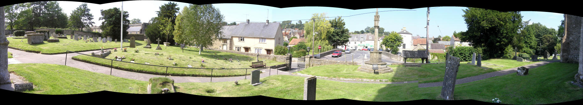
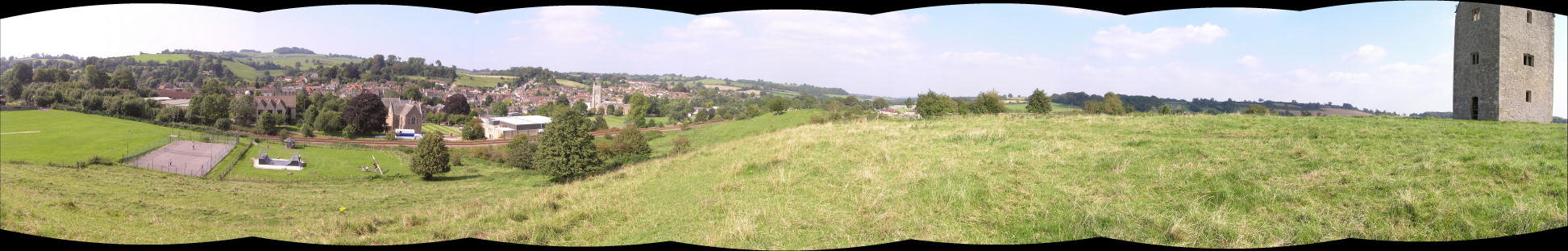
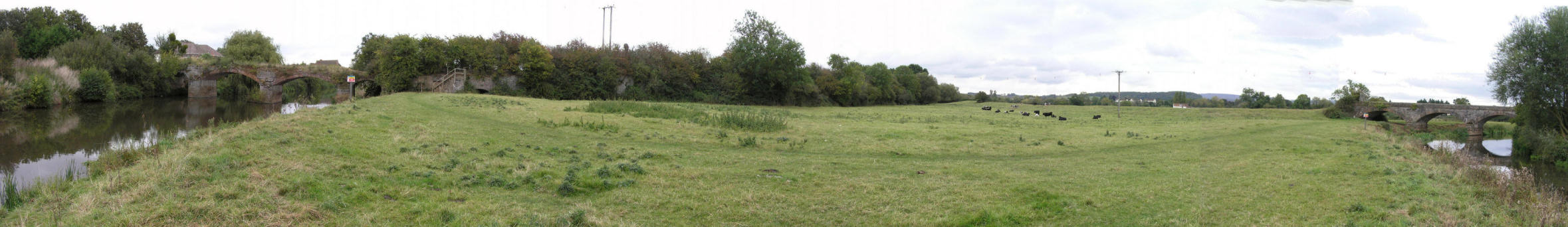
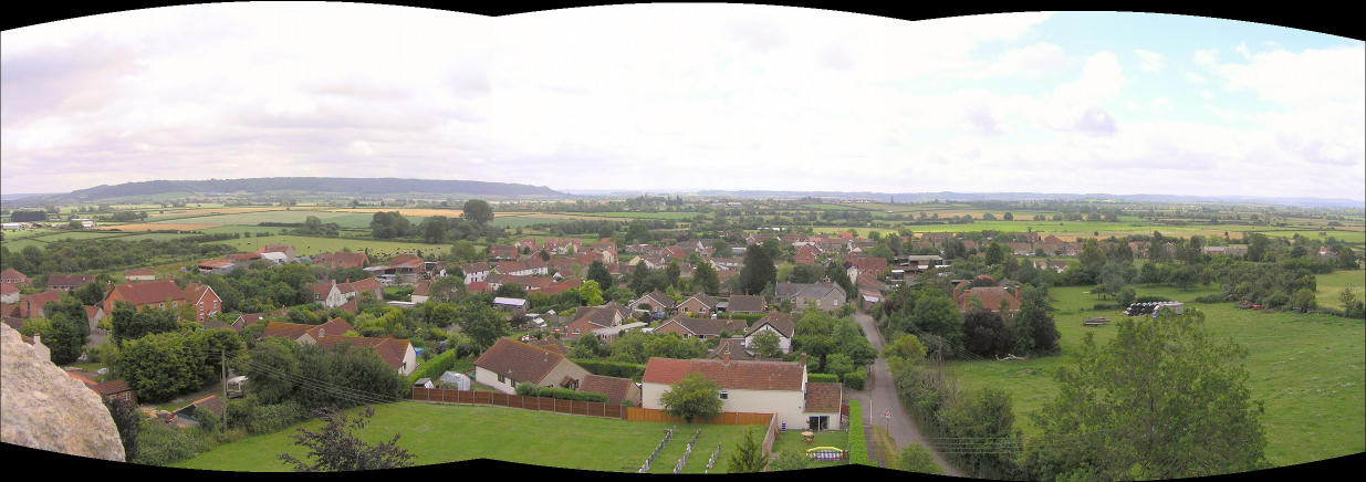
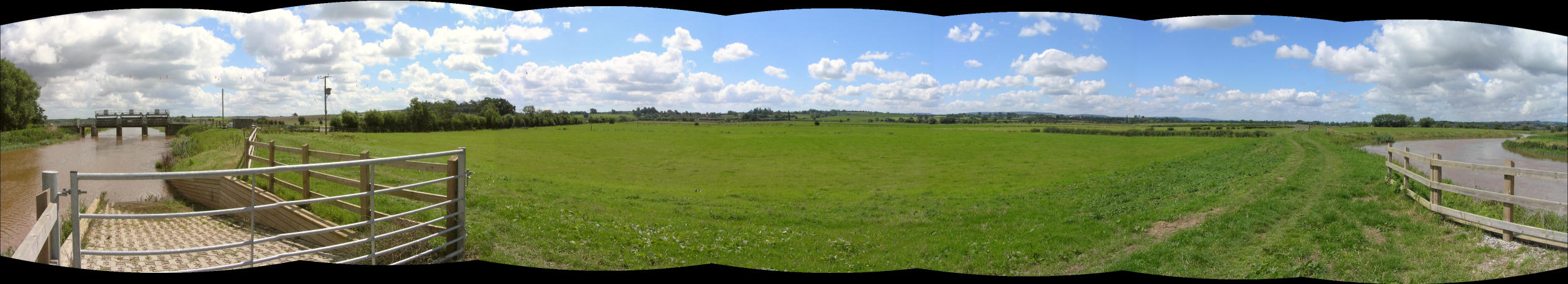
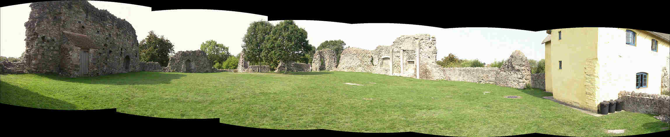
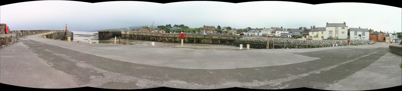
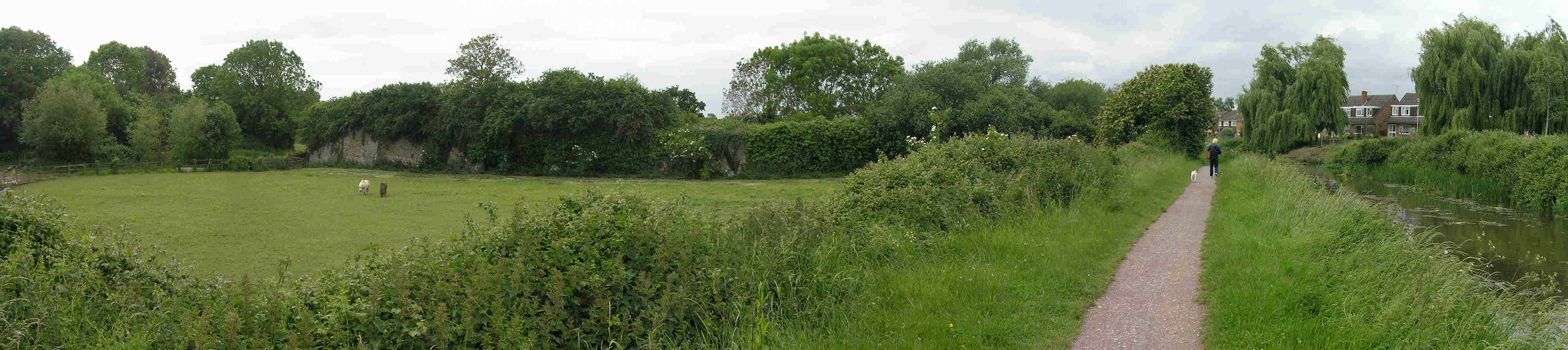
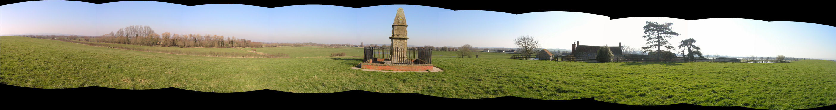
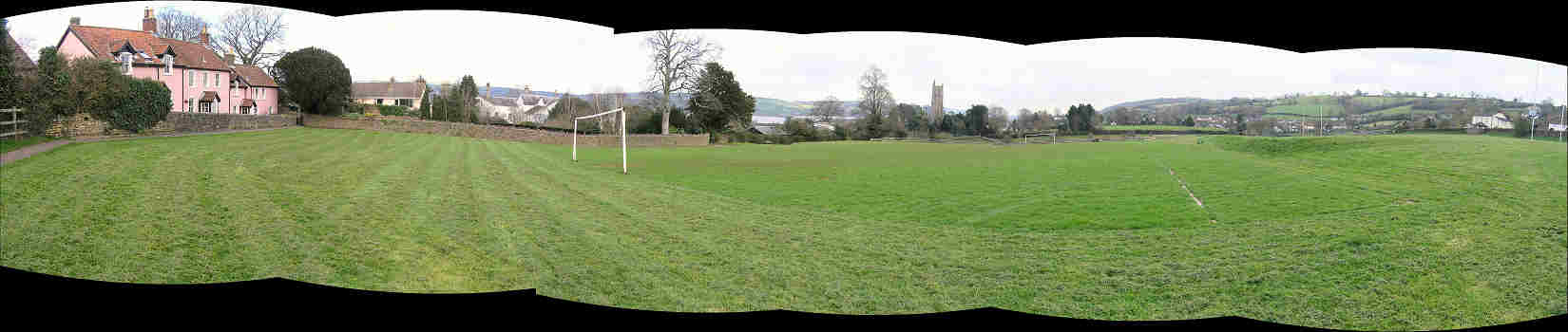
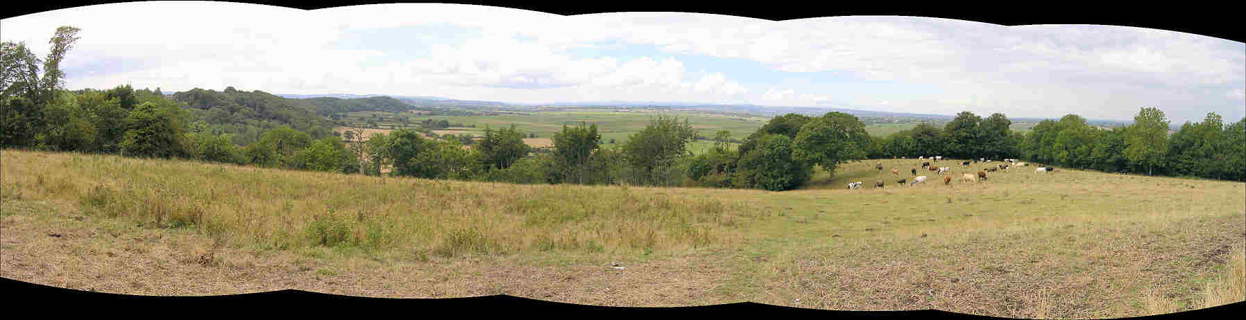
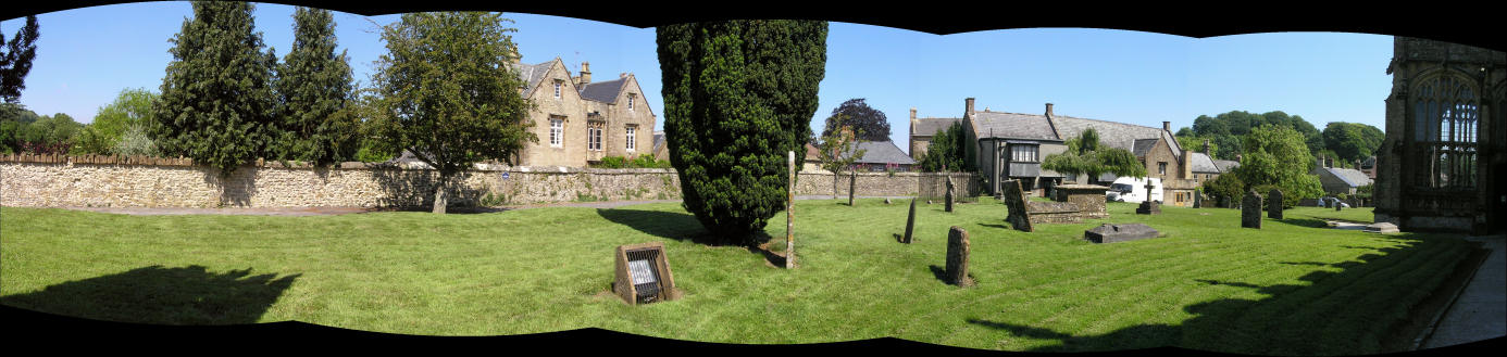
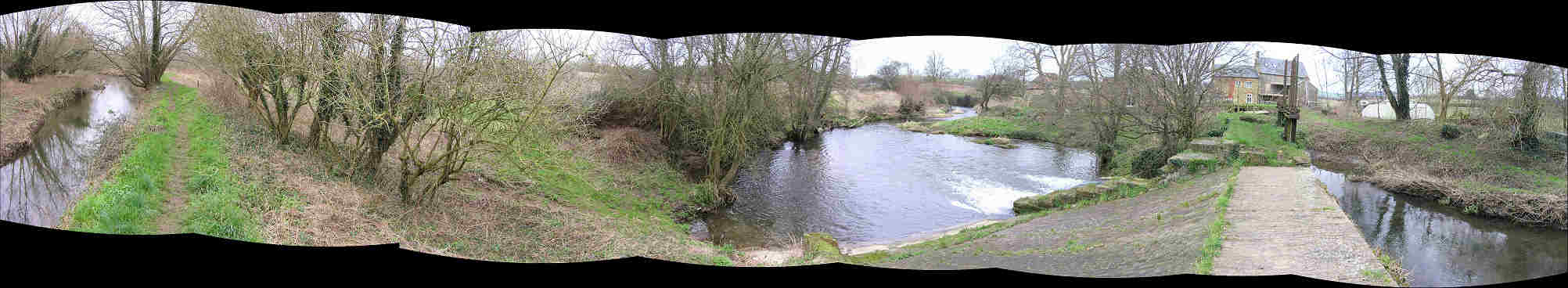
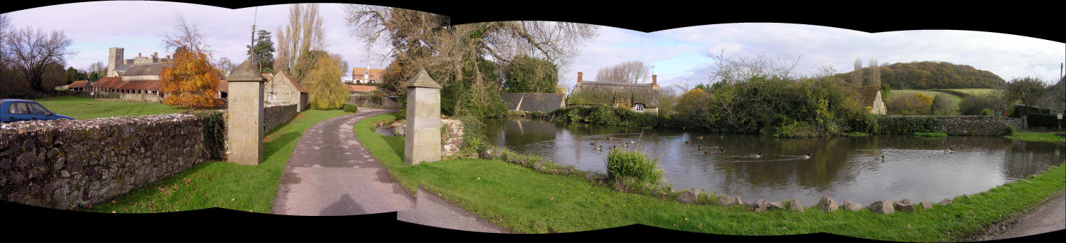
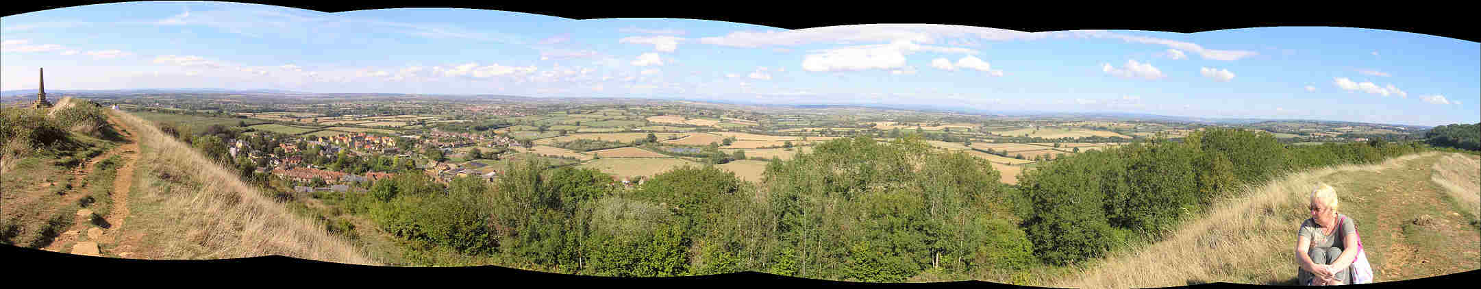
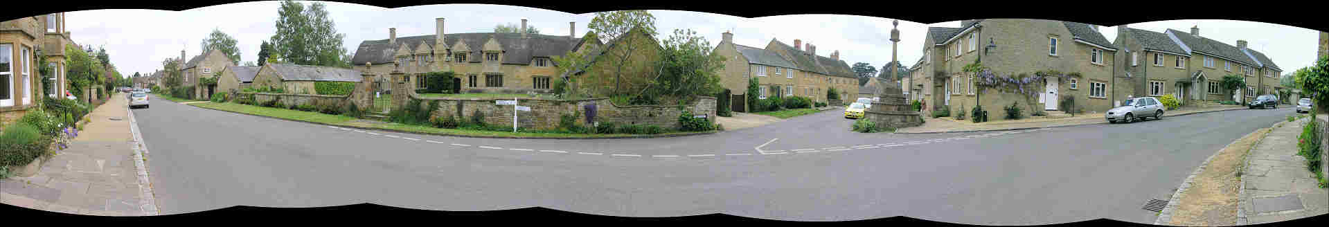
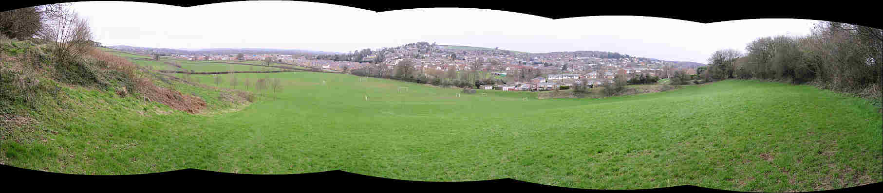
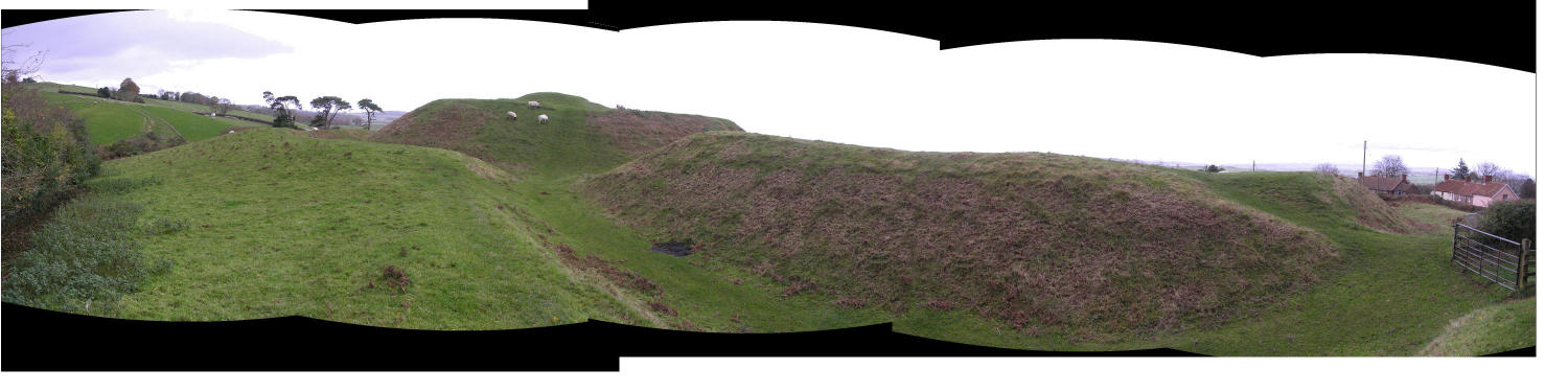
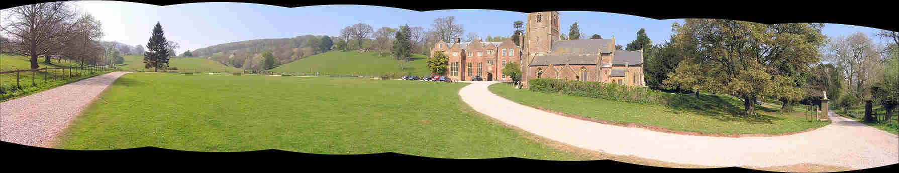
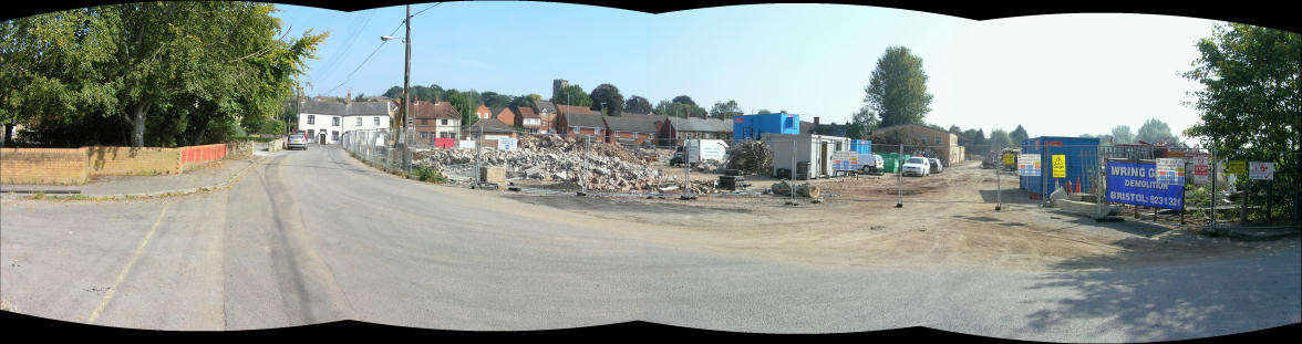
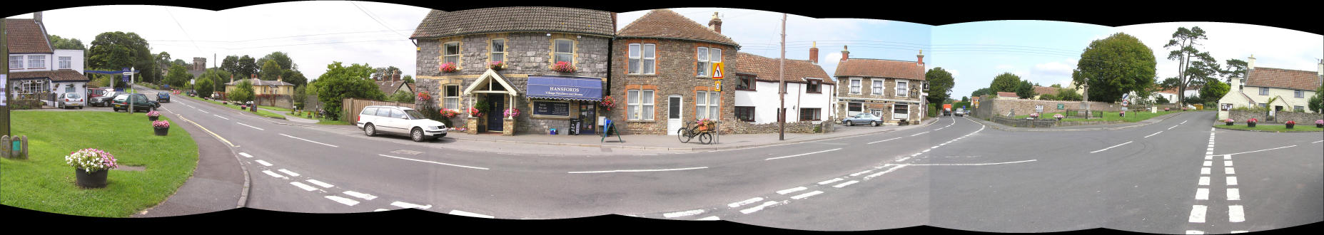
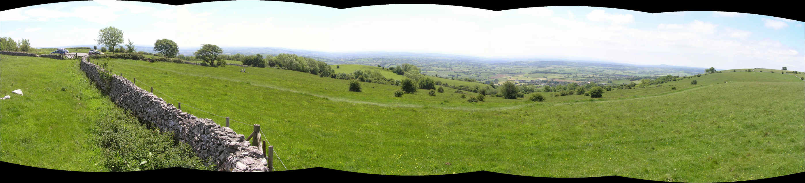
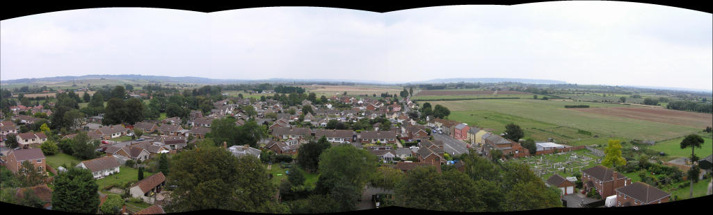
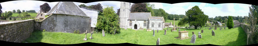