1: Bridgwater & Around Through Time.
2: Burnham on Sea &
Highbridge Through Time.
3: The Bridgwater Railway
through Bawdrip
4 Finding the Bridgwater Railway.
Last updated : 300123
Bridgwater & Around Through Time.
This book shows many
views from the early part of the 1900’s revealing some of the history of
Bridgwater. Many of the pictures show features that have long since
disappeared.
It is split into the following sections: Bridge & River, Blake Gardens, Eastover, Fore Street, Cornhill, High Street, Docks & Canal, St Marys Street, Taunton Road, Other areas, and many local villages including Aller, Ashcott, Bawdrip, Burrowbridge, Cannington, Chedzoy, Cossington, Dunball, Highbridge, Knowle, Langport, Middlezoy, Othery, Puriton and Westonzoyland. Below are some sample pages from the book…………….
Facebook page at : https://www.facebook.com/pages/Bridgwater-and-around-through-time/320308398173301
Front Cover Picture below right : The Bridge and Quay 1909
The low tide reveals that a boat is positioned on the gridiron ready for repair work by Carvers boatyard. A mass of mud and reeds covers that area of the bank today. The last building on West quay directly above the bridge was Binford House. The library building stands there today. Ships and small boats lay on the river along West Quay, but there are none there today.
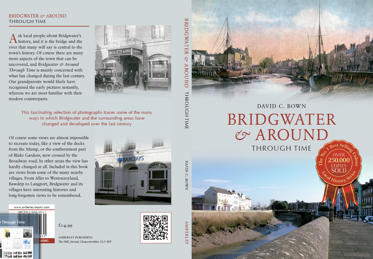
Penel Orlieu at left. The Canal and Docks at right.
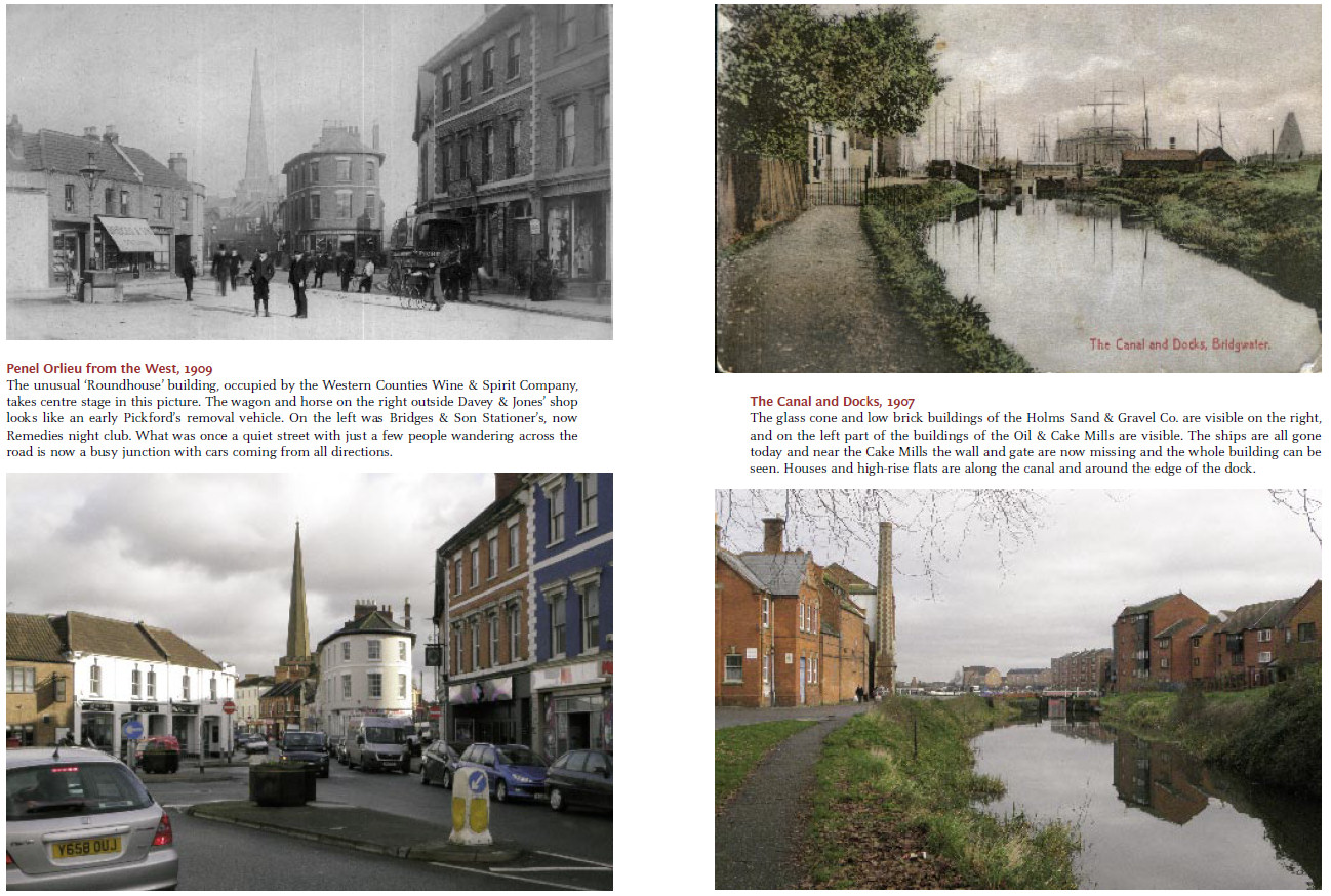
The Great Western Station at left. The old GWR Woodsheds that were along where the Clink is now, at right.
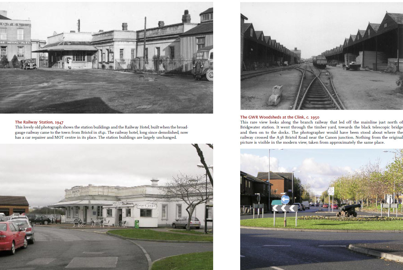
Crandon Bridge with the
old Silver Fish Café at left. Knowle Hall gates at the Crandon Bridge/Silver Fish
junction on the A39.
Burnham
on Sea & Highbridge Through Time.
Burnham on Sea and Highbridge history in the early part of the 1900’s is revealed by this book which is split into the following sections: Sea Front North, Sea Front South, Streets and Buildings, Gardens, Berrow Road, Highbridge, The Railway at Highbridge.
Facebook page at : https://www.facebook.com/pages/Burnham-on-Sea-and-Highbridge-through-time/1492699494341643
Below are some sample pages from the book…………….
Front
Cover Picture below right: Looking south
towards the jetty. 1904
A white funnelled paddle steamer is moored at the jetty on a quiet day at Burnham. The high tide has covered the sands, and a lone person stands near the water on the wooden steps that led down the sloping sea wall. Today the 1988 sea wall dominates the view, which apart from the sea wall has changed very little.

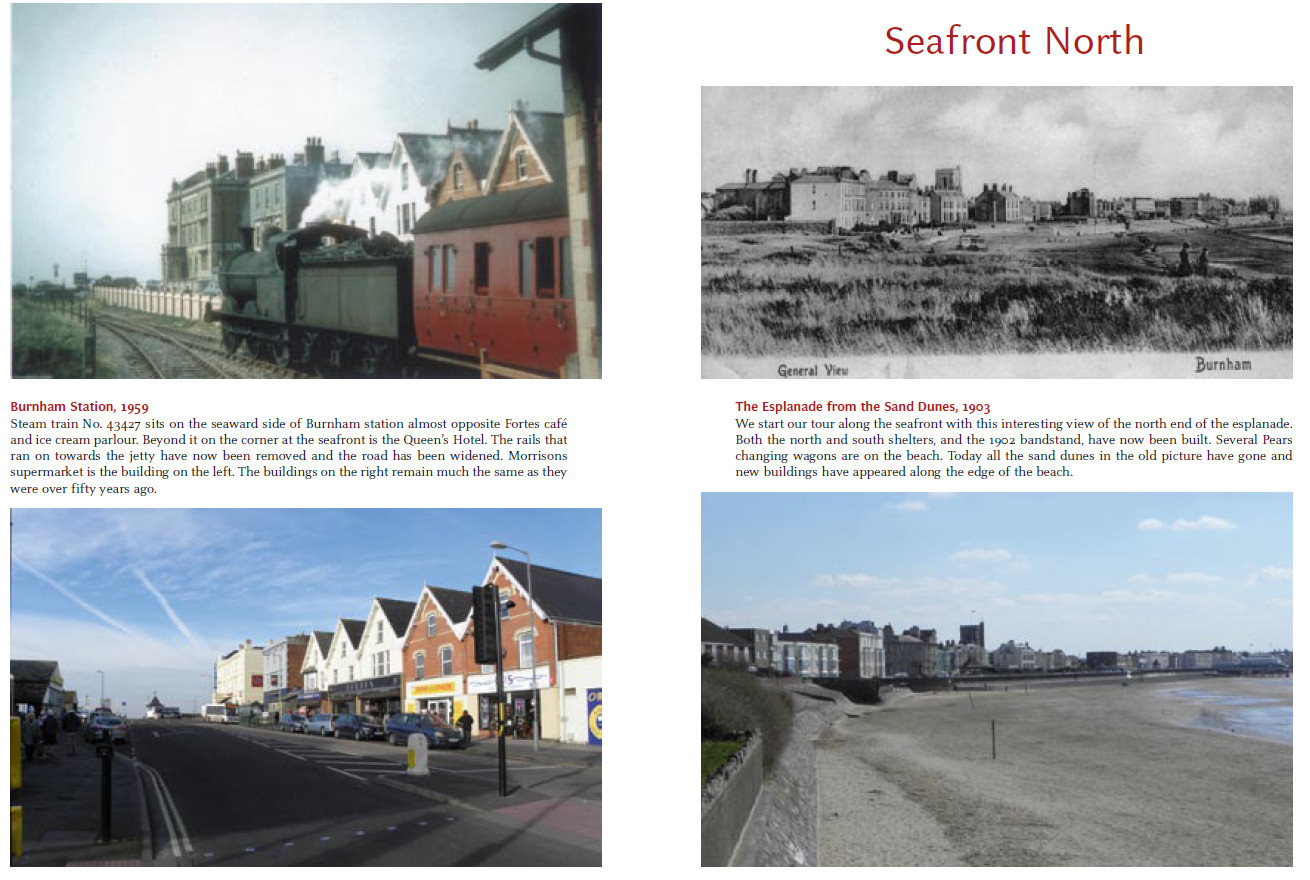
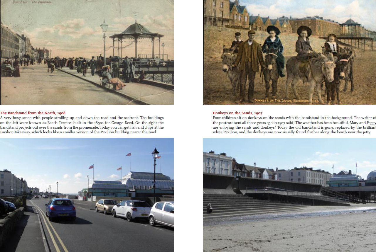
The Station and the Seafront at the North end of the Promenade.
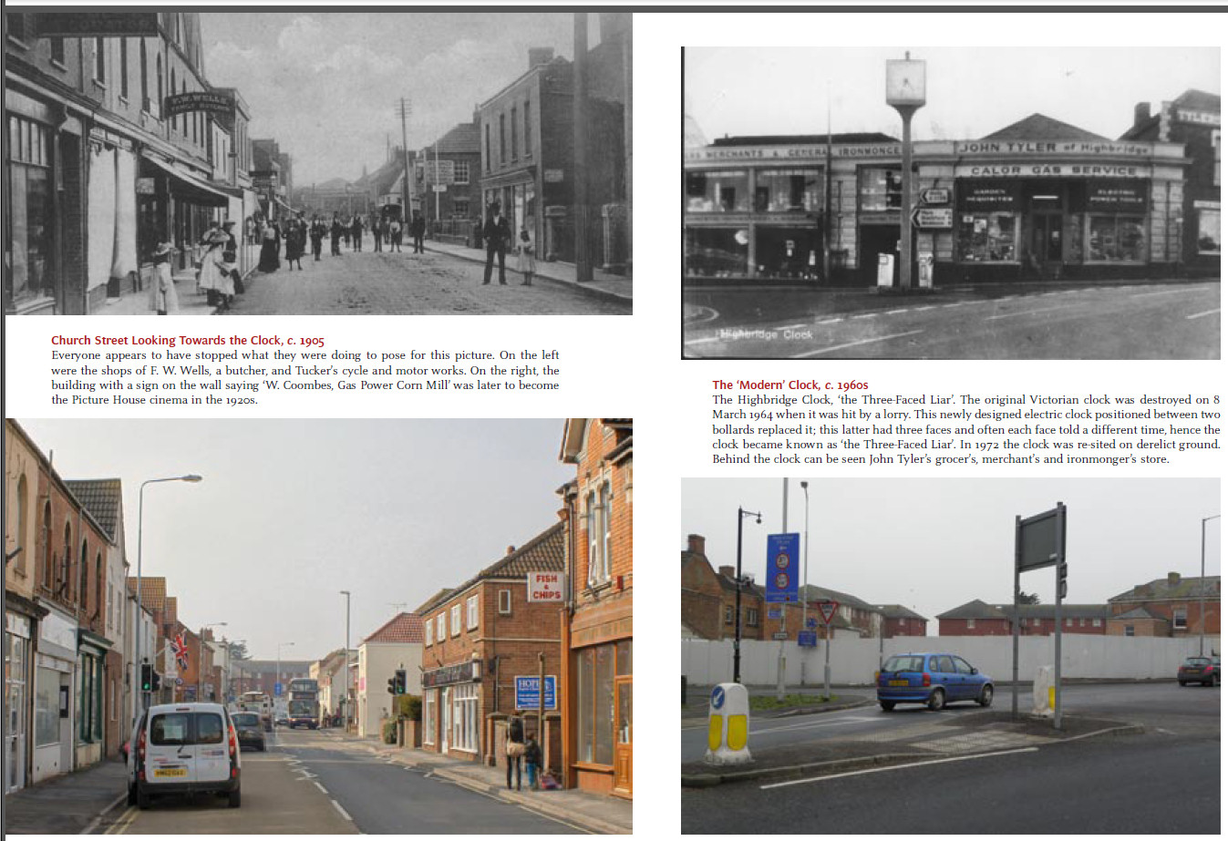
And a few views from around Highbridge, Church Street and the famous Clock.
The Bridgwater
Railway through Bawdrip
For latest news on this book goto:
Facebook page at https://www.facebook.com/The-Bridgwater-Railway-through-Bawdrip-319676441489684/
The Bridgwater Railway opened for business on 21st July 1890 and ran from Bridgwater Station (re named Bridgwater North in Sept 1949) over the Bristol Road and the GWR railway via bridges, across Horsey Lane, under the A39 road bridge near Bradney turning, through Bawdrip, and Cossington, to Edington Junction near Burtle, a total distance of 7miles, 3 furlongs, where it connected to the Glastonbury to Burnham railway. There was one station on the line at Cossington. In 1892 there were 9 ‘up’ and 9 ‘down’ trains each day, and this was reduced to 7 ‘up’ and 8 ‘down’ by 1903. In 1923 Bawdrip Halt, was built, a concrete platform long enough for 4 carriages, and a year later a shelter with seats was added. The first Bill submitted by the town of Bridgwater to Parliament in April 1866 was rejected. Some years and several Bills later, a Bill of August 1882 was successful, and eventually through the years 1888 to 1890 the line was built by the Bridgwater Railway Company. The operating company was to be the LSWR Company, but the railway was initially leased and run for 3 years by the S&DJR, the Somerset & Dorset Joint Railway. The new line offered a route through Edington and Glastonbury to Evercreech Junction where the S&DJR then went north to Bath or south almost to Bournemouth. From Bath the Midland Railway went to Birmingham and the North. From Bournemouth the London & South West Railway went to Southampton then London Waterloo. The Bournemouth to Burnham connection was also seen as a Channel to Channel service for the S&DJR. After 64 years of service the Bridgwater Railway Line was finally closed in October 1954. Dismantling of the line took several more years as far as can be determined at the moment.
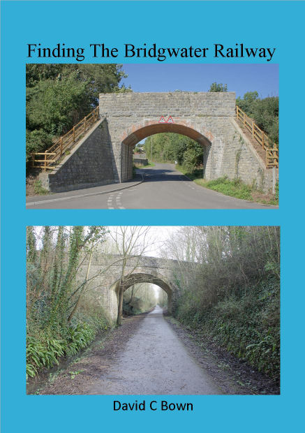
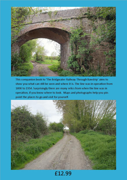
Finding the Bridgwater Railway.
This companion book to ‘The Bridgwater Railway Through Bawdrip’ aims to show you what can still be seen and where it is.
The line was in operation from 1890 to 1954. Surprisingly there are many relics from when the line was in operation, if you know where to look.
Maps and photographs help you pinpoint the places to go and visit for yourself. Now with OS map locations for every place mentioned.
The line and probably most of the buildings were completed during a 2 year period between April 1888 and July 1890. There is an excellent description of the line in the Bridgwater Mercury in July 1890, just prior to the opening of the new railway.
After 64 years of service the Bridgwater Railway Line was finally closed in October 1954.
Now in 2017, 63 years later, what remains of the railway?
Is there anything we can see today?
The answer is ‘Quite a lot’!
Facebook page at : https://www.facebook.com/Finding-the-Bridgwater-Railway-638392113033222/
Above photos:
Top: Railway over
the road at Bawdrip. Bridge 306. : Bawdrip Halt 200yds
to the right.
Btm: A39 Road over the railway near Woolavington corner. Bridge 305. Cossington Station 1/3
mile beyond this bridge.
Above photos:
Top: Railway over
Dole Lane track, north of Chilton Polden. Bridge 299. Edington Junction to the
right.
Btm: Stone End Crossing, about ½ mile further
north of bridge 299. Edington Junction to the right.
Bridges, buildings,
steps, walls, cuttings, and embankments are all things that can still be seen.